Bustio - Pendueles

- Pimiango, La Franca, Buelna, Pendueles Eastern Asturias
- Distance: 17.05 kms
- Difficulty: Moderate
- Cumulative difference in altitude: +307 m
- Cumulative difference in altitude: -307 m
- Maximum altitude: 157 m
- Minimum altitude: 4 m
- IBP index: 55
The itinerary includes the Pindal Cave (World Heritage Site), the Santiuste Jester, the inland beach of Cobijeru and the Picones viewpoint. A journey along cliffs, beaches and meadows that connects history and landscape next to the Cantabrian Sea.
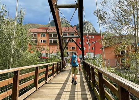
The route from Bustio to Pendueles is a journey that combines history, archaeology and nature with the spectacular landscapes of the eastern coast of Asturias.
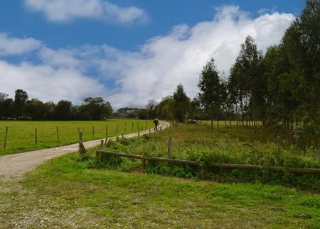
The route begins in the Remansona de Bustio Park, a small fishing village located at the mouth of the river Deva, which marks the natural border between Asturias and Cantabria. From here, the path climbs steeply uphill for the first two kilometres, and then descends gently to the remains of the church of Santa María de Tina, a vestige of 12th century Romanesque architecture. Although today only ruins remain, its location among meadows and woods gives the place an atmosphere of seclusion and beauty.
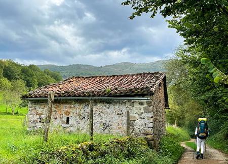
The route continues to the area around San Emeterio, where you will find the hermitage of the same name, the Pindal Cave Interpretation Centre, and the detour to one of the highlights of the route: the Pindal Cave (declared a World Heritage Site by UNESCO), known for its cave paintings. The species most represented in the Pindal is the bison, followed by the horse, although the most represented is the doe and the most exceptional are the mammoth and the fish. Just 250 metres from the path, a visit to the site - by prior reservation - allows you to take a look at the prehistoric art that inhabited this coast thousands of years ago.
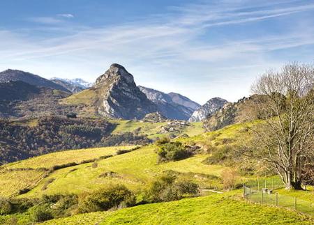
From here, the path climbs up to the Picu viewpoint, with unbeatable views of the Cantabrian Sea and, on clear days, the Picos de Europa. The path continues through meadows and open fields, and takes us to the Bufón de Santiuste, where on days with strong waves the sea gushes out through cracks in the cliffs, forming spectacular water spouts. Santiuste is considered to be the largest of all the buffoons on the east coast, as it can spurt up to 40 metres high.
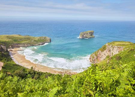
Further on we reach another unique natural enclave: the beach of Cobijeru, where the seawater penetrates through an underground gallery giving rise to an inland beach. Nearby you can also visit the Cobijeru cave and the Bufón de Cobijeru, a natural site declared a Natural Monument due to its geological singularity.
The route continues along a quiet stretch until it reaches Buelna beach, a small cove of golden sand and transparent waters, famous for its unspoilt surroundings and the vertical rock known as El Picón.
In the final stretch, the path runs between cliffs, meadows and wooded areas, passing the Picones viewpoint, from where there is a beautiful view of Pendueles beach, framed by high cliffs. The day ends in the village of Pendueles, where you can rest or join the next stage of the trail.
A route that combines coastal scenery, prehistoric archaeology, religious architecture and unique geological phenomena, in one of the most complete and varied stretches of the Asturian coast.
- It runs partially through the ZEC and ZEPA Ría de Ribadesella - Ría de Tinamayor and through the ZEC Sierra Plana de la Borbolla of the Natura 2000 Network.
- The route partially coincides with the GR-204.
- Catering services along the entire route
Basic tips before going into the mountains
- If you go with a dog, always keep it on a leash.
- Avoid approaching livestock.
- If you find mastiffs protecting livestock, do not approach them, do not pet them and do not feed them. Do not allow them to follow you or stray from their herd. They are working.
- Don't leave a trail. Collect all your waste, including organic waste. Nature is not a dumping ground.
- Act with prudence. Plan your route well, take everything you need and make sure it is adapted to your physical capacity.