Pica Peñamellera

- Mier Eastern Asturias
- Distance: 10.95 kms
- Difficulty: Difficult
- Cumulative difference in altitude: +742 m
- Cumulative difference in altitude: -742 m
- Maximum altitude: 764 m
- Minimum altitude: 47 m
- IBP index: 72
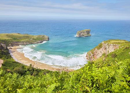
Along the route, you will enjoy spectacular views of the Picos de Europa and the Cares valley. Only suitable for experienced mountaineers, this route combines physical challenge with natural beauty.
The route to Pica Peñamellera from Mier offers a challenging and spectacular itinerary that combines nature, physical effort and unequalled views from one of the most unique peaks in eastern Asturias.
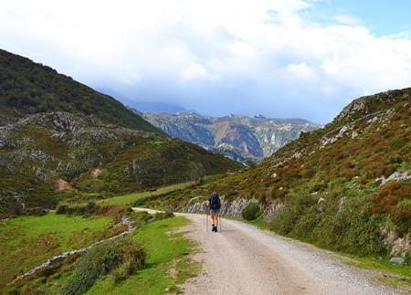
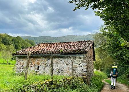
The route starts in the park of Mier, next to the river Cares, from where you cross the Mexico bridge to enter the village. After passing a fountain, the route leaves the town centre and joins the GR-109 at the parish church, beginning a gentle climb that allows you to enjoy the tranquillity of the rural Asturian countryside.
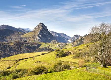
As you go on, the path becomes steeper and heads towards the base of the imposing Pica Peñamellera, whose characteristic pyramidal shape dominates the horizon. The views begin to open up, with mid-mountain landscapes that anticipate what awaits at the summit.
Once you reach Collado Huerto, the most demanding section of the route begins. The route leaves the main path and takes a path to the left that skirts the slope in the direction of the rocky base of La Pica. From here, the path becomes steeper and more technical, with a last part that involves a climb over rocky and steep terrain, only recommended for experienced mountaineers. This section, although short, requires caution, fitness and safety, especially on the descent.
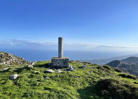
The summit of Pica Peñamellera (766 m) offers one of the most impressive views in the area: 360 degree panoramic views over the Peñamellera Alta council, the nearby valleys, the eastern and central massifs of the Picos de Europa, and on clear days, even the silhouette of Picu Urriellu (Naranjo de Bulnes).
The descent is made along the same path, paying extreme attention in the climbing area. After this stretch, the descent becomes progressively gentler, allowing the hiker to enjoy the scenery and return quietly to the starting point in the Mier Park.
A short but demanding route, ideal for those looking for spectacular views and a complete mountain experience without long distances.
- This route partially coincides with the GR-109.
Basic tips before going into the mountains
- If you go with a dog, always keep it on a leash.
- Avoid approaching livestock.
- If you find mastiffs protecting livestock, do not approach them, do not pet them and do not feed them. Do not allow them to follow you or stray from their herd. They are working.
- Don't leave a trail. Collect all your waste, including organic waste. Nature is not a dumping ground.
- Act with prudence. Plan your route well, take everything you need and make sure it is adapted to your physical capacity.