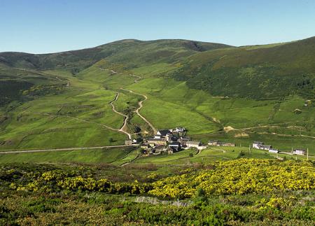
Moal Forest Route

- Adresse Mual Westasturien
- Distanz Distanz: 8,8 kms
- Schwierigkeit Schwierigkeit: Media
- Kumulierter Höhenunterschied + Kumulierter Höhenunterschied: +533 m
- Kumulierter Höhenunterschied - Kumulierter Höhenunterschied: -533 m
- Maximale Höhe Maximale Höhe: 1006 m
- Mindesthöhe Mindesthöhe: 574 m
- PPI-Index PPI-Index: 57
- Modus Modus: Senderistas
- Art der Rundfahrt Art der Rundfahrt: Circular
- Routentyp Routentyp: Montaña
- Rückfahrt mit der Bahn Rückfahrt mit der Bahn: Nein
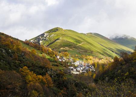
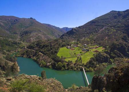
Die Route beginnt in Mual, dem Beispielhaften Dorf Asturiens 2018, und führt durch den Wald zum Aussichtspunkt Montecín, von dem aus man einen spektakulären Blick auf das Tal und das Integrale Naturreservat von Muniellos hat. Eine ideale Route, um sich mit der Natur zu verbinden.
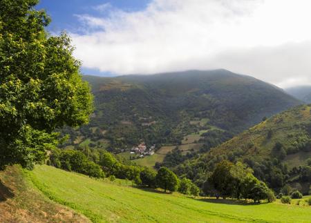
Die Waldroute Moal beginnt im Dorf Mual, das 2018 mit dem Preis "Beispielhaftes Dorf Asturiens" für sein Engagement zum Schutz der Umwelt ausgezeichnet wurde. Mual liegt im Tal des Muniellos-Flusses, vor den Toren des Integralen Naturschutzgebiets Muniellos, und zeichnet sich durch seine Anpassung an die bergige Umgebung und seine mit der nachhaltigen Nutzung des Waldes verbundene Geschichte aus.
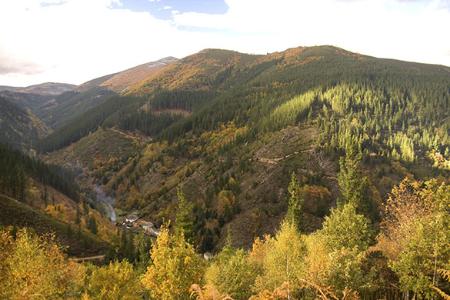
Der Weg beginnt im Zentrum des Dorfes, überquert den Fluss Muniellos und führt über einen Waldweg, der sanft zwischen Eichen, Buchen und Kastanien ansteigt, den typischen Baumarten der Gegend. Im weiteren Verlauf des Weges zeugt das Vorhandensein von "Cortines" (Steinkonstruktionen zum Schutz der Bienenstöcke vor Bärenangriffen) von der traditionellen Koexistenz zwischen Mensch und lokaler Fauna.
An der ersten ausgeschilderten Kreuzung biegen Sie links ab und nehmen den rechten Weg für den Rückweg. Die Steigung nimmt allmählich zu und die Landschaft verdichtet sich zu einem einheimischen Wald, in dem Traubeneiche, Honigeiche und Buche die Umgebung dominieren. Der Weg steigt bis zum Aussichtspunkt Montecín an, von dem aus man das Mual-Tal, das Dorf selbst und die Tore des Muniellos-Reservats sehen kann.
Auf dem Rückweg geht es leicht bergab, zurück in den Wald, bevor man wieder auf den Weg trifft, der zum Ausgangspunkt zurückführt. Dieser Rundweg mit geringem Schwierigkeitsgrad und direktem Kontakt zur Natur ermöglicht es Ihnen, die reiche Artenvielfalt und die Geschichte der Wälder im Südwesten Asturiens zu genießen.
- Er verläuft durch das Biosphärenreservat Muniellos, den Naturpark Fuentes del Narcea, Degaña und Ibias und das GGB Fuentes del Narcea, Degaña und Ibias des Natura-2000-Netzes.
- PR-AS 132
Grundlegende Tipps, bevor Sie ins Gebirge gehen
- Vermeiden Sie die Annäherung an das Vieh.
- Wenn Sie auf Doggen treffen, die das Vieh schützen, nähern Sie sich ihnen nicht, streicheln Sie sie nicht und füttern Sie sie nicht. Erlauben Sie ihnen nicht, Ihnen zu folgen oder sich von ihrer Herde zu entfernen. Sie arbeiten.
- Wenn Sie mit einem Hund unterwegs sind, nehmen Sie ihn immer an die Leine.
- Hinterlassen Sie keine Spuren. Sammeln Sie alle Ihre Abfälle, auch die organischen. Die Natur ist keine Müllhalde.
- Handeln Sie mit Bedacht. Planen Sie Ihre Route gut, nehmen Sie alles mit, was Sie brauchen, und achten Sie darauf, dass sie an Ihre körperliche Leistungsfähigkeit angepasst ist.


