Vizcares Peak
, the highest peak in Piloña at 1,419 metres, is a classic in Asturian hiking. The summit of Cureñu, deep beech forests and crests culminate in a peak with views of the Sueve, Picos de Europa and the sea. A demanding but unforgettable route that can be completed by the usual route or, for experienced mountaineers, by a direct variant through the beech forest of Vallina de Luiña.")
- Distance: 13.06 kms
- Difficulty: Very difficult
- Cumulative difference in altitude: +1034 m
- Cumulative difference in altitude: -1034 m
- Maximum altitude: 1413 m
- Minimum altitude: 388 m
- IBP index: 104
- Modality: Mountaineers
- Type of route: Circular
- Route type: Mountain
- Return by Train: No
A demanding but unforgettable route that can be completed by the usual route or, for experienced mountaineers, by a direct variant through the beech forest of Vallina de Luiña.
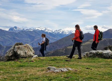
The ascent to Pico Vízcares (1,419 m), the highest peak in the municipality of Piloña, is one of the most spectacular and demanding mountain routes in the municipality. With more than 1,000 metres of positive height gain and a combination of tracks, wooded paths and cresting sections, it is an unforgettable route for lovers of high-altitude hiking.
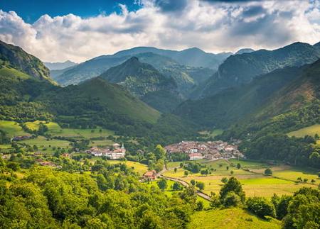
The route starts at the recreational area of La Pesanca, which can be reached from Infiesto/L'Infiestu along the PI-4 road, passing through the villages of Espinaréu and Rifabar, where there are still numerous hórreos and paneras (raised granaries) that showcase traditional Asturian architecture. Shortly before reaching the starting point there is also the Miera Arboretum, a unique space with emblematic species of Asturian flora.
From La Pesanca, the route starts along a forest track that runs parallel to the Infierno river, passing by the houses of El Muñizón and Monte Degoes, and crossing the Monte La Cerezal area. We soon leave the main track to take a detour towards Traslafuente. After crossing the Estaquera Bridge over the Estaquera stream, the most mountainous part of the route begins: an ascending path through a forest dominated by beech trees, which leads to Majada Cureñu, with a fresh water spring and ample pastures.
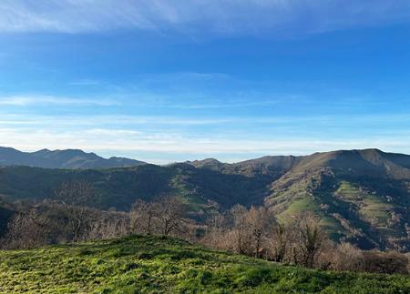
From here, the path continues to gain height until it reaches Collado Traslafuente, at the foot of Pico Maoñu, which marks the boundary between Piloña and Ponga. The views from this point are already exceptional, with the Cordal de Ponga, the Sierra de Xiblaniella and the Picos de Europa standing out. After crossing the sheepfold, a small path ascends through the Culebrina Valley before reaching the crest area.
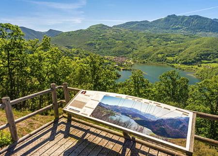
The final stretch, which is more irregular and demanding, links several peaks such as El Cabezu or Pico La Verdad, before reaching the summit of Vízcares, from where you can enjoy one of the most complete panoramic views of central and eastern Asturias: the Cantabrian Sea, the coastal mountain ranges of Sueve and Cuera, Collau Zorru, the Picos de Europa with Peña Santa, the Sierra de Pandemules and numerous other peaks.
The descent can be made along the same path, but more experienced mountaineers can opt for a more direct and unmarked variant, via the Canal de la Vallina, which leads to Majada Degoes through the beech forest of Vallina de Luiña. This section is technical, very steep and potentially slippery in wet conditions, so it is only recommended with good weather, experience and suitable footwear.
After crossing the river over the Degoes bridge, it links up again with the outward route to La Pesanca, closing a complete, demanding and spectacular mountain route, which passes through unique spots such as La Majada Cureñu or Collado Traslafuente, and which remains etched in the memory both for its beauty and the effort it requires.
- PR-AS 289
Basic tips before going into the mountains
- If you go with a dog, always keep it on a leash.
- Avoid approaching livestock.
- If you find mastiffs protecting livestock, do not approach them, do not pet them and do not feed them. Do not allow them to follow you or stray from their herd. They are working.
- Don't leave a trail. Collect all your waste, including organic waste. Nature is not a dumping ground.
- Act with prudence. Plan your route well, take everything you need and make sure it is adapted to your physical capacity.