Cuyargayos Peak

- Agues, Llaíñes/Ladines Central Asturias
- Distance: 13.5 kms
- Difficulty: Difficult
- Cumulative difference in altitude: +856 m
- Cumulative difference in altitude: -856 m
- Maximum altitude: 1391 m
- Minimum altitude: 441 m
- IBP index: 78
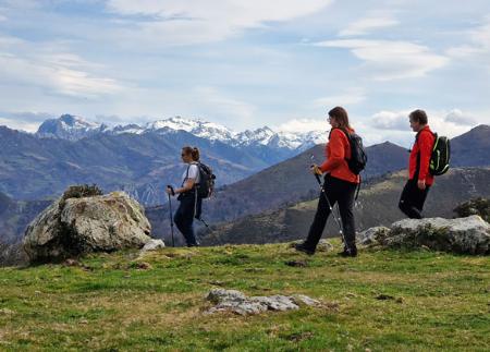
- Modality: Hikers
- Type of route: Circular
- Route type: Mountain
- Return by Train: No
The path climbs through forests and pastures to the summit of Cuyargayos (1391 m), with spectacular views of the Rusecu/Rioseco reservoir and the main peaks of the Redes landscape. The descent, via the Foz de Nozalín, completes a circular route of unparalleled beauty.
The route to Cuyargayos starts in Agues, a picturesque village in the council of Sobrescobio, in the heart of the Redes Natural Park. From the start, next to the church of San Andrés, the route shows the charm of the Asturian countryside. After leaving the last houses behind, take a fork to the left and begin a gentle ascent along a wide track that enters a dense autochthonous forest.
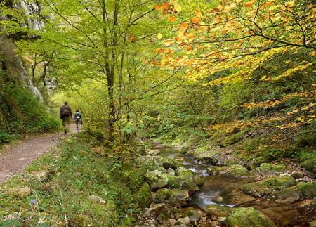
The vegetation becomes the protagonist as you advance through the valley of the river Argayades, with occasional views of the village of Llaíñes/Ladines, which can be glimpsed through the foliage. Shortly afterwards, the track gives way to a narrower and more natural path. Crossing the river over a log, you finally reach Llaíñes/Ladines (620 m), where the church of San Pedro, of medieval origin and rebuilt in the 17th century, stands out.
The path continues through the district of La Riba, leaving the centre of Llaíñes/Ladines and once again entering areas of pasture and woodland. It crosses old sheepfolds such as Faidiellu and Faisaldes (932 m), enjoying privileged views over the Alba valley and the Crespón mountain range. After a stretch through the beautiful beech forest of Monte Tornu, the ascent intensifies along the western slope of the Rubios range, climbing between stone walls and scattered beech trees until reaching Collado Imblenes (1201 m).
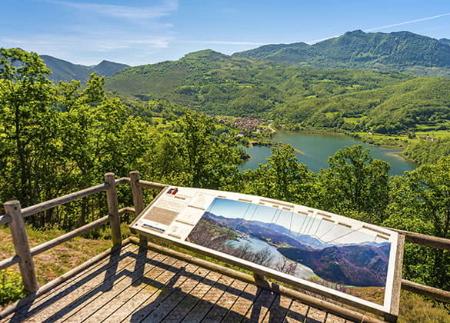
From here we face the last stretch of the ascent to Pico Cuyargayos (1391 m), considered one of the most beautiful and representative peaks in the Redes Natural Park. The path climbs up its southern slope, well signposted with stone milestones, and culminates in a panoramic summit that rewards the effort. From the top, the views are spectacular: towards Caso, Tiatordos, Macíedome, La Llambria, Campigüeños, La Carasca and La Senda and Peña Ten. Towards the Rusecu/Rioseco reservoir, several villages: Campiellos, La Xamoca, Llaíñes/Ladines and, if we continue looking west, the Crespón mountain range.
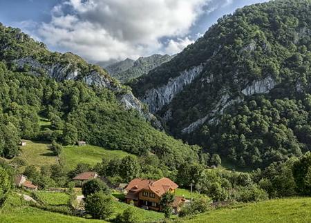
The descent continues southwards along the crest of the Sierra Bermeja mountain range, skirting the summit of Pico Mezquita (1309 m). Then begins a steep descent down its western slope, crossing the village of Farriondas, with its traditional shepherds' huts. From here, it joins a zigzagging track that descends to the Feleches valley, before entering the narrow and picturesque Foz (gorge) of the river Nozalín.
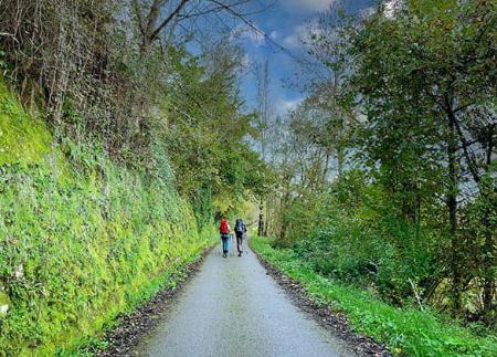
After crossing the river, you reach a wide and comfortable track that leads back to Agues, descending gently through a wooded environment typical of the area to close a circular route that combines nature, rural heritage and unforgettable panoramic views.
- It runs through the Redes Natural Park and Biosphere Reserve, this area also being a ZEC and ZEPA of the Natura 2000 Network.
- PR-AS 063
Basic tips before going into the mountains
- If you go with a dog, always keep it on a leash.
- Avoid approaching livestock.
- If you find mastiffs protecting livestock, do not approach them, do not pet them and do not feed them. Do not allow them to follow you or stray from their herd. They are working.
- Don't leave a trail. Collect all your waste, including organic waste. Nature is not a dumping ground.
- Act with prudence. Plan your route well, take everything you need and make sure it is adapted to your physical capacity.