La Xamoca Peak

- Campiellos Central Asturias
- Distance: 13.9 kms
- Difficulty: Very difficult
- Cumulative difference in altitude: +888 m
- Cumulative difference in altitude: -888 m
- Maximum altitude: 1282 m
- Minimum altitude: 516 m
- IBP index: 86
- Modality: Mountaineers
- Type of route: Circular
- Route type: Mountain
- Return by Train: No
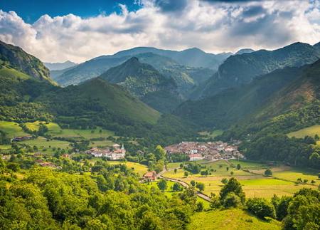
From the top there are panoramic views of the Rusecu/Rioseco reservoir and the surrounding valleys. The return, via the Foz de Nozalín, completes a circular route of great scenic value.
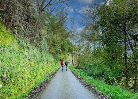
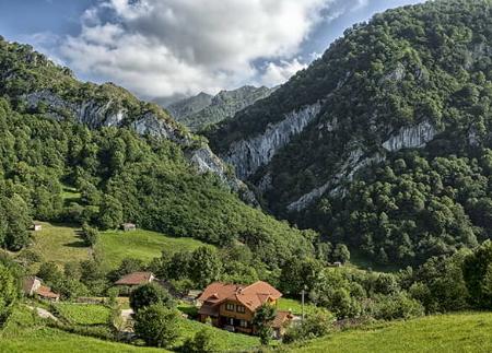
The route starts in the village of Campiellos, a beautiful example of a rural Asturian village at an altitude of 530 metres, where granaries, cobbled paths and traditional buildings still survive. From the information panel located in the car park, take a track that climbs up through the upper part of the village, passing by a granary and the water tank, and enters a forest dominated by chestnut trees, which provides shade and coolness in the first few metres.
The path gains altitude gently until it reaches the Collado del Arcu (628 m), next to which stands an old restored hut. From here, the route continues through an increasingly open environment, with impressive views of the Comillera stream valley, Peña Blanca Peak and the mountain range that culminates in La Xamoca. A real natural balcony opens up at a sharp bend, inviting a first contemplative pause.
After a more demanding stretch, the Llagos sheepfold is reached, where old pastoral buildings are preserved amidst wide meadows. Here you will find a spring-water spring declared a natural mineral spring, the first of its kind in a protected area in Asturias. Nearby, a viewpoint with tables and a hundred-year-old texu offers one of the most complete views of the reservoir and the village of Rusecu/Rioseco, under the silhouette of mountains such as Peña Mea and Retriñón.
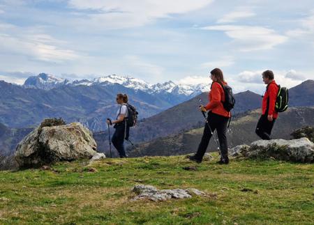
From the upper end of the sheepfold, a signpost marks the path to La Xamoca, which enters a small wood before coming out onto a slope with low scrubland and limestone rock. The path runs halfway up the slope, while the northern slope of the peak is covered by a leafy beech forest. The climb culminates at the summit of La Xamoca (1289 m), an impressive natural viewpoint overlooking an extensive landscape: the councils of Sobrescobio, Laviana, Caso and Piloña, with the backdrop of the Redes and Sueve mountain ranges, and even, on clear days, the profile of the Bay of Biscay.
After enjoying the panoramic view, we continue along the ridge towards the south, in the direction of the Collado de Unqueru, passing through wooded areas such as the Falafría mountain. The path skirts Picu la Carba, reaching a small hollow in the Collado de Faidiellu, where you can still make out old huts.
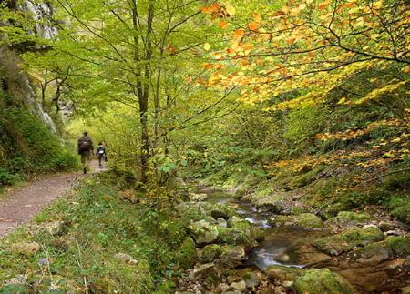
From the Collado de Unqueru, take a path that is not very visible before, which crosses a waterlogged area and heads towards the Espines huts, from where the steepest descent of the route begins. The path crosses a steep slope between Espines and Práu Ríu, following the river Nozalín, which is crossed over a concrete bridge with a wooden handrail. The last stretch runs among centenary chestnut trees, along well-marked paths that, after leaving the Güergu hut behind, connect again with Campiellos, thus completing this circular route.
- It runs almost entirely through the Natural Park and Biosphere Reserve of Redes, this area also being a ZEC and ZEPA of the Natura 2000 Network.
- PR-AS 123
- This route partially coincides with PR-AS 122.
Basic tips before going into the mountains
- If you go with a dog, always keep it on a leash.
- Avoid approaching livestock.
- If you find mastiffs protecting livestock, do not approach them, do not pet them and do not feed them. Do not allow them to follow you or stray from their herd. They are working.
- Don't leave a trail. Collect all your waste, including organic waste. Nature is not a dumping ground.
- Act with prudence. Plan your route well, take everything you need and make sure it is adapted to your physical capacity.