Soto - L'Acebal - Soto

- Llorío, L'Acebal, Soto Central Asturias
- Distance: 13.8 kms
- Difficulty: Moderate
- Cumulative difference in altitude: +426 m
- Cumulative difference in altitude: -426 m
- Maximum altitude: 759 m
- Minimum altitude: 326 m
- IBP index: 53
- Modality: Hikers
- Type of route: Circular
- Route type: Mountain
- Return by Train: No
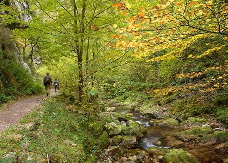
The descent crosses hamlets such as L'Acebal and Ribota, and follows the La Coruxera canal to Llorío. A varied itinerary, ideal for enjoying the rural Asturian landscape and the serene beauty of the protected landscape of the Cuencas Mineras.
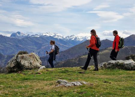
This circular route starts in Soto, in the council of Laviana, and offers a complete experience of landscape, rural heritage and Asturian nature. The itinerary begins in the vicinity of the neighbourhood of La Covina, taking a forest track known as the Fuentes route, which accompanies the walker in the first stages of the ascent. The climb is gentle, surrounded by the shade of chestnut trees and traditional meadows.
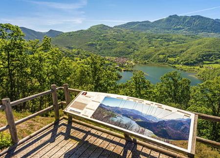
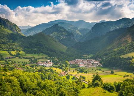
After half an hour you reach La Peorrúa, at the foot of Mount Fueyu, from where the views start to open up towards the Breza valley, the peaks of Ortigosa and the imposing silhouette of La Xamoca. The panoramic view accompanies us for a good part of the route up to El Cordal, the highest point of the route (about 4 km from the start), reached after passing the Campa Fondera and Les Edraes springs. This upper section allows us to contemplate, from the top, the mountains of Peña Mea, the Campas Doñango and the hamlet of Los Tornos.
From El Cordal, the route begins a long and pleasant descent through the valley of La Fonmermeya, passing through Pandu Peral, from where you can see the well-preserved meadows and livestock farms of Daon. At around kilometre 6, take a crossroads to the left that leads to the La Lláscara spring, a spring with water all year round, ideal for a stop.
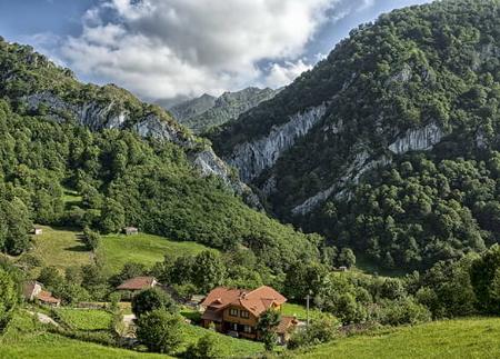
The path continues towards the village of L'Acebal, and from there you continue along the road for about 800 metres until you reach the entrance to Ribota. At this point, turn right and go around the village, crossing a small bridge at the foot of which is the Obellayo hermitage, a place of great popular devotion.
The final section runs parallel to the La Coruxera canal, along a path that crosses the village of Llorío, passing next to the house where Fray Norberto was born. After crossing the town centre, the loop ends, returning to the starting point in Soto.
This circular route, just over 11 kilometres long and with well-balanced uphill and downhill sections, offers an immersion in the landscapes of central Asturias. With its open views, traditional fountains, rural architecture and paths flanked by stone walls and meadows, it is an ideal route for those who wish to enjoy a day's walk amidst nature, history and tranquillity.
- It runs through the Cuencas Mineras Protected Landscape and through the Cuencas Mineras SAC of the Natura 2000 Network.
- This route coincides partially with IMBA0621.
- PR - AS 53
Basic tips before going into the mountains
- If you go with a dog, always keep it on a leash.
- Avoid approaching livestock.
- If you find mastiffs protecting livestock, do not approach them, do not pet them and do not feed them. Do not allow them to follow you or stray from their herd. They are working.
- Don't leave a trail. Collect all your waste, including organic waste. Nature is not a dumping ground.
- Act with prudence. Plan your route well, take everything you need and make sure it is adapted to your physical capacity.