Peña Mea

- Pelugano Central Asturias
- Distance: 10 kms
- Difficulty: Very difficult
- Cumulative difference in altitude: +910 m
- Cumulative difference in altitude: -910 m
- Maximum altitude: 1558 m
- Minimum altitude: 638 m
- IBP index: 89
- Modality: Mountaineers
- Type of route: Round trip
- Route type: Mountain
- Return by Train: No
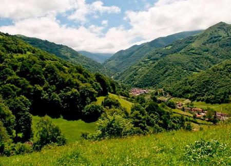
The route starts in Peḷḷuno (Aller), a village that is home to one of the largest concentrations of hórreos and paneras in the whole of Asturias. From the village viewpoint and the church, the path ascends through the last houses of the upper district, sharing the first sections with the GR 109. Soon, the livestock track leads to the farmhouse of La Vallina, where the surroundings begin to open up to extensive mountain meadows.
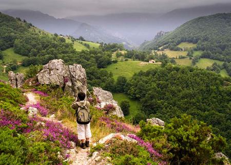
As you gain altitude, you reach the El Truncu spring, the usual resting point and reference point on the route before tackling the toughest sections of the ascent. From here, the route reaches the Collada de Peḷḷuno pass, where you leave the GR 109 and take the detour towards the Cerreo meadows, leaving behind the grassy areas to enter high mountain terrain.
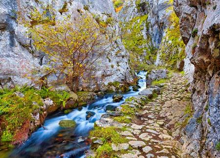
The path, increasingly rocky and steep, crosses the Canal de las Cuevas, with a steady slope, until it reaches one of the most characteristic and photographed points of the Asturian mountains: the Ojo de Buey. This large hollow, more than 15 metres in diameter, is the result of karstic erosion of the limestone and offers a spectacular natural window onto the landscape of valleys and mountain ranges.
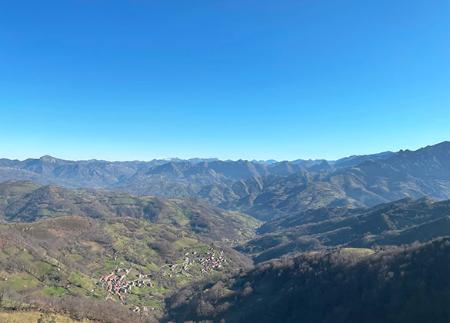
For many hikers, reaching Ojo de Buey is already the main objective of the route, but those who want to complete the ascent can continue on to the summit of Peña Mea, located some 250 metres up from this point. The final stretch, steep but without technical steps, leads to the summit, from where there is a 360-degree panoramic view: to the east, the Picos de Europa and Peña Ten; to the south, the fertile lowlands of Riotuerto and Babia; to the west, Peña Rueda and the peaks of the Ubiñas and to the north, the Aramo mountain range, Mostayal and, on clear days, even the Cantabrian Sea.
The return is generally along the same route - although it is possible to consider circular variants if you choose to go up from Les Campes (Laviana) and return via Doñango and La Boyica - descending with caution through the rockiest area until you return to the comfortable route of the Cerreo meadows. From there, the descent becomes gentler until reaching Peḷḷuno again.
This route, one of the most classic in the Asturian mountains, is especially recommended on days when the weather is good and it is always necessary to check the weather forecast. Although well signposted, it is important to have mountain experience in order to tackle the steepest sections and crest areas safely.
The route to Peña Mea offers a complete experience: effort, livestock heritage, unique geology and unforgettable panoramic views, crowned by one of the most recognisable natural symbols of Asturias.
- PR-AS 262
- This route partially coincides with the GR-109.
Basic tips before going into the mountains
- If you go with a dog, always keep it on a leash.
- Avoid approaching livestock.
- If you find mastiffs protecting livestock, do not approach them, do not pet them and do not feed them. Do not allow them to follow you or stray from their herd. They are working.
- Don't leave a trail. Collect all your waste, including organic waste. Nature is not a dumping ground.
- Act with prudence. Plan your route well, take everything you need and make sure it is adapted to your physical capacity.