Agüeria Pass Route

- Ḷḷindes Central Asturias
- Distance: 11.53 kms
- Difficulty: Difficult
- Cumulative difference in altitude: +753 m
- Cumulative difference in altitude: --753 m
- Maximum altitude: 1546.35 m
- Minimum altitude: 927.95 m
- IBP index: 80
- Modality: Mountaineers
- Type of route: Round trip
- Route type: Mountain
- Return by Train: No
The path runs through holly tree forests and past large cliffs with impressive cliffs. A hiking experience for the most daring hikers that combines challenge with impressive landscapes and connects us with the livestock tradition of the high mountains.
The Puerto de Agüeria is known for possibly being one of the places on the Peninsula with the greatest number of holly trees, an endangered species that finds refuge here, between Peña Rueda, to the north, and Las Ubiñas, to the south.
The route begins in the village of Ḷḷindes, in the municipality of Quirós, where we can leave the car in the car park and where we will find the signs marking the start of the route.
After walking approximately 1.3 kilometres, the path starts to become steeper, entering a beautiful, leafy beech forest. Here, the gradient becomes steeper, inviting you to pace yourself and enjoy the scenery.
When you have covered about 2 kilometres from the start, you will reach the area known as El Colláu. From this strategic point, the imposing Foz Grande opens up before our eyes, a natural gorge between two rocky giants: Peña Rueda and Peña Arpín. Half a kilometre further on, we will find a turning to the right that would take us to the summit of Peña Rueda; however, for this route, we will continue straight on.
Once you have left El Colláu behind, you will find yourself immersed in the Foz Grande. The path runs through this majestic landscape. We will cross the river for the first time at approximately kilometre 3 of the route, and we will cross it again when we reach the next kilometre.
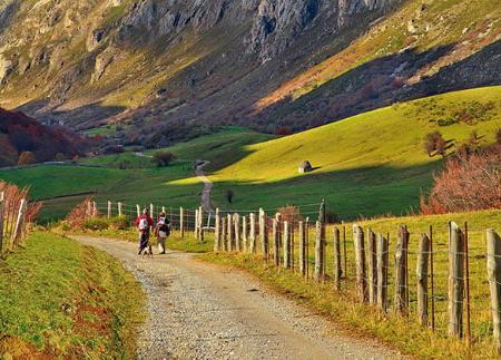
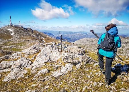
When we reach kilometre 5, we will have left the Foz Grande behind us and come to an area of wide green meadows surrounded by an amphitheatre of impressive mountains. This is the end point of our route. An area of incomparable beauty that offers beautiful views of the Ubiñas massif.
Reaching the Puerto de Agüería will not only allow us to enjoy spectacular views but will also connect us with the ancestral tradition of taking the cattle to the mountains (passes), summer after summer, to take advantage of the rich pastures in the high areas, while in the valleys they cured the grass to fill the haystacks for the winter.
After taking a break in this privileged natural environment, we will return to Ḷḷindes following the same route.
Basic tips before going into the mountains
- If you go with a dog, always keep it on a leash.
- Avoid approaching livestock.
- If you find mastiffs protecting livestock, do not approach them, do not pet them and do not feed them. Do not allow them to follow you or stray from their herd. They are working.
- Don't leave a trail. Collect all your waste, including organic waste. Nature is not a dumping ground.
- Act with prudence. Plan your route well, take everything you need and make sure it is adapted to your physical capacity.