Urbiés mountain range

- La Ḷḷera, Urbiés Central Asturias
- Distance: 9.67 kms
- Difficulty: Moderate
- Cumulative difference in altitude: +501 m
- Cumulative difference in altitude: -501 m
- Maximum altitude: 875 m
- Minimum altitude: 395 m
- IBP index: 54
- Modality: Hikers
- Type of route: Circular
- Route type: Mountain
- Return by Train: No
The route begins next to the bridges of La Ḷḷera, where a concrete track begins a gentle but steady climb towards the hamlet of Lleu, a small village that is still inhabited and where a fountain marks the entrance to the village. Shortly afterwards, the track turns into a dirt track and continues to El Artusu, an uninhabited hamlet that conserves the ruined structures of houses and stables, witnesses to the progressive depopulation of the Asturian countryside.
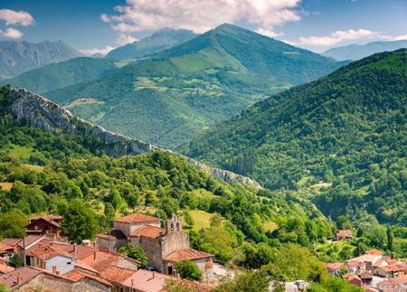
From here, the path enters a leafy forest of beech and chestnut trees, providing shade and coolness to the ascent, and takes us to the remains of an old path towards the Castril de Muries hill fort, still unexcavated, which adds an archaeological touch to the route. Continuing along the Camino Real de San Xusto, we border the valley until we reach the Ethnographic Complex of San Xusto, located on the southern slope of Picu Cogollu. This group of huts and hórreos, some of which are still in seasonal use, reflects the survival of the mountain livestock tradition.
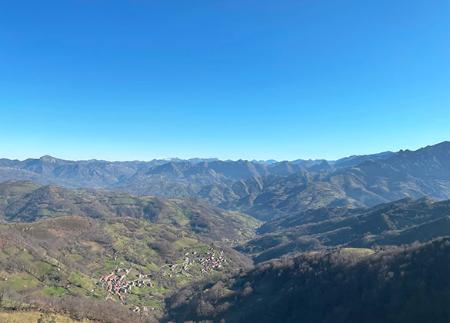
The route continues eastwards, ascending to the Campa Les Abeyes, the highest point of the mountain range, a wide pass open to the sky which offers one of the most spectacular panoramic views of the area: the mountain ranges of Laviana, Aller and Mieres, as well as the valleys which extend towards the centre of Asturias.
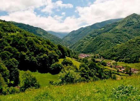
From Les Abeyes, the path links up with the PR AS-44 and continues towards the Campa de Urbiés, beginning the descent through beech and chestnut woods. The path crosses the Recerezal stream and enters the parish of Urbiés, passing through the neighbourhood of El Corraldusu. From here, it connects with the AS-337 road, to return to the starting point at La Ḷḷera, thus closing a circular route that sums up the essence of these mountains in just a few kilometres.
The Urbiés Mountain Range Route is a perfect proposal for those looking for quiet hiking, varied landscapes and contact with the rural heritage in one of the most beautiful and least travelled mountain ranges in central Asturias.
- PR-AS 43
- It runs through the Cuencas Mineras Protected Landscape and through the Cuencas Mineras SAC of the Natura 2000 Network.
- Partially coincides with PR-AS 44 and GR-208.
Basic tips before going into the mountains
- If you go with a dog, always keep it on a leash.
- Avoid approaching livestock.
- If you find mastiffs protecting livestock, do not approach them, do not pet them and do not feed them. Do not allow them to follow you or stray from their herd. They are working.
- Don't leave a trail. Collect all your waste, including organic waste. Nature is not a dumping ground.
- Act with prudence. Plan your route well, take everything you need and make sure it is adapted to your physical capacity.