Route der Brañas Vaqueiras in Cudillero

- San Martín de Luiña Westasturien
- Distanz: 23,94 kms
- Schwierigkeit: Sehr schwer
- Kumulierter Höhenunterschied: +836 m
- Kumulierter Höhenunterschied: --836 m
- Maximale Höhe: 665 m
- Mindesthöhe: 33 m
- PPI-Index: 91
- Modus: Bergsteiger
- Art der Rundfahrt: Rundweg
- Routentyp: Berge
- Rückfahrt mit der Bahn: Nein
Ideal für diejenigen, die eine Wanderung durch Geschichte, wilde Natur und unbesuchte Berglandschaften suchen. Die Möglichkeit, in die Kultur der "vaqueiros de alzada" einzutauchen und die Wanderstrecke anzupassen, machen diese Route zu einer bereichernden Erfahrung.
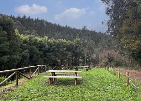
Diese Route mit mittlerem Schwierigkeitsgrad führt durch einige der authentischsten und am wenigsten begangenen Gegenden im Inneren der Gemeinde Cudillero und taucht in die Tradition der Cowboys ein, indem sie mehrere alte Berghütten besucht, von denen viele noch in Betrieb sind. Die Hauptroute ist ein Rundweg mit einer Länge von etwa 24 Kilometern, es gibt jedoch auch kürzere Varianten, die eine Anpassung der Route ermöglichen.
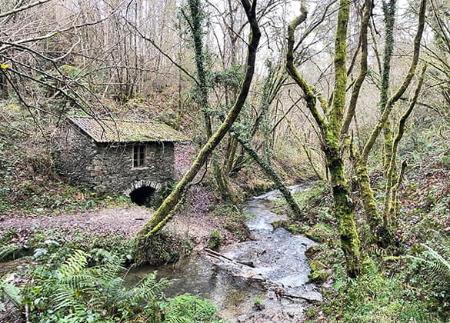
Die Route beginnt in der Nähe der Kirche San Martín de Luiña, einem Gotteshaus von großem historischem Wert, in dem eine Inschrift auf dem Fußboden an die Absonderung der vaqueiros de alzada, der Wanderhirten, erinnert, die während der Messe die hinteren Bänke besetzten. Von hier aus durchquert die Route die Bezirke Castañedo und Mumayor und führt durch das Barca-Tal hinunter in die Nähe des Flusses Uncín, in die Gegend von Artedo.
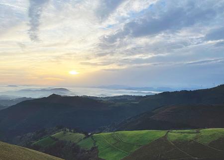
Von hier aus beginnt ein sanfter Anstieg an den Hängen der Gebirgszüge Argoma und Pascual, der durch einheimische Wälder von bemerkenswertem ökologischen Reichtum führt. Unterwegs sieht man häufig Rehe, Wildschweine und andere Wildtiere.
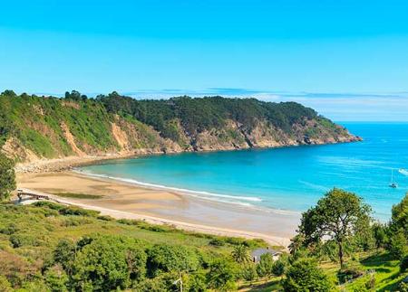
Mit zunehmender Höhe eröffnet sich ein Panoramablick auf einen großen Teil der Gemeinde: den Leuchtturm von Vidio, San Martín de Luiña, Lamuño, Salamir, Soto de Luiña, Pramaro oder Oviñana und viele andere. Vom Gebiet von La Xunglosa aus kann man die Route entlang der Hänge des Llan de Cubel fortsetzen oder einen Abstecher zur Braña von Teixidiello, einer der höchsten, machen, um dann über andere traditionelle Brañas wie Folgueirúa, La Puerca, Gallinero und L'Eireo nach San Martín zurückzukehren.
Wer die Route verlängern möchte, kann zu den Brañaseca- und Busfrío-Brañas in der Pumar-Gebirgskette weiterwandern, obwohl diese Option mehrere Kilometer mehr bedeutet und ein Begleitfahrzeug erfordert, wenn man den Rückweg nicht zu Fuß antreten möchte. Die Gesamtstrecke kann in diesem Fall bis zu 30 km betragen.
Diese Route bietet ein tiefes Eintauchen in die Landschaft, Geschichte und Kultur Asturiens und verbindet den Genuss der Natur mit dem Erbe einer alten Lebensweise, die mit der saisonalen Weidehaltung in den Höhenlagen verbunden ist.
PR-AS 272
Grundlegende Tipps, bevor Sie ins Gebirge gehen
- Wenn Sie mit einem Hund unterwegs sind, nehmen Sie ihn immer an die Leine.
- Vermeiden Sie die Annäherung an das Vieh.
- Wenn Sie auf Doggen treffen, die das Vieh schützen, nähern Sie sich ihnen nicht, streicheln Sie sie nicht und füttern Sie sie nicht. Erlauben Sie ihnen nicht, Ihnen zu folgen oder sich von ihrer Herde zu entfernen. Sie arbeiten.
- Hinterlassen Sie keine Spuren. Sammeln Sie alle Ihre Abfälle, auch die organischen. Die Natur ist keine Müllhalde.
- Handeln Sie mit Bedacht. Planen Sie Ihre Route gut, nehmen Sie alles mit, was Sie brauchen, und achten Sie darauf, dass sie an Ihre körperliche Leistungsfähigkeit angepasst ist.