Die Route der Castros

- El Mazo Westasturien
- Distanz: 16,13 kms
- Schwierigkeit: Schwer
- Kumulierter Höhenunterschied: +798 m
- Kumulierter Höhenunterschied: -798 m
- Maximale Höhe: 724 m
- Mindesthöhe: 118 m
- PPI-Index: 76
- Modus: Wanderer
- Art der Rundfahrt: Rundweg
- Routentyp: Berge
- Rückfahrt mit der Bahn: Nein
Der Weg führt hinauf zum Penácaros-Gipfel (733 m), wo sich die Penácaros-Tumuli befinden, die von alten Siedlungen zeugen. Eine Reise zurück in die prähistorische Zeit und die Entdeckung der Spuren der ersten Siedler Asturiens.
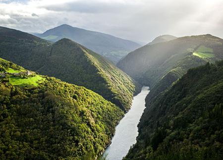
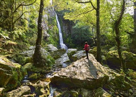
Die Route beginnt an der Casa de la Apicultura in El Mazo und führt durch eine abwechslungsreiche Landschaft, die ursprüngliche Wälder, verlassene Dörfer und historische Überreste miteinander verbindet. Entlang der Route wechseln sich Feldwege, Bergpfade und Straßenabschnitte ab und bieten eine Route, in der die natürliche Schönheit mit dem reichen kulturellen Erbe der Region kontrastiert.
Von der Casa de la Apicultura führt die Route nach El Mazo und nimmt einen unbefestigten Weg, der durch einen belaubten Auenwald hinabführt. Dieser schattige und kühle Abschnitt folgt dem Lauf des Pendia-Bachs, der die Talsohle markiert. Nachdem wir ihn überquert haben, nähern wir uns der Ortschaft As Viñas und erreichen im weiteren Verlauf den verlassenen Weiler Riumayor, in dem noch Reste alter Wohnhäuser und ein Steinbruch zu sehen sind, der in der Vergangenheit zum Steinabbau genutzt wurde.
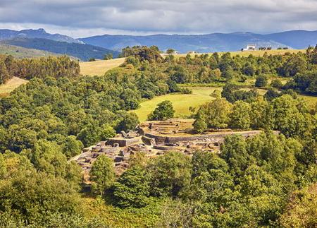
Von hier aus geht es weiter bis zum Dorf Arbededo, wo wir auf die örtliche Straße nach Pendia treffen. Auf dieser praktisch ebenen und unschwierigen Strecke erreichen wir das Hillfort von Pendia, eine in den 1940er Jahren von den Archäologen Antonio García y Bellido und Juan Uría Ríu ausgegrabene Stätte.
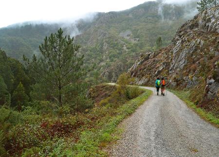
Nach der Besichtigung des Hillforts beginnt der anspruchsvollste Teil der Route. Der Weg steigt vom Castro bis zum Friedhof von Villanova an, wo ein Abschnitt mit stärkerem Gefälle beginnt. Es geht weiter den Berg hinauf, bis man am Pico Penácaros eine Höhe von 733 Metern erreicht. In der Nähe des Gipfels befinden sich die Penácaros-Tumuli, antike Überreste, die auf prähistorische Siedlungen in dieser Gegend hinweisen.
Von hier aus geht es hinunter in Richtung des Erholungsgebietes von Llaviada und auf einem Weg, der zum Dorf As Cabanas führt.
Die Route führt weiter in Richtung El Sarredo, wo der Weg, nachdem er die Häuser hinter sich gelassen hat, im Zickzack durch eine Wiese absteigt, die uns zurück nach El Mazo führt und so einen Rundweg vervollständigt, der Natur, Archäologie und beeindruckende Berglandschaften miteinander verbindet.
- PR-AS 249
- Straßenabschnitte
- Schräge Abschnitte
Grundlegende Tipps, bevor Sie ins Gebirge gehen
- Wenn Sie mit einem Hund unterwegs sind, nehmen Sie ihn immer an die Leine.
- Vermeiden Sie die Annäherung an das Vieh.
- Wenn Sie auf Doggen treffen, die das Vieh schützen, nähern Sie sich ihnen nicht, streicheln Sie sie nicht und füttern Sie sie nicht. Erlauben Sie ihnen nicht, Ihnen zu folgen oder sich von ihrer Herde zu entfernen. Sie arbeiten.
- Hinterlassen Sie keine Spuren. Sammeln Sie alle Ihre Abfälle, auch die organischen. Die Natur ist keine Müllhalde.
- Handeln Sie mit Bedacht. Planen Sie Ihre Route gut, nehmen Sie alles mit, was Sie brauchen, und achten Sie darauf, dass sie an Ihre körperliche Leistungsfähigkeit angepasst ist.