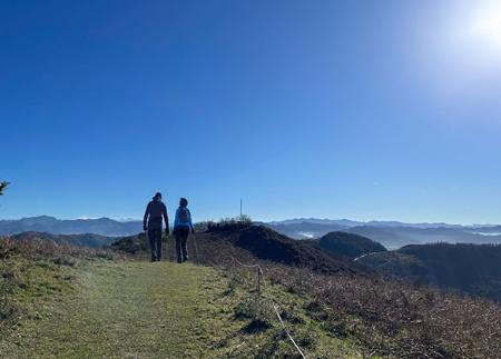
Sotrondio to Santa Bárbara route

- Sotrondio, Miera Medio, Paniceres, La Restinga, La Pedrera Central Asturias
- Distance: 7.45 kms
- Difficulty: Moderate
- Cumulative difference in altitude: +82 m
- Cumulative difference in altitude: --82 m
- Maximum altitude: 338.99 m
- Minimum altitude: 249.93 m
- IBP index: 25
- Modality: Families
- Type of route: Round trip
- Route type: Mountain
- Return by Train: Yes
- FEVE
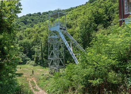
Along the way, we will find vestiges of an industrial past in harmony with the environment, old villages full of tradition and a rich biodiversity. An experience to enjoy nature in the mining basins.
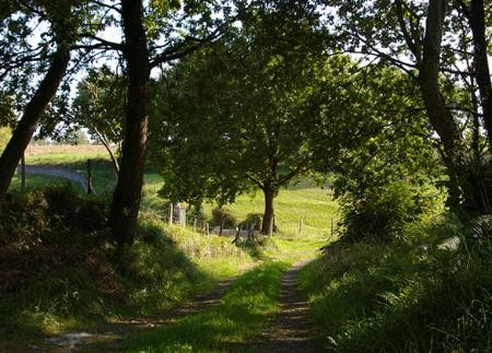
In the Asturian mining basins, the industrial legacy is intermingled with authentic natural gems such as this route that starts in Sotrondio in San Martín del Rey Aurelio and meanders along the Santa Bárbara river. Here, the mouths of the river merge discreetly into the vegetation, almost camouflaged by the dense forest that embraces the riverbed.
This simple route starts in Sotrondio, a town where you can easily park your car. We start the route by crossing a bridge that spans the waters of the river Nalón, the great backbone of the basins. With caution, we then cross the AS-177 road, from where we can see the path that will guide us on this short but interesting route.
The route runs parallel to the right bank of the Santa Bárbara river, taking us into a valley steeped in history and tradition. As we advance, at approximately the first kilometre, we will pass the town of Miera Medio on our right, an enclave that forms part of the Protected Landscape of the Cuencas Mineras, a testimony to the natural and heritage wealth of the area.
We will pass through the small villages of Paniceres and La Restinga, where rural life is shown in its essence.
Throughout the route, the Santa Bárbara river accompanies us, and with it, the wildlife. We can stop to try to detect the presence of blackbirds, the silhouette of trout in the clear waters of the river, or the sudden appearance of a kingfisher.
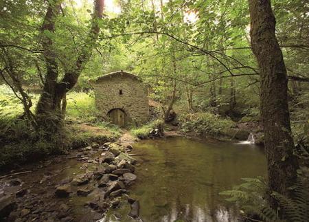
After 2.3 kilometres, on our left, we come across a moving monument: the "Prau Molín", which pays homage to the miners in the mine. The next kilometre after crossing a small road, we reach the Church of Santa Bárbara, a mid-18th century building that marks the high point of our route.
A few metres from the Church of Santa Bárbara, we can observe "casiellos", old bee hives made from tree trunks, a curious vestige of traditional beekeeping; farm implements resting on a granary, a symbol of local agriculture; and even elements of the mine used for the creation of tunnels, a reminder of the area's mining past.
From here, we return along the river path to Sotrondio, immersed in an almost continuous forest. For those who wish to explore further, if we have taken the route in the direction of Santa Bárbara/Santa Bárbola, there is the possibility of continuing the path in the direction of La Colladiella, opening the door to continue discovering this interesting corner of Asturias.
Basic tips before going into the mountains
- If you go with a dog, always keep it on a leash.
- Avoid approaching livestock.
- If you find mastiffs protecting livestock, do not approach them, do not pet them and do not feed them. Do not allow them to follow you or stray from their herd. They are working.
- Don't leave a trail. Collect all your waste, including organic waste. Nature is not a dumping ground.
- Act with prudence. Plan your route well, take everything you need and make sure it is adapted to your physical capacity.