Back Discover the best Greenways and Paths in Gijón
Discover the 5 best Greenways and Trails in Gijón
Gijón/Xixón is an ideal city for walking. It has numerous trails and greenways that start in the heart of the city, which are perfect for enjoying outdoor routes.
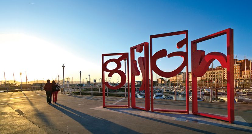
Gijón/Xixón is captivating at first sight. It is a fascinating city full of life, a mixture of tradition and modernity, photogenic and constantly reinventing itself. Its people, gastronomy and nightlife complement an experience that is enriched by a visit to the city's most emblematic spots, such as San Lorenzo beach, the iconic Elogio del Horizonte, the monumental Laboral Ciudad de la Cultura or the captivating Cimadevilla neighbourhood, among many others.
The capital of the Costa Verde has a lot to offer. Among other things, it boasts several hiking routes, which start in the city or in the surrounding area. This is a compilation of its five most popular trails and greenways, which add to the variety of things to do in Gijón/Xixón.
Ñora river path
Start and finish: from La Llorea Golf Course to La Ñora beach.
Distance: 10 kilometres, there and back.
The Ñora river path is a pleasant river walk along the banks of the Llorea stream and the Ñora river. It starts a slight descent from the La Llorea golf course, from where you can enjoy panoramic views of the L'Altu L'Infanzón hills and Mount Deva.
After a short stretch, we cross the first of the 5 charming wooden bridges that we will find along the path. This is where the wooded area begins and the route joins the Ñora stream, which with its soothing murmur will be the ideal companion practically until the end of the route.
It is a surprising path, and the trees and abundant vegetation along the river seem more typical of a remote area of Asturias than of the outskirts of the largest city in Asturias. Along the walk there are several informative signs with information about the fauna that inhabits the area.
The path continues until you come to the remains of the dam and the canal that supplied what are now the remains of the Molín de Pilo. A little further on, the forest is left behind to welcome us, almost five kilometres later, to the beautiful beach of La Ñora. Surrounded by vegetation and cliffs, it is a perfect place to enjoy the Cantabrian Sea and take a rest before starting the return journey.
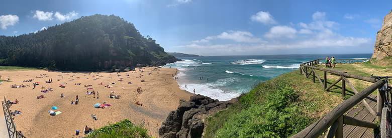
The Ñora river path is well signposted and easy to follow, as you only have to follow the course of the river to the beach. It can be done at any time of the year, although summer is probably the best time: the forest protects you from the sun and it is the perfect season to combine hiking with a swim at the beach. Due to its short length and low gradient, the path is perfect for the whole family, taking it easy and enjoying the landscape and the surroundings.
Cervigón Path
Start and finish: from Santa Catalina hill to La Ñora beach.
Distance: 18 kilometres round trip.
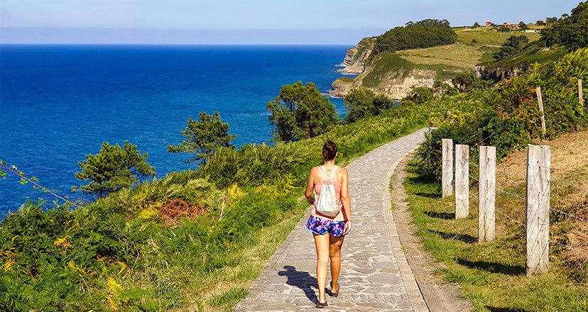
The Cervigón path is a beautiful and complete route that runs along the coast, between cliffs, beaches and spectacular landscapes. Along the way, you can also see several sculptures.
It starts at Cervigón beach, better known as Rinconín beach, although it is also very common to start this trail at Santa Catalina hill (24 kilometres round trip), in the city of Gijón/Xixón, where one of the city's best-known icons is located, Eduardo Chillida's monumental sculpture, the Elogio del Horizonte (In Praise of the Horizon). A few metres away you will discover the first of the fantastic panoramic views of the day: the view of the bay of Gijón/Xixón and the beach of San Lorenzo with the city behind.
In a few minutes you reach the church of San Pedro, another of the city's landmarks. This is the start of San Lorenzo beach and the promenade, which is very lively at any time of the year.
After a kilometre and a half along the beach and past the river Piles, you continue along the promenade, which has a total length of 3 kilometres. Here the urban landscape changes, with the tall buildings being replaced by single-family houses. Soon another of the sculptures on the path appears: "Sombras de Luz" (Shadows of Light), by the Asturian sculptor Fernando Alba, popularly known as the Chaponas.
A few metres away, on a ledge that divides the Cervigón beach, where the official route begins, there is another sculpture that leaves no one indifferent. It is "La Madre del Emigrante", by the sculptor Ramón Muriedas, a moving work that represents the pain of the Asturian mothers who were saying goodbye to their children who were leaving for America. Behind it is the Rinconín park, very busy in summer, where we find the sculpture "Solidarity", by the sculptor Pepe Noja.
From here, leaving the city of Gijón/Xixón behind, there is a continuous up and down path, which can be overcome without great difficulty, to reach a recreational area with beautiful views of the Bay of Biscay. We find a work made by Joaquín Rubio Camín from a piece of the Castillo de Salas ship, in memory of the shipwreck of 1986.
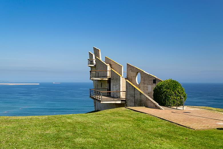
The path now descends to the wild beach of Peñarrubia, where it is time to gain height again to reach the park of La Providencia and look out over its famous prow-shaped viewpoint, the work of Ángel Noriega. The panoramic views of Gijón/Xixón and its bay from the top are spectacular.
The path continues towards the Colina del Cuervo (Crow Hill) and then descends progressively, passing the accesses to the beaches of Serín, La Cagonera and Estaño on foot.
In a short time you reach the viewpoint to the beach of La Ñora. From the cliff the view of the beach is spectacular, and if the day is sunny and the sea is calm the water is transparent with the characteristic Asturian emerald green tone. From the viewpoint to the beach there are only 200 steps between eucalyptus trees.
It is possible to shorten the route by starting at other points, such as Estaño beach, Serín beach or the Providencia viewpoint.
La Camocha Greenway
Start and finish: from Poblao de Santa Bárbara, in Tremañes, to the old Pozu La Camocha castles, in the parish of Samartín de Güerces.
Distance: 14 km round trip
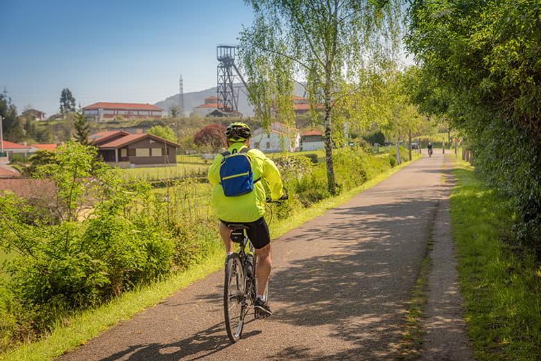
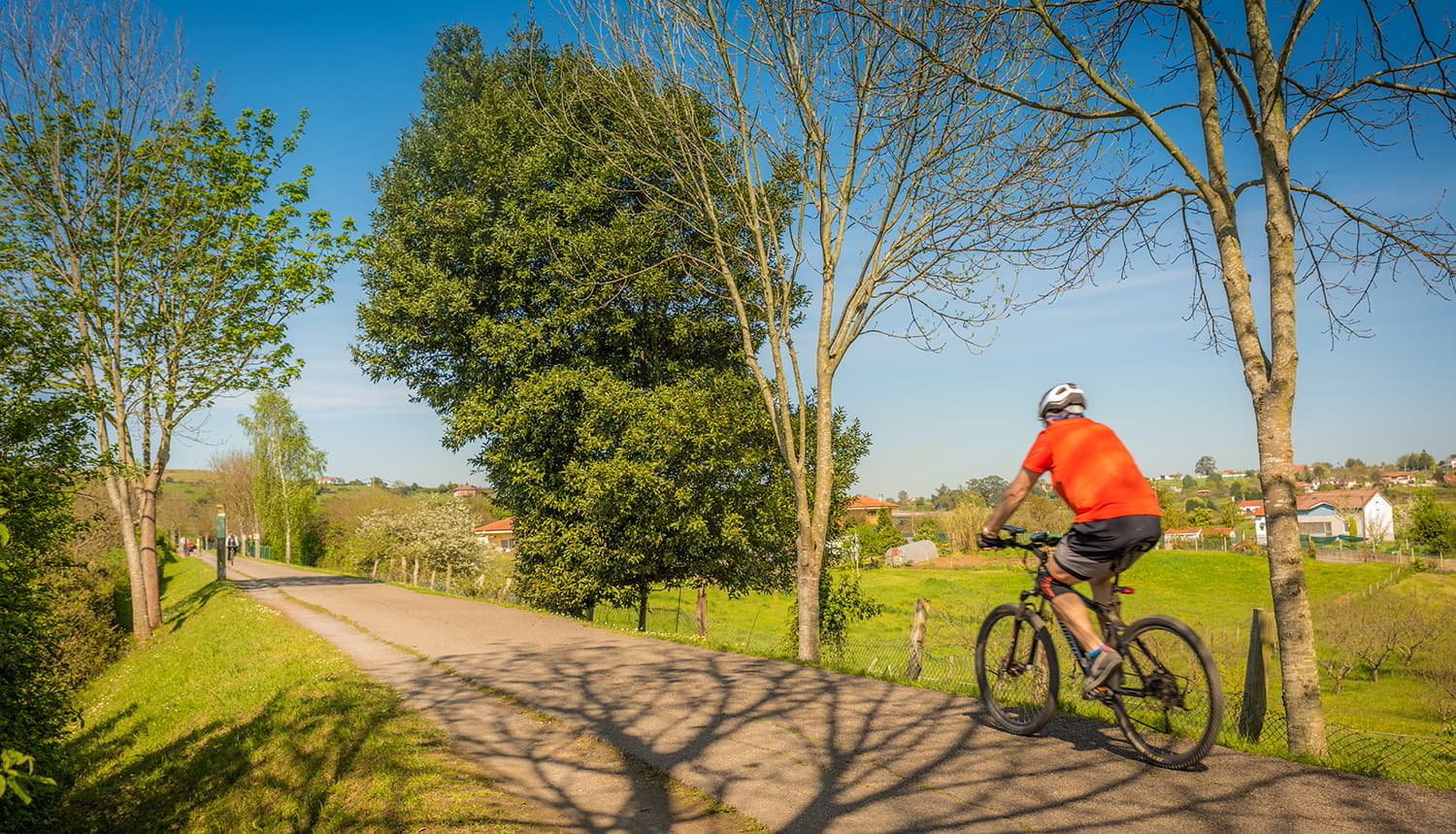
In 1993, a project was launched to recondition disused railway lines to give them a new life as hiking and cycling routes. The Camocha Greenway belongs to this programme and recovers the route of a mining train that used to connect the La Camocha pits with Veriña to sell Asturian coal in other markets through the Port of Musel. This greenway shows the change from the urban and industrial landscape to the rural one, and is currently one of the busiest routes in the city.
It begins a slight descent, passing the Quinta La Torre estate (the former palace of the Marquises of Casa Tremañes) to reach the Morteru fountain, where the route flattens out again. It continues through a wooded area with abundant vegetation where the Pilón stream appears, which is crossed over a wooden bridge to reach the village of La Fana.
The track passes under the road that connects with Oviedo/Uviéu and reaches an industrial estate, which is left behind in a few minutes to continue through a grove of trees. After leaving the parish of La Pedrera we have to cross a 400 metre long illuminated tunnel, built under the Carbonera road, where the charcoal from the steam engines can still be seen on the walls. The exit is at Leorio/Llorio, to reach the Puentón (old railway bridge), where there is a rest area.
Finally, as you pass under the viaduct of the mining motorway, you can see the Pico el Sol/ Picu'l Sol (439 m) and you can see the derricks of the shafts of the La Camocha mine, the end point of this greenway. La Camocha was a coal mine that was active from 1935 to 2008, today preserved as a valuable element of the region's industrial heritage.
Piles river path
Start and finish: from the bridge over the river Piles, on the beach of San Lorenzo, to the village of La Camocha, in the parish of Vega.
Distance: 18 km round trip
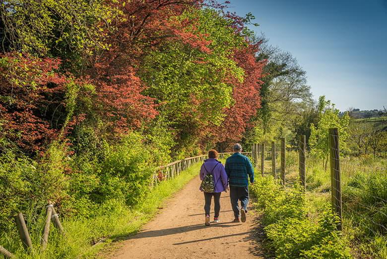
This path is a pleasant and accessible walk with the river Piles as the protagonist, which flows into the beach of San Lorenzo. It is a river path which, despite running close to buildings and roads, is practically silent and allows you to isolate yourself from the city and feel at one with nature.
From the bridge over the river Piles, the path passes through the popular Isabel la Católica park, next to the El Molinón football stadium, to reach the Guía roundabout, near where the river Piles meets the river Peñafrancia. It is at this point where the change from an urban landscape to a more rural one begins to be noticed.
Walking along the banks of the river Piles, the path continues along the surroundings of the Las Mestas sports complex, perhaps the busiest area of this path, but also the perfect place for a stop as there are several recreational areas.
A few minutes later, the path runs under the network of bridges of the Cantabrian and Minera motorways, but soon the landscape becomes more peaceful, reaching an area typical of a riverside forest.
Continuing along the path, we cross the Carbayera river park, reaching the houses of Vega d'Abaxo without difficulty. As you approach the final stretch of the route, you cross the La Pola Siero road by means of a footbridge, and the path continues its course until you reach La Camocha.
Despite its length, the path is easy, with a minimal gradient, simple to follow and extremely interesting. In a short time, it offers the opportunity to change the urban landscape for a rural one.
Peñafrancia Path
Start and finish: from La Guía roundabout to Lavadero de Deva.
Distance: 12 km round trip
Inaugurated on 5 June 2005, it is one of the busiest paths in Gijón. It starts in La Guía, where we find the sculpture Sentimientos by Manuel García Linares, very close to the Molinón football stadium and the Las Mestas sports centre, where the Peñafrancia river flows into the Piles river. After passing under some bridges, we reach the area around the university campus.
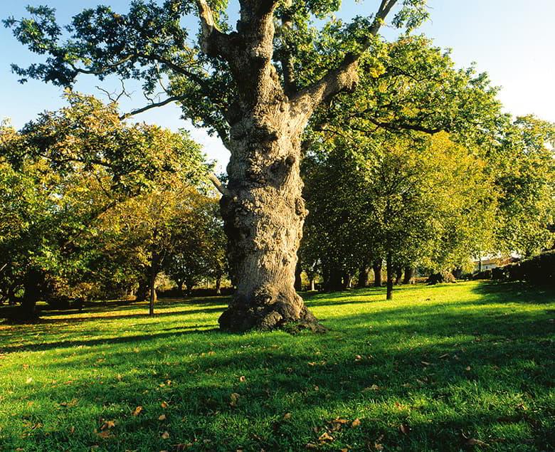
The path crosses a leafy area up to the El Tragamón golf course and continues placidly past the Carbayera del Tragamón, an impressive forest of hundred-year-old oak trees (carbayos in Asturian).
Leaving this interesting natural museum behind, continue along the Maizales path, where the signs lead to the Cabueñes neighbourhood. Here, the landscape changes completely, adopting an eminently rural character, while the imposing building of the Universidad Laboral can be seen in the distance.
This stretch offers an excellent opportunity to stop, rest and recharge your batteries, as there is a recreational area with benches for visitors to enjoy.
Leaving Cabueñes behind, you reach the parish of Deva, where you pass the fortified entrance to the Quinta del Conde de Revillagigedo, an important protected architectural heritage site, where the family coat of arms is clearly visible.
After passing the Church of San Salvador de Deva, the path ends at an exceptional spot: the Güeyu Deva (Ojo de Deva in Asturian). The setting is truly privileged and looks like something out of a fairy tale. Here you will find a washing place, a fountain and a stone bridge over the waters of a beautiful pond. The Peñafrancia river rises from the Güeyu Deva and legend has it that you can meet the Xanas (water nymphs) here at certain dawns, such as San Juan, when they can be disenchanted.
Conclusion
Gijón's trails and greenways are yet another attraction in the city, offering an urban escape and the option of enjoying nature and practising active tourism just a few minutes from the city centre. These trails that wind through green and coastal areas are, without a doubt, one of the best things to do in Gijón and the perfect complement for anyone visiting the city.
Subscribe to our newsletter and take advantage of offers, discounts, and news
Subscribe

