Eastern Way of St James


- Ribadesella/Ribeseya
- Distance: 44 kms
- Difficulty: Fácil
- Total ascent: 565 m
- Maximum altitude: 98 m
- Minimum altitude: 2 m
- IBP index: 34
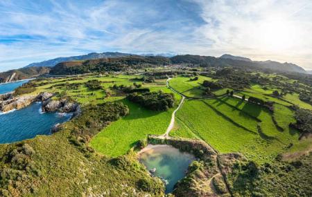
We set off from Ribadesella/Ribeseya along the AS-379 and, after passing the station, take the track towards Orellana. Following the route, we approach the foothills of the Sierra Cueva Negra, passing through Meluerda and Camangu, and before reaching Belmonte de Pría we briefly join the Camino de Santiago, leaving it momentarily before rejoining it again as we head towards Nueva. This section has been developed for visitors, but in a way that is respectful of and blends in with its rural surroundings.
Shortly after Nueva, we can decide whether to continue along the Camino route towards Villaḥormes and Naves, to reach the beach and viewpoint at San Antolín, or, if the weather and our spirits are up to it, head to the Picos de Europa viewpoint, which offers a magnificent view of Los Picos, weather permitting. After visiting the viewpoint, we return to Naves, from where we rejoin the route to reach San Antolín.
After taking in the scenery, we head back westwards, following the signs for the Camino de Santiago. This brings us to Gulpiyuri beach, designated a Natural Monument and a site of geomorphological interest; it is a tiny beach situated inland, which is even more charming at low tide.
We continue along winding tracks close to the coastline, following the suggested route to avoid getting lost at the junctions, many of which are unmarked. We recommend stopping as often as you like to enjoy the rural and coastal scenery. From Llames, we rejoin the Camino and arrive at another must-see spot, the Los Acantilados del Infierno viewpoint, where we can admire the sculptures that the sea has carved into the rock over the centuries.
All that remains is to cycle the gentle final 3 km to reach the start and finish point, Ribadesella/Ribeseya, a coastal town with many attractions, such as its historic centre and the seafront promenade.
All along the route, you’ll find all sorts of amenities (shops, bars, accommodation, etc.).
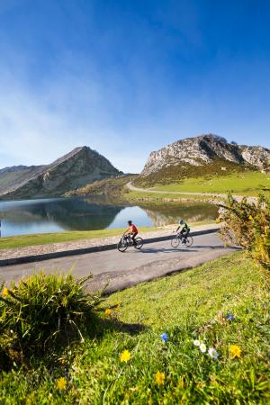
You can take a detour to reach the Picos de Europa viewpoint
The detour to the viewpoint adds 4 km to the route