Loredo Valley Greenway


- La Perea, Lloreo
- Distance: 4 kms
- Difficulty: Very easy
- Total ascent: 45 m
- Maximum altitude: 236 m
- Minimum altitude: 188 m
- IBP index: 3
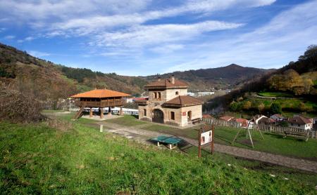
This route begins in La Perea, where we leave the railway station and take a tarmac road that leads us to the start of the Vía Verde.
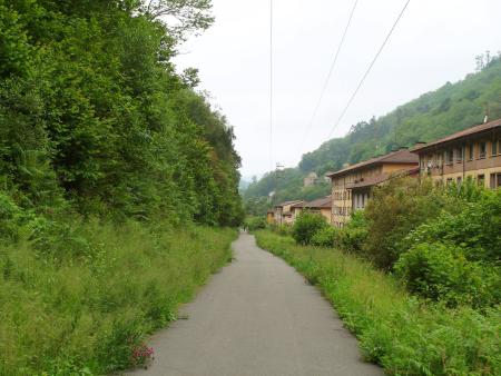
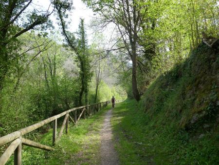
After passing through the La Perea leisure area, we come to a short incline, after which the entire route is practically flat. We soon enter a magnificent native woodland, with the route running halfway up the hillside, allowing us to admire the impressive Caudal riverbed, nestled at the bottom of the valley.
The route passes through several tunnels, all of which are lit, as it winds its way through impressive limestone ridges.
About halfway along the route, you reach the well-preserved village of Lloreo, where the old narrow-gauge railway station houses an Interpretation Centre showcasing the history of the coalfield and how this line operated.
We continue through woods and clearings, from which we can see the Caudal River, increasingly hemmed in, at the bottom of the valley, until we reach a tunnel where the route ends and we can rest at a small picnic area. We return along the same path.
Along the route there are several spots with small rest areas where you can sit down and recharge your batteries.