Luanco Beach - Verdicio

- Lluanco/Luanco,Verdicio Central Asturias
- Distance: 20 kms
- Difficulty: Moderate
- Cumulative difference in altitude: +301 m
- Cumulative difference in altitude: -306 m
- Maximum altitude: 95 m
- Minimum altitude: 2 m
- IBP index: 57
- Modality: Hikers
- Type of route: Crossing
- Route type: Coast
- Return by Train: No
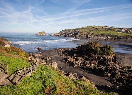
The views from Cabo Peñas, the La Mofosa viewpoint and the old Llumeres mine, the longest iron ore mine in Asturias, stand out. Along the route, there is a succession of beaches, cliffs and viewpoints, closing a varied itinerary that culminates at the spectacular Verdicio beach.
The route starts at Luanco beach, from where you climb up to the recreational area of La Mofosa, an excellent natural viewpoint that allows you to contemplate the port of Lluanco/Luanco and a good part of the coastline. On clear days, it is possible to make out La Campa Torres and even the Picos de Europa. From there, the path descends to the Moniello beach-park, an ideal rest area for a break before continuing.
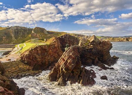
The path continues along the edge of the cliffs until it reaches Bañugues. The landscape here is characterised by alternating coastal meadows and steep rocky outlines, offering a visually stunning setting. The route continues in the direction of the old Llumeres mine, where there is a viewpoint from which you can see both the old mineral wharf and the industrial environment that marked this area. The Llumeres mine and cove bear witness to the longest-running iron ore mine in Asturias, whose history dates back to 1858 with the Compañía Minera de Gozón. For decades, the emblematic iron and steel company Duro Felguera, from the Nalón basin, managed this mine. On the cliffs there are still remains of the old Simancas shaft - such as a warehouse, offices and the toilet block - and, on the shore, a mine shaft and the jetty, from where the ships loaded with ore left for the port of Gijón.
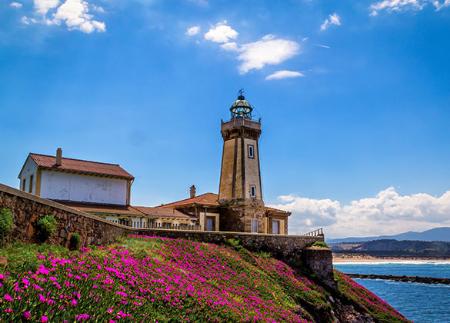
From this point, the path descends towards Llumeres beach and continues along the coast towards Viodo beach. Along a path parallel to a small stream, it joins the road that leads to Cabo de Peñas. The lighthouse, built at the end of the 19th century, stands as the northernmost point on the Asturian coast and houses the Interpretation Centre of the Cabo de Peñas Protected Landscape. From its quartzite cliffs, over a hundred metres high, you can enjoy spectacular views of the sea and the island of La Herbosa.
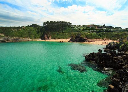
As you go on, the lighthouse is gradually left behind as the path meanders through heather and gorse bushes. After crossing a wooden bridge, the route reaches Ferrero, from where you can access the viewpoint with views of Carnera beach. The final section runs along paths close to the sea until it reaches Verdicio beach, also known as Tenrero beach, closing a 20-kilometre route that combines nature, history, industrial heritage and seafaring tradition.
- It runs partially through the Cabo de Peñas Protected Landscape and through the Cabo Busto-Luanco SAC and SPA of the Natura 2000 Network.
- Partially coincides with the PR-AS 025 and PR-AS 025.1 or GR-204.
Basic tips before going into the mountains
- If you go with a dog, always keep it on a leash.
- Avoid approaching livestock.
- If you find mastiffs protecting livestock, do not approach them, do not pet them and do not feed them. Do not allow them to follow you or stray from their herd. They are working.
- Don't leave a trail. Collect all your waste, including organic waste. Nature is not a dumping ground.
- Act with prudence. Plan your route well, take everything you need and make sure it is adapted to your physical capacity.