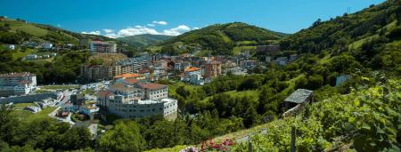
Los Puertos Scenic Route


- San Antolín de Ibias, Cangas del Narcea
- Distance: 101 kms
- Difficulty: Muy Dura
- Total ascent: 2560 m
- Maximum altitude: 1318 m
- Minimum altitude: 252 m
- IBP index: 159
- Mythical mountain passes
- Type of bicycle: Road
- Type of route: Circular
- Return by Train: No
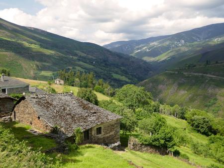
The route starts in Cangas del Narcea, where we take the AS-15 road to La Regla. Here, we turn right onto the AS-29 towards San Antolín de Ibias. We continue on a gentle climb to El Forcao, where the gradient begins to steepen until we reach the Pozo de las Mujeres Muertas (1098 m), a spot offering spectacular views over the Valledor. The toughest section is just over 4 km long, with gradients of around 13–15% over long stretches. From the Pozo de las Mujeres Muertas, there are just a couple of very gentle kilometres left before reaching the summit of the Alto de Valver.
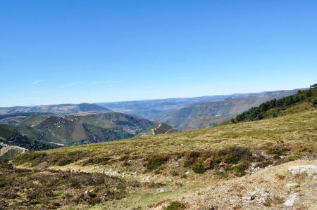
We begin the descent of around 20 km down to San Antolín de Ibias. From here, we continue towards Cecos and from there along the AS-348 to tackle the second major climb of the day, the Connio Pass (1,315 m); longer at 19 km, but with more manageable gradients. We enter a wooded area, passing through the Muniellos Integral Nature Reserve, a vast forest of oak, birch, beech and chestnut trees that shelter us during the final kilometres of the climb. There are several viewpoints (Sestón and C.I. Muniellos) from which to enjoy the views.
We begin the 14 km descent to Pousada de Rengos, where we take the AS-15 to La Riela, descending gently and following the course of the River Narcea. Here we take the AS-29 to Cangas del Narcea, where the route ends.
It is undoubtedly one of the most beautiful routes you can take, where nature and the landscape permeate absolutely everything.
It can also be reached from Oviedo/Uviéu