Los Molinos Route


- La Caizuela
- Distance: 13 kms
- Difficulty: Very easy
- Total ascent: 228 m
- Maximum altitude: 215 m
- Minimum altitude: 68 m
- IBP index: 19
- Family routes
- Type of bicycle: MTB
- Type of route: Circular
- Return by Train: No
The route begins in the council’s main town, La Caizuela, and, depending on the type of surface, it can be divided into three sections.
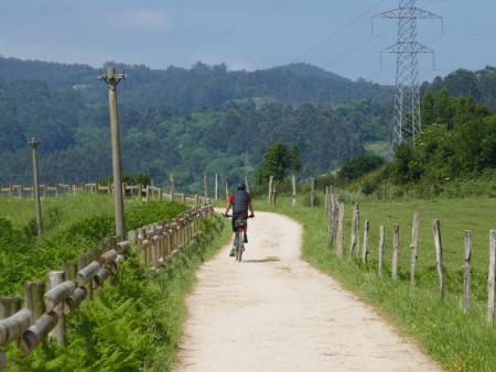
In the first section, after passing through the village, the route begins a descent along a dirt track which is occasionally pitted with gullies caused by runoff water and requires a bit of care. This track, which is sometimes reduced to a narrow path by the vegetation, takes us towards the stream, which we cross via wooden bridges and which, depending on the time of year, may partially flood the track. About three kilometres into the route lies the Velasco mill, and after continuing for just over a kilometre alongside the river and crossing several bridges, you reach the end of this section and the Senda de los Molinos trail. This section is strictly for mountain bikes.
From here, the second section begins, joining the Senda del Agua, which runs mainly through Corvera and has a gravel surface in good condition, running alongside the canal that supplies water to the Trasona reservoir.
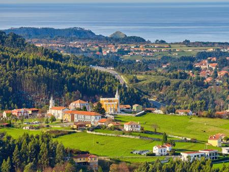
Continue along the track until you reach El Barrial, where you come to the AS-321 road; leave the trail here and return along the final section on tarmac, passing through small rural hamlets such as Zanzabornín and Taborneda before returning to La Caizuela. On the descent, near the end of the route, you can see the Palacio de Bárzana, a prominent building in the historical heritage of Illas.