Avilés - Luarca


- Avilés, Cudillero, Luarca/Ḷḷuarca
- Distance: 99 kms
- Difficulty: Medio
- Total ascent: 1675 m
- Maximum altitude: 170 m
- Minimum altitude: 1 m
- IBP index: 119
The route leaves Avilés heading west along the road close to the coast, passing through small rural villages such as Salinas, a seaside town with a stately air that has been reconquered by the hippie spirit of surfers from halfway around the world. We then border the Asturiana de Zinc factory, until we reach the beautiful plain of Arnao. Here we find the old mine of Arnao, where you can visit its museum and its peculiar castle. In this area there is also a picnic area where you can recharge your batteries. We continue until we reach the CT-1 which takes us to another village, Santa María del Mar/El Puertu, where on the beach of the same name there is also an old mine of historical interest.
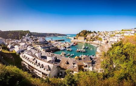
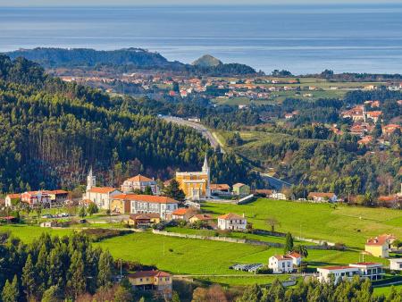
We continue along the track, which will take us along roads immersed in a varied landscape, rustic, coastal and mountainous, until we reach the mouth of the Nalón, where we can enjoy the scenery from the viewpoint at Los Quebrantos Beach, and return to the route to go around the whole of the San Esteban estuary. The road leads us to the Espíritu Santo viewpoint, which offers majestic views from Cabo Peñas to Cabo Vidio. From here, the route continues along local roads, passing several interesting points, such as the viewpoint over Aguilar beach, or the Palacio de La Quinta, home to the Selgas Fagalde Foundation, until we reach Cudillero, where, after enjoying the charm of this fishing village, we continue along the road around the fishing port.
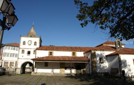
We continue along the old N-632 and 632a roads, skirting the beach of La Concha de Artedo, until we reach the beautiful beach of San Pedro de la Ribera, and continue on to Soto de Luiña, where we can stop to see the church of Santa María, a former pilgrims' hospital linked to the Pilgrims' Route to Santiago de Compostela. We continue along the N-632a road to Oviñana, where we can either continue or take the short detour (about 3 km one way) to the Cape Vidio lighthouse and its magnificent cliffs. We continue towards Cadavéu, crossing small hills and valleys and a fairly well-preserved landscape. At this point, it is highly recommended to take a detour (just 1.5 km one way) to reach the small hermitage of La Regalina, as the views from the cliffs are well worth the effort.
If you have enough time and strength, we can take a detour to contemplate the views from the Protected Landscape of Cape Busto (a detour of about 4 km one way). The route ends in Luarca/Ḷḷuarca, a fishing village with a beautiful fishing port and all kinds of services.
Respect the direction of traffic on urban stretches.
Caution with the traffic towards the beaches in summer.