Water Trail


- Distance: 8 kms
- Difficulty: Very easy
- Total ascent: 136 m
- Maximum altitude: 133 m
- Minimum altitude: 53 m
- IBP index: 11
- Family routes
- Type of bicycle: Gravel,MTB
- Type of route: Circular
- Return by Train: No
The route has been adapted to include the easiest and most attractive sections of La Ruta del Agua, avoiding areas with heavy traffic in summer and making use of some local roads to ensure a smooth journey. It is designed to be enjoyed by the whole family.
The starting point is Xuncéu/Juncedo, although it is possible to start at any other point along the route, and it can be walked in either direction. Shortly after setting off, the route joins a section shared with the Camino de Santiago, which it soon leaves behind to cross the CV-2 road and tackle a short climb leading up to the viaducts of the Cantabrian Motorway.
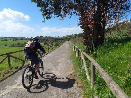
The route continues, alternating between different sections of local roads with little traffic, until it reaches El Fondu Villa; and, after crossing the stream, you reach the AS-319 road, which you follow to begin the ‘La Senda del Agua’ section that runs parallel to the canal supplying the Trasona reservoir. This section has a gravel surface and is in very good condition.
Finally, upon reaching the VC-2 road once more, you can descend to Xuncéu/Juncedo to finish the route or continue along the Senda del Agua to El Castiellu, rejoining the Camino de Santiago to return to Xuncéu/Juncedo. If you choose the second option, take care on the descent, particularly in wet conditions.
It is advisable to pay attention at junctions and where the route joins the various local roads.