Pic Cueto de Arbas

- El Puertu Asturies occidentales
- Distance: 7,2 kms
- Difficulté: Moyen
- Dénivelé cumulé: +421 m
- Dénivelé cumulé: -421 m
- Altitude maximale: 1964 m
- Altitude minimale: 1539 m
- IBP index: 62
- Modalité: Randonneurs
- Type de parcours: Aller-retour
- Type d'itinéraire: Montagne
- Retour avec le Chemin de fer: Non
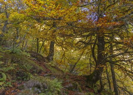
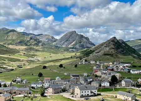
Au départ d'El Puertu, l'itinéraire traverse des zones humides, des zones tourbeuses et des dépôts de moraines qui reflètent le modelage glaciaire de l'ouest des Asturies. Au sommet, vous pourrez profiter de vues panoramiques sur la vallée de Naviego et la Sierra del Cabril.
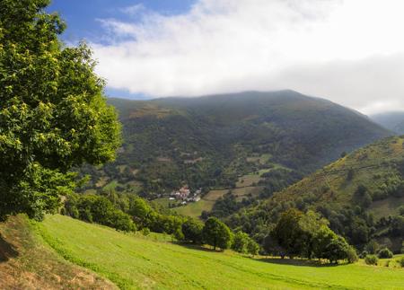
L'itinéraire vers Cueto de Arbas commence à El Puertu, le village le plus élevé des Asturies (1 550 m). Le sentier monte doucement sur une piste qui mène aux installations de la station d'hiver, offrant dès le départ une vue dégagée sur le télésiège. Après quelques minutes, le sentier rejoint une piste plus large qui longe un répéteur de télécommunications et passe à côté d'une zone de loisirs, idéale pour une petite pause.
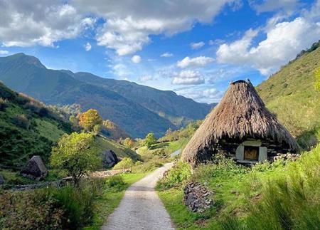
Après environ 35 minutes de marche, on arrive à la Laguna de Arbas, le plus grand lac d'origine glaciaire de la région, situé au pied du massif. Sa nappe d'eau, encadrée par des cirques et des bassins de creusement glaciaire, reflète l'histoire géologique de la zone, marquée par l'action d'anciens glaciers. À partir de ce point, le sentier devient plus raide, traversant des zones humides avec des cours d'eau et de petites étendues de fausse plaine jusqu'à atteindre le col de Fanetina. Ce col naturel marque la frontière entre les Asturies et León et offre des vues sur un lac plus petit, situé à un niveau plus élevé, et sur les sommets du parc naturel de Somiedo.
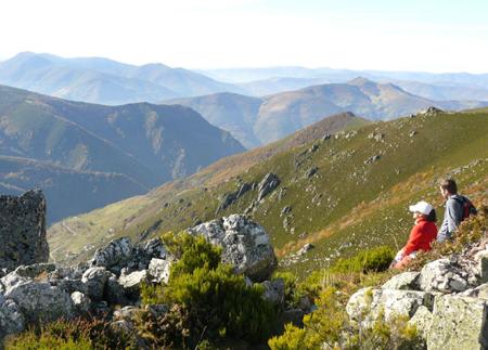
Depuis le col, l'itinéraire se poursuit en direction de l'Alto de la Ferradura et suit la ligne de crête jusqu'à Cueto de Arbas (2 002 m). Au sommet, on trouve une cabane de berger, des antennes de télécommunications et le sommet géodésique qui marque l'un des points les plus élevés des Asturies occidentales. Les vues panoramiques sont spectaculaires : au nord, la vallée de Naviego et le Pico Fraile ; au sud, la Sierra del Cabril et l'Alto Sil ; et à l'est, par temps clair, le massif d'Ubiñas.
La descente se fait par le même chemin, ce qui permet d'apprécier le paysage sous un nouvel angle. Cet itinéraire, de difficulté moyenne, est idéal pour ceux qui souhaitent profiter d'une immersion en haute montagne sans grandes exigences techniques.
- Il traverse en partie la réserve de biosphère de Muniellos, le parc naturel de Fuentes del Narcea, Degaña et Ibias, et la ZEC Fuentes del Narcea, Degaña et Ibias du réseau Natura 2000.
- Signalisation propre
Conseils de base avant de partir en montagne
- Si vous partez avec un chien, tenez-le toujours en laisse.
- Évitez d'approcher le bétail.
- Si vous trouvez des mastiffs qui protègent le bétail, ne les approchez pas, ne les caressez pas et ne les nourrissez pas. Ne les laissez pas vous suivre ou s'éloigner de leur troupeau. Ils travaillent.
- Ne laissez pas de traces. Ramassez tous vos déchets, y compris les déchets organiques. La nature n'est pas un dépotoir.
- Agissez avec prudence. Planifiez bien votre itinéraire, prenez tout ce dont vous avez besoin et veillez à ce qu'il soit adapté à votre capacité physique.