Senda del Oro

- San Antolín de Ibias, Cecos Occidente de Asturias
- Distancia: 8,14 kms
- Dificultad: Media
- Desnivel acumulado: +383 m
- Desnivel acumulado: -383 m
- Altitud máxima: 595 m
- Altitud mínima: 262 m
- IBP index: 57
- Modalidad: Senderistas
- Tipo recorrido: Circular
- Tipo de ruta: Montaña
- Retorno en Ferrocarril: No
Naturaleza, memoria y belleza rural se funden en esta ruta serena que comienza y termina en San Antolín de Ibias.
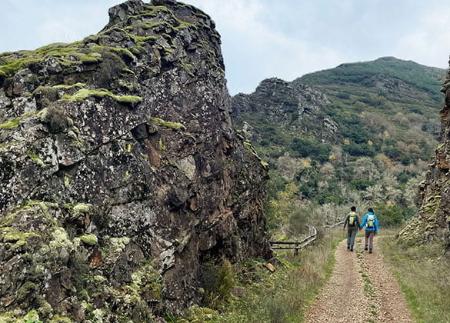
La Senda del Oro recorre algunos de los paisajes más representativos del valle de Ibias, combinando naturaleza, arqueología y cultura tradicional. Su nombre no es casual: fueron los romanos, en su incansable búsqueda de oro en los territorios del noroeste peninsular, quienes transformaron el relieve de esta zona, dejando como legado antiguos desmontes mineros que hoy podemos descubrir caminando por este apacible itinerario.
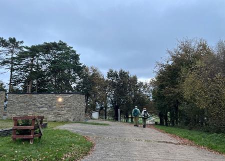
El recorrido comienza en San Antolín de Ibias, junto a la iglesia de Santa María, muy cerca del Centro de Interpretación de la Palloza. Desde aquí parte un sendero que cruza el río Ibias por un puente y discurre paralelo a su curso en los primeros tramos, entre praderas, brezales y viñedos que revelan el aprovechamiento agrícola de las laderas. En la zona de El Trigal, destacan los antiguos bancales vitivinícolas que nos hablan del cultivo tradicional en terrenos escarpados, hoy destinados en parte a la producción de vino de la Tierra de Cangas, compartido con el vecino municipio de Allande.
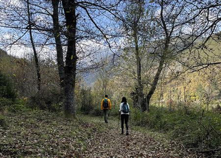
El ascenso es suave y progresivo hasta alcanzar una cota más elevada, desde la que se desciende por unas escaleras rústicas hasta un puente de madera. Al otro lado, el sendero continúa próximo al río, acompañado por el canto de los mirlos acuáticos que habitan entre las pozas y corrientes. A este tramo fluvial le sigue el caserío de La Pena’l Corvo, un conjunto etnográfico perfectamente conservado que incluye casa, hórreo, molino, cuadra y una pequeña capilla, muestra del modo de vida tradicional en Ibias.
En este punto, la ruta ofrece una variante hacia el pueblo de Cecos, reconocido como Pueblo Mágico de España. Este núcleo conserva una notable arquitectura de pizarra y una iglesia con encanto, además de ofrecer al caminante una experiencia auténtica de vida rural. El regreso al cruce principal marca el inicio del ascenso hacia Villamayor, por un camino sombreado de castaños que, en otoño, se tiñe de dorado. A medida que ganamos altura, aparecen vestigios de los antiguos yacimientos auríferos romanos, verdaderos protagonistas silenciosos de esta ruta.
Villamayor se alza con sus casas de pizarra y tejados inclinados, un pueblo encaramado en el paisaje que domina el valle del Ibias. Desde aquí, el sendero desciende de nuevo entre viñedos y prados, ofreciendo amplias vistas del valle y permitiendo observar estructuras como los “cortines”: cerramientos de piedra seca utilizados para proteger colmenas de los osos, elementos clave de la apicultura tradicional de la zona.
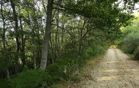
La última parte del recorrido nos conduce entre castañares hasta regresar a San Antolín de Ibias, completando un circuito de baja dificultad y gran valor interpretativo. La Senda del Oro es mucho más que un paseo: es un viaje por la historia minera romana, por el legado campesino y por los paisajes que aún hoy sustentan la vida rural de este concejo fronterizo con Galicia.
- Recorrido coincidente parcialmente con el PR-AS 306, el PR-AS 24 y el GR 203
Consejos básicos antes de salir a la montaña
- Si vas con perro, llévalo siempre atado.
- Evita acercarte al ganado.
- Si encuentras mastines protegiendo al ganado no te acerques, no les acaricies ni les des comida. No permitas que te sigan ni se alejen de su rebaño. Están trabajando.
- No dejes huella. Recoge todos tus residuos, incluidos los orgánicos. La naturaleza no es un vertedero.
- Actúa con prudencia. Planifica bien la ruta, lleva todo lo necesario y asegúrate de que se adapta a tu capacidad física.