Ordiales Aussichtspunkt Route

- Distanz: 11,2 kms
- Schwierigkeit: Schwer
- Kumulierter Höhenunterschied: +732 m
- Kumulierter Höhenunterschied: --37 m
- Maximale Höhe: 1759 m
- Mindesthöhe: 1040 m
- PPI-Index: 67
- Modus: Bergsteiger
- Art der Rundfahrt: Linear
- Routentyp: Berge
- Rückfahrt mit der Bahn: Nein
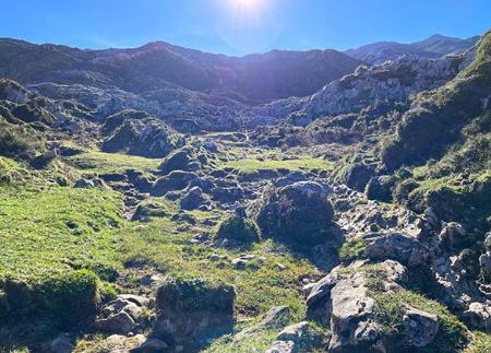
Zwischen Weiden und Bergwiesen führt uns der Weg zum Grab von Pedro Pidal, der treibenden Kraft hinter der Gründung des ersten Nationalparks in Spanien. Unterwegs entdecken wir den Pozo del Alemán und alte Hirtenhäuser, bevor wir einen unvergleichlichen Blick auf das Tal von Angón, Amieva und Ponga haben.
Vom Enolsee aus folgen Sie dem Schild "Refugio de Pastores" und fahren weiter nach Pandecarmen, wo die Route beginnt. Sie können die Route auch in Buferrera beginnen. Von hier aus sind es ca. 22,4 km, für die man 6 Std. 30 Min. (Hin- und Rückweg) benötigt.
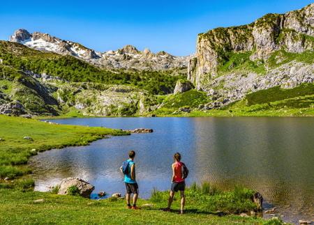
Es handelt sich um eine mittelschwere Rundwanderung mit schönen Ausblicken auf das asturische Zentralgebirge und auf Redes. Wenn wir die Seen erreicht haben, kommen wir, nachdem wir die Zufahrtsstraße von Cuadonga/Covadonga hinaufgefahren sind, an eine Weggabelung. Der linke Weg führt am Enol-See vorbei zum Ercina-See; wir nehmen den rechten Weg, um unsere Route zu beginnen.
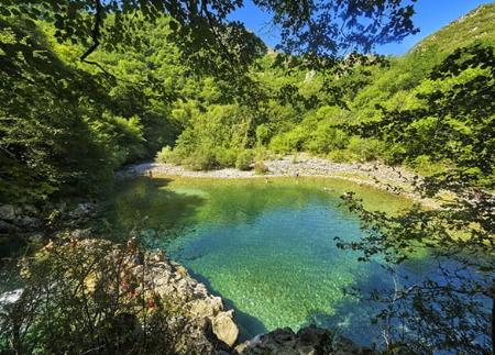
Etwas mehr als einen halben Kilometer weiter führt rechts ein kleiner Weg zur Schutzhütte am Enol-See, aber wir gehen auf dem linken Weg weiter, der uns nach Pandecarmen führt, wo wir einen Parkplatz finden, wo wir unser Auto abstellen können, wenn wir die Route von hier aus beginnen wollen. Nach etwa 350 Metern erreichen wir den berühmten Pozo del Alemán, der so genannt wurde, weil Roberto Frassinelli, ein Deutscher, der sich in die Picos de Europa verliebte und sich 1811 im nahe gelegenen Dorf Corao niederließ, darin badete. Es handelt sich um einen kleinen Brunnen mit einem Durchmesser von drei oder vier Metern und einer Tiefe von einem Meter, der auch am Ende des Sommers noch mit frischem, kristallklarem Wasser gefüllt ist. Nach einem Kilometer erreichen wir den Schafstall Vega la Piedra, einen der schönsten und charakteristischsten der Picos de Europa, der auf einer Höhe von 1.120 Metern liegt.
Bei Kilometer 7 unserer Route, nachdem wir zwischen den verschiedenen Schafställen hindurchgegangen sind, erreichen wir die Vegarredonda-Hütte, die auf einer Höhe von 1.470 Metern liegt, und etwa 3 Kilometer weiter kommen wir zur berühmten Ordiales-Hütte, ganz in der Nähe des Endes unserer Route. Wenige Meter weiter erreichen wir den Aussichtspunkt Ordiales, den Endpunkt unserer Route.
Es handelt sich um eine natürliche Terrasse, die in einer Höhe von 1.750 Metern in der Leere hängt und eine beeindruckende Aussicht bietet. Berühmt ist sie als Begräbnisstätte der sterblichen Überreste von Pedro Pidal y Bernaldo de Quirós, dem Markgrafen von Villaviciosa de Asturias, der nicht nur Bergsteiger war, sondern auch die treibende Kraft hinter der Gründung des heutigen Nationalparks Picos de Europa.
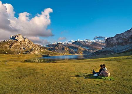
Nachdem wir die beeindruckende Aussicht vom Aussichtspunkt Ordiales genossen und die Figur von Pedro Pidal gewürdigt haben, treten wir den Rückweg auf demselben Weg an. Der Abstieg ermöglicht es uns, die Landschaft mit ihren Bergwiesen, Weiden und Felsformationen, die im Tageslicht ihre Farbe ändern, neu zu entdecken.
Schließlich erreichen wir die Schutzhütte Vegarredonda, wo wir nach einer unvergesslichen Tour im Herzen der Picos de Europa eine Pause einlegen und neue Kräfte sammeln können.
PR-PNPE 5
Grundlegende Tipps, bevor Sie ins Gebirge gehen
- Wenn Sie mit einem Hund unterwegs sind, nehmen Sie ihn immer an die Leine.
- Vermeiden Sie die Annäherung an das Vieh.
- Wenn Sie auf Doggen treffen, die das Vieh schützen, nähern Sie sich ihnen nicht, streicheln Sie sie nicht und füttern Sie sie nicht. Erlauben Sie ihnen nicht, Ihnen zu folgen oder sich von ihrer Herde zu entfernen. Sie arbeiten.
- Hinterlassen Sie keine Spuren. Sammeln Sie alle Ihre Abfälle, auch die organischen. Die Natur ist keine Müllhalde.
- Handeln Sie mit Bedacht. Planen Sie Ihre Route gut, nehmen Sie alles mit, was Sie brauchen, und achten Sie darauf, dass sie an Ihre körperliche Leistungsfähigkeit angepasst ist.