

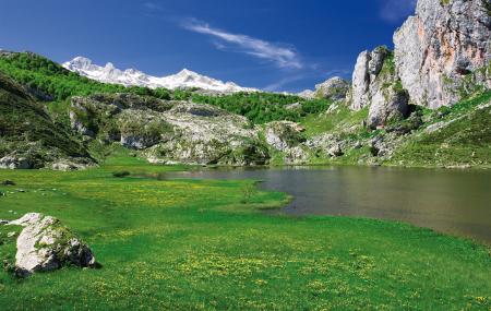
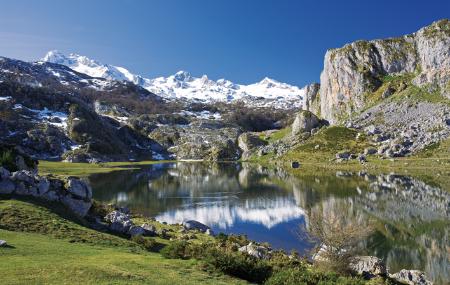
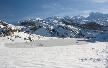
Lake Ercina
- Cangas de Onís Eastern Asturias
- Extension: 8 Ha. km 2
- Maximum elevation: 1.108 m.
Images

Info
Thanks to this dam, the original length was doubled.
The colour of the water varies with changes in the light and the aquatic vegetation, from light green to dark green and sometimes even yellowish, bluish-green and reddish tones.
Plant life
The Ercina, with its shallow basin, is a fertile environment for macro-vegetation. The plant communities rooted at the bottom occupy most of the lake basin, although many of the plants are not easy to see with the naked eye, as they are permanently submerged or because their reproductive organs only emerge to the surface for a short period of time.
The 'tapín' or 'trema del llagu' is what the shepherds call the floating reedbed that trembles when you walk on it, although the risk of sinking is great because it is generally very muddy and the sediments are false. It is made up of concentrations of herbaceous phanerogams, sedges, reedbeds, cattails and shrubs. Among other species, Carex diandra stands out, which is abundant and contributes, after fruiting, to the change in colour of the lake from green to ochre. There is also the cirpus lacustris (Scirpus lacustris), which forms reed beds or emerges from the water in isolated groups. Another species found in the floating mass, as well as on the margins of the lake, is the spagnum ramosus (S. erectum). Finally, the willow variety known as the salgar (Salis atrocinera) is abundant in the vicinity of the lake.
The development of the vegetation, and even the appearance of a lake, can change greatly, not only in the different seasons of the year, but also on the same dates in successive years, and it is clear that not everything depends on climatic variations, but that there are many other factors at play.
Wildlife
Two groups well represented in this lake are the avifauna and dragonflies.
Amphibians include: webbed newt (Triturus helveticus), alpine newt (T. alpestris), common midwife toad (Alytes obstetricans), common toad (Bufo bufo) and brown frog (Rana temporaria).
Among the aquatic birds, the most abundant is the coot (Fulica atra), although the mallard (Anas platyrhynchos) is also abundant.