Senda Costa Norte: Playa de Arnao-L'Arena

- Arnao, L'Arena Centro de Asturias
- Distancia: 15 kms
- Dificultad: Media
- Desnivel acumulado: +379 m
- Desnivel acumulado: -389 m
- Altitud máxima: 114 m
- Altitud mínima: 0 m
- IBP index: 58
- Modalidad: Senderistas
- Tipo recorrido: Travesía
- Tipo de ruta: Costa
- Retorno en Ferrocarril: No
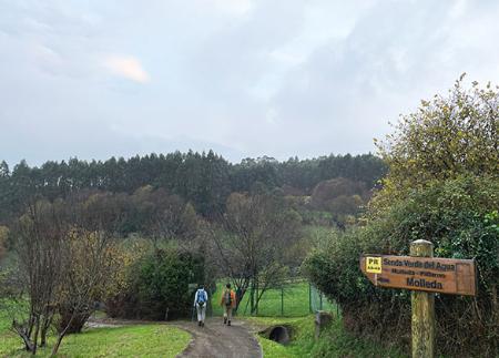
A lo largo de este recorrido, que discurre por la ZEC Cabo Busto-Luanco de la Red Natura 2000, se visitan antiguos elementos mineros, como el Castillete de la Mina de Arnao, y miradores naturales sobre acantilados, playas y sistemas dunares, finalizando junto a la ría de San Esteban en un entorno de gran valor
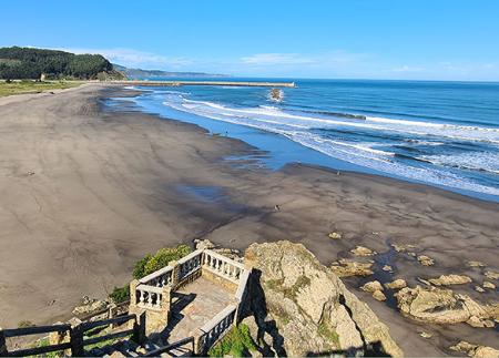
El inicio se sitúa en el extremo oriental de la playa de Arnao, en el concejo de Castrillón. Desde aquí, el camino atraviesa la playa en dirección oeste hasta llegar al Museo de la Mina de Arnao y el Castillete de la Mina de Arnao, primer pozo vertical de carbón de Asturias, hoy convertido en centro de interpretación del pasado industrial de la zona. Tras esta primera parada, el sendero inicia una suave ascensión hacia el Mirador de Las Arribas, ofreciendo ya las primeras panorámicas abiertas del mar Cantábrico.
A continuación, la senda alcanza el Mirador de La Ladrona, desde el que se puede contemplar la isla del mismo nombre y una amplia franja de costa. Desde aquí, el itinerario desciende hacia la localidad de Santa María del Mar/El Puertu, donde se bordea su playa, una de las más frecuentadas del concejo, equipada con áreas de descanso y servicios.
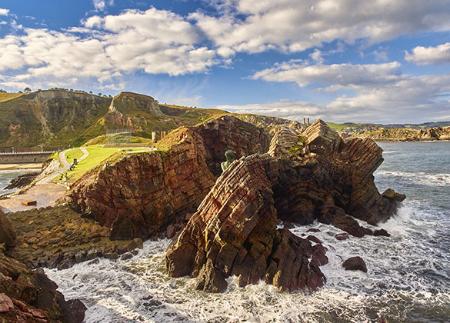
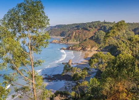
Siguiendo el litoral, se alcanza el Mirador Punta El Escayo, con vistas hacia formaciones rocosas modeladas por la erosión marina. Más adelante, se suceden playas como la de Bahinas, Munielles y El Cordial, hasta llegar al Mirador de Deva. Desde este punto, la visión de la isla de La Deva, espacio declarado Monumento Natural, y del Playón de Bayas, con su sistema dunar protegido, refuerza el valor ambiental del entorno.
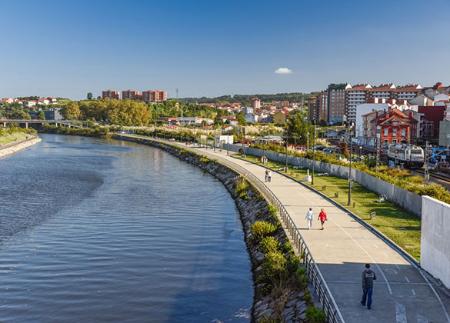
Continuando el trayecto, el sendero permite acceder al Mirador de Bayas o de la Racionera, que ofrece otra perspectiva del Playón de Bayas y su entorno natural. Desde aquí continuamos sendero hasta bajar al playón de Bayas, por el que avanzaremos hacia el oeste hasta el Mirador de Los Quebrantos, desde donde se observa la playa homónima y la ría de San Esteban. La senda continúa bordeando la ría hasta llegar al parque Prau de la Rula, en L'Arena, donde finaliza el recorrido junto al puerto deportivo.
Este itinerario es ideal para quienes buscan una experiencia completa junto al mar, combinando historia, geología, naturaleza y vistas espectaculares en un entorno costero de gran singularidad.
- Discurre parcialmente por la ZEC Cabo Busto-Luanco de la Red Natura 2000.
- Recorrido coincidente parcialmente con el GR-204
Consejos básicos antes de salir a la montaña
- Si vas con perro, llévalo siempre atado.
- Evita acercarte al ganado.
- Si encuentras mastines protegiendo al ganado no te acerques, no les acaricies ni les des comida. No permitas que te sigan ni se alejen de su rebaño. Están trabajando.
- No dejes huella. Recoge todos tus residuos, incluidos los orgánicos. La naturaleza no es un vertedero.
- Actúa con prudencia. Planifica bien la ruta, lleva todo lo necesario y asegúrate de que se adapta a tu capacidad física.