
River Sella
- Cangas de Onís, Ponga, Ribadesella, Parres, Amieva Eastern Asturias
- Extension: 59,6 Km. km 2
Images


Info
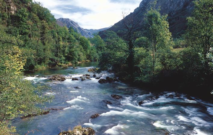
It covers an area of 1,246 square kilometres and a length of 66 km. It has two large lateral sub-basins, represented by the tributaries Ponga and Piloña on the left, which are much larger and more abundant, and Dobra and Güeña on the right. It is considered one of the most important salmon rivers in Spain.
It enters Asturias through the Beyos Gorge. On leaving this channel, at Vega de Cien, Amieva, the terrain becomes somewhat flatter although it is still narrow.
At Santiyán it joins the River Ponga, making the meadows wide.
Further down it receives the waters of the Dobra River (at Puente Dobra) and we can find some meanders such as the one at Cañu.
We arrive at Cangues d' Onís/Cangas de Onís where it receives the river Güeña, after passing under the Puente Romano.
In Arriondas it meets the waters of the Piloña and following its course it joins the Río de Parda (in Triongu).
In one of the last before reaching the Ría de Ribadesella, it receives the Arroyo de Cuevas, which has the peculiarity of crossing the Peña de Cuevas through a karst grotto, the only land entrance to the village of Cuevas.
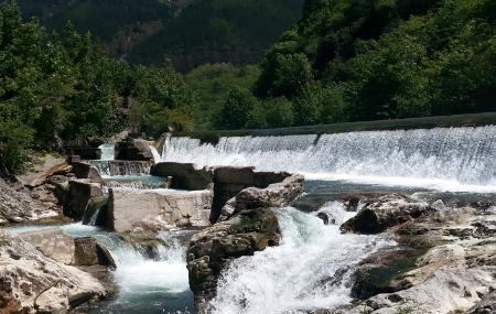
In this river we find several points of interest, such as the Aguasalió Waterfall, in Puente Vidosa (a 20-metre high waterfall in the heart of the Beyos Gorge), or the Roman Bridge of Cangues d' Onís/Cangas de Onís...
Map
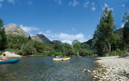
The International Descent of the Sella is held in its waters, between the bridges of Arriondas (Parres) and Ribadesella, a highly prestigious Festival of International Tourist Interest.