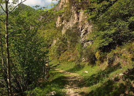
El Cabril

- Dirección Xinestosu Occidente de Asturias
- Distancia Distancia: 14,24 kms
- Dificultad Dificultad: Muy Dura
- Desnivel acumulado + Desnivel acumulado: +705 m
- Desnivel acumulado - Desnivel acumulado: --705 m
- Altitud máxima Altitud máxima: 1861 m
- Altitud mínima Altitud mínima: 1145 m
- IBP index IBP index: 88
- Modalidad Modalidad: Montañeros
- Tipo recorrido Tipo recorrido: Circular
- Tipo de ruta Tipo de ruta: Montaña
- Retorno en Ferrocarril Retorno en Ferrocarril: No
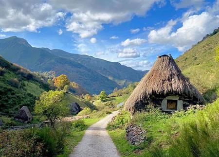
A lo largo del recorrido se encuentran lagunas, brañas y una riqueza paisajística y etnográfica única. Una experiencia ideal para senderistas con buen fondo físico, amantes de la montaña auténtica y de las rutas con identidad propia.
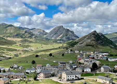
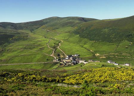
La ascensión a El Cabril es una de las travesías más singulares del occidente asturiano, con inicio y final en Xinestosu (Genestoso), una aldea situada a 1.000 metros de altitud y conocida por su exquisito queso artesanal de montaña, moldeado en aros de esparto. Esta ruta circular, que combina historia, paisaje de alta montaña y biodiversidad, permite descubrir antiguas vías de trashumancia, lagunas glaciares y brañas pastoriles en el límite entre los concejos de Somiedo y Cangas del Narcea.
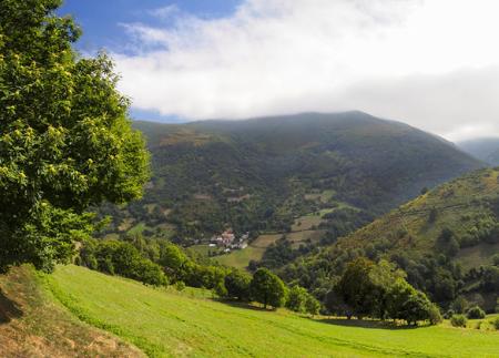
El recorrido comienza al final de la localidad de Xinestosu, junto al río homónimo. Una vez cruzado el río, el camino inicia un ascenso suave hacia el valle Los Corros, pasando por las praderas de Las Carruexas y la fuente de La Pasadina. En este tramo se atraviesan pastizales y se vislumbra el paisaje ganadero que aún se conserva activo.
En el valle Los Corros, donde se localiza una pequeña braña rehabilitada, el sendero sigue ganando altura hasta alcanzar el collado Tres Lagunas. Poco antes del collado puede verse, a la derecha del camino, una laguna permanente ubicada al abrigo de unas peñas. Justo después, las tres lagunas estacionales que dan nombre al collado aparecen sobre una amplia planicie.
Desde aquí, el camino continúa hacia el Col.láu Entrecuetos, paso natural entre El Cabril y Peña Treisa. La cima de El Cabril está a escasos 600 metros, y desde ella se disfrutan vistas de 360º que, en días claros, alcanzan hasta las costas gallega y asturiana. Hacia el sur se abre el impresionante valle de Pigüeña, con sus aldeas y brañas tradicionales como La Pornacal, y hacia el este, se divisan los valles leoneses.
El regreso puede hacerse por varias variantes. La opción más directa es descender desde el col.láu de Fanarrionda por el Camino de la Polvorosa, un antiguo paso de comunicación entre Xinestosu y Villar de Vildas que discurre por un frondoso bosque de abedules. Esta bajada es corta pero bastante empinada.
Nosotros hemos optado por la opción más panorámica, es decir continuar por el antiguo Camino Real, que discurre bajo la línea de cumbres, pasando por el col.láu Los Secuel.los y el valle de Las Zreizales, para alcanzar el desvío de El Llano y regresar a Xinestosu por La Gobia, con vistas excepcionales sobre el valle de Xinestosu.
Nota importante:
Esta ruta transcurre por zona de presencia osera. Según el Decreto 10/2015, el acceso está regulado y solo está permitido del 16 de junio al 15 de agosto, y del 1 de octubre al 30 de noviembre. Planifica tu salida dentro de esos periodos autorizados.
PR-AS 110
Según Decreto 10/2015 la ruta solo puede realizarse del 16/06 a 15/08 y 01/10 a 30/11.
Consejos básicos antes de salir a la montaña
- Evita acercarte al ganado.
- Si encuentras mastines protegiendo al ganado no te acerques, no les acaricies ni les des comida. No permitas que te sigan ni se alejen de su rebaño. Están trabajando.
- Si vas con perro, llévalo siempre atado.
- No dejes huella. Recoge todos tus residuos, incluidos los orgánicos. La naturaleza no es un vertedero.
- Actúa con prudencia. Planifica bien la ruta, lleva todo lo necesario y asegúrate de que se adapta a tu capacidad física.


