Fox Peak

- Distance: 15.75 kms
- Difficulty: Very difficult
- Cumulative difference in altitude: +844 m
- Cumulative difference in altitude: --844 m
- Maximum altitude: 1832.94 m
- Minimum altitude: 1083.75 m
- IBP index: 98
- Modality: Mountaineers
- Type of route: Round trip
- Route type: Mountain
- Return by Train: No
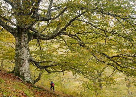
Starting from the Les Bedules sheepfold, the path leads us through beech forests, green high mountain pastures and hills with panoramic views towards the culminating point, the ascent to Pico Zorro, a peak that rewards the effort with unequalled views of the Cantabrian Mountains.
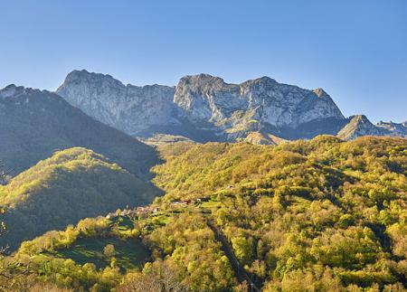
The ascent route to Pico Zorro begins in the hamlet of Les Bedules (Ponga), which we reach by car from San Xuan/San Juan de Beleño in the direction of Viegu. Les Bedueles is an enclave from where we can enjoy an impressive panoramic view of emblematic Asturian peaks such as Tiatordos, Recuencu and Peña Sueves.
From here, we start the route along a path that leads to an area called Los Biforcos and borders the Prau Toru in the direction of Les Foyaques.
The path takes us steadily upwards to Les Llampes, a sheepfold at an altitude of 1,300 metres where we can see the remains of old huts. The path continues through a high mountain landscape in the direction of Recuencu Peak, crossing a forest along a clear and well-marked path until it reaches Pomerín pass (1512 metres), a natural viewpoint that offers spectacular views of the peaks of Luengo and Zorro.
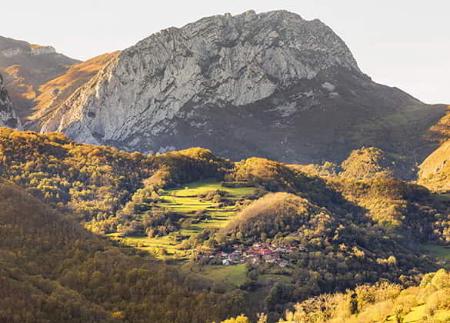
From this point, the route once again enters another beech forest, a stretch that takes us to the Antiguo valley.
We continue ascending towards the Sus pass, passing through the majada de las Fuentes, an ideal place to refresh ourselves, drink water and recharge our batteries. From here, the only thing left to do is to follow the ridge that leads directly to the summit of Pico Zorro.
The summit welcomes us with an incomparable reward: a view that takes in a large part of the Cantabrian Mountains, the impressive Picos de Europa, the valleys of Ponga with its grandiose forests, and a view that stretches as far as the mountains of neighbouring León.
The return is by the same route, retracing the steps of this ascent and once again enjoying the landscapes and milestones of the route, this time with the satisfaction of having conquered the summit of Pico Zorro.
Basic tips before going into the mountains
- If you go with a dog, always keep it on a leash.
- Avoid approaching livestock.
- If you find mastiffs protecting livestock, do not approach them, do not pet them and do not feed them. Do not allow them to follow you or stray from their herd. They are working.
- Don't leave a trail. Collect all your waste, including organic waste. Nature is not a dumping ground.
- Act with prudence. Plan your route well, take everything you need and make sure it is adapted to your physical capacity.