- Address Santo Adriano, Proaza, Teverga and Quirós, Yernes and Tameza and Somiedo Asturias Centre
- Distance Distance: 227,8 kms
- Difficulty Difficulty: Short
- Cars Cars: 5 days
- Start point Start point: Tuñón
- Route type Route type: car
- Layout of the route Layout of the route: Download kml
In the time of Emperor Augustus, the Romans entered Asturias through high mountain ranges that opened into deep gorges.
Info
In the times of Emperor Augustus, the Romans entered Asturias through high mountain ranges that opened up into deep gorges. The Camín Real de la Mesa was one of the most important communication routes from those ancient times until the 19th century, and today it is the umbrella under which the territory is articulated.
Route
Tuñón - Samartín 20,4
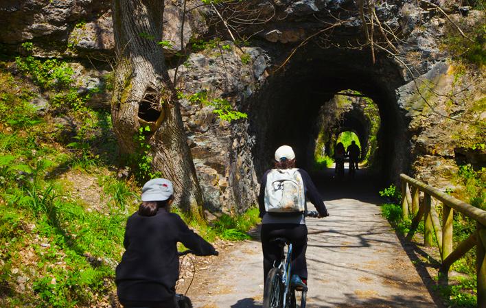
Day 1: The journey along the Camín begins in the Valles del Oso, in the municipalities of Santo Adriano, Proaza, Teverga and Quirós. The best way to get to know these lands is to follow the route with which they share their name: the Senda del Oso. Built on a railway box, it is suitable for all ages and is dotted with recreational areas. It has two branches that can be covered on foot or by bicycle (available for hire). The original is the one from Tuñón to Entragu, which is almost twenty kilometres long. Near the end of the route, there is another branch towards Quirós, which adds another thirteen kilometres. The excursion can be completed with a visit to the Cercado Osero (bear enclosure), located on the trail, where there is an enclosure where bears live in captivity, rescued from poachers.
Samartín - Yernes y Tameza - Entragu - Samartín 49,5
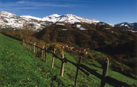
Day 2: The traveller ascends to his first summit. From Samartín, just half an hour's drive away, the Puerto de Marabio rises to an altitude of over 1,000 metres, which is formed by an extensive mountain meadow. Next to the Ermita de Santa Ana hermitage there is space to leave the car and take a walk or a circular route that can be completed in three hours. Further on, on the road to Marabio, is Villabre. In the capital of Yernes y Tameza there are now less than a hundred inhabitants, but the typical high mountain buildings are still intact. On the way back to the Bear Valleys, there is still time to visit the Prehistoric Park, in San Salvador de Alesga, and see the best examples of cave art. A short distance away is Cueva Huerta, a karst complex fourteen and a half kilometres deep, of which the first three hundred metres can be visited. It is essential to book in advance.
Entragu - Pola de Somiedo 51,8
Day 3: From the Bear Valleys to Somiedo. The journey from Teverga to Pola de Somiedo takes about fifty minutes, via the AS-265 and AS-227 roads. In La Pola, you will find the Visitor Reception and Interpretation Centre of the Somiedo Natural Park, a first stop to get a better understanding of the environment. A stroll through the village completes the adaptation. The Ecomuseum of Somiedo goes deeper into this explanation of the combination of nature and culture. It is divided into two sites. The first, Los Oficios y la Trashumancia, is in Caunedo, three and a half kilometres south on the AS-227. To get to the second, La Casa Veigas, it is necessary to take the AS-227 in the opposite direction from La Pola and take the SD-1 towards Saliencia.
Pola de Somiedo - Saliencia Lakes - Belmonte/Balmonte 65,8
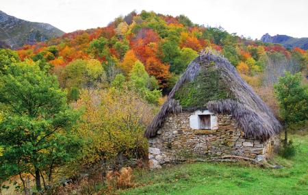
Day 4: The mountains can also be explored on foot and Somiedo offers many options. An interesting alternative for a day of leisure in nature are the Saliencia Lakes. The complete Saliencia route (with the lakes of Cueva, Calabazosa, Saliencia, Cerveriza and El Valle) is fourteen and a half kilometres long (one way), which can be covered in about four and a half hours. There is also a short version of 7 kilometres, which excludes El Valle and takes about two hours to walk. The starting point for both is at the Alto de la Farrapona, which is accessed by a track prepared for traffic. The second option - more suitable for lovers of ethnography and culture - is the La Pornacal route, which starts in Villar de Vildas, a village which can be reached via a detour in Aguasmestas. This braña preserves 32 teitos, which are buildings with a vegetation cover that served as a dwelling and livestock hut. The shortest route is four and a half kilometres long, and can be extended to Braña Viecha.
Belmonte/Balmonte - Candamo 40,2
Day 5: The journey continues north along the AS-227 towards Belmonte/Balmonte. In its streets, the Aula del Oro, housed in the old prison, reminds the traveller that he is in a gold-bearing basin. The next stop is in the town centre of Grau / Grado, a town with a protected historic-artistic site, in which the Palace of Miranda-Valdecarzana, the remains of the wall, the chapels and the mansions of the indianos stand out. To complete the route that the Romans followed along the Camín Real de la Mesa, you should travel to San Román de Candamo, from Grau / Grado along the AS-237, to visit the Cueva de La Peña cave, which houses cave paintings discovered in 1919 and declared a World Heritage Site by UNESCO. It is necessary to check opening dates and book in advance.
Map
Itinerary
Santo Adriano - Proaza - Teverga - Quirós - Yernes y Tameza - Somiedo


