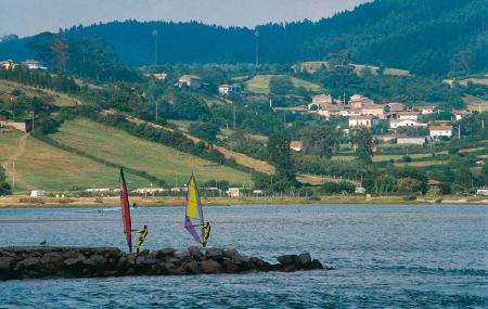
- Address Nava and Villaviciosa Eastern Asturias
- Distance Distance: 164,5 kms
- Difficulty Difficulty: Short
- Cars Cars: 5 days
- Start point Start point: Nava
- Route type Route type: car
- Layout of the route Layout of the route: Download kml
In the 1st century AD, Strabo, the Greek geographer, traveller and writer, mentioned zythos in a book on the Iberian Peninsula, probably the first ancestor of today's Asturian cider.
Info
In the 1st century AD, Strabo, the Greek geographer, traveller and writer, in a book on the Iberian Peninsula, mentioned zythos, probably the first ancestor of today's Asturian cider. However, historians are convinced that Strabo never set foot on this land, that his writings are compilations of other sources and that he was therefore never able to taste zythos. This is something that should not be lost on the traveller who nowadays visits the Cider Shire.
Route
Nava - Nava 5,24
Day 1: Nava, with its Cider Museum, is the starting point. The facility, located in the centre of the town, allows visitors to follow the cider production cycle, from apple picking to the traditional 'espicha', in which people sing 'tonada', eat home-made cider and drink the best 'palu'. The exhibition part contains interactive installations. Once the visit is complete, a stroll through the town will show cider houses, old cider presses, the church of San Bartolomé and the Town Hall. Nava grows in the shadow of Peña Mayor. This mountain is climbed along a road in the direction of Piloñeta. The final part consists of a steep track that leads to meadows from where you can enjoy a panoramic view of the central area of Asturias.
Nava - Martimporra - Sariego - Nava 51,5
Day 2: Les Foces del Río Pendón is the route planned for the second day. It starts in the vicinity of Huentesanta, less than four kilometres from Nava on the NA-1 road. Close to the starting point is the privately owned Palacio-Casa Fuerte de la Ferrería, a 14th century building that has been declared a historic-artistic monument. The Les Foces route is ten kilometres long, which can be covered in three and a half hours. On the way back to the village, you can take part in a guided visit to a wine press or go to Martimporra on the AS-251, the capital of Bimenes, to visit the Palace of the Marquis of Casa Estrada. From here we continue on to Sariego to discover the Romanesque churches of Santa María de Narzana and Santiago El Mayor. Both are buildings of great beauty that stand in isolated spots. Sariego can be reached by the local AS-357 road, which reveals its vast rural area. The return to Nava can be made via the A-8 and the N-634.
Nava - Villaviciosa 28,8
Day 3: From Nava to Villaviciosa on the AS-335 via Cabranes, another of the cider hubs. As we enter the council of Cabranes we find the House-Museum of Asturian Popular Pottery in Piñera (by appointment), a visit to Torazu, Exemplary Village of Asturias in 2008, and a walk through time with the exhibition of the Rural School Museum in Viñón. Once in Villaviciosa, a well-scheduled walk takes you to La Ballina park, the remains of a medieval wall, the House of José Caveda y Nava, the Food Market, the House-Palace of Los Valdés or the renovated Riera Theatre. In this council, guided visits are offered to the apple orchards and cider presses, where you can see the success of the last harvest.
Villaviciosa - Argüeru - Villaviciosa 49
Day 4: Valdediós, a village located south of Villaviciosa, has a priceless monastery and Pre-Romanesque church in a rural setting. This could be a good first stop. On the way back to the coast, the obligatory stop is at the Villaviciosa Estuary Interpretation Centre, where the ecological wealth of this partial nature reserve is explained, although it is only open daily during the summer. Closer to the coast, on the AS-256 road, in the direction of Gijón/Xixón, is the village of Argüeru, where an Ecomuseum of the Asturcón, a typical Asturian breed of rustic horse, has been created. It is an exhibition area integrated in a rural nucleus, where there is also a breeding stable. On the way back to Villaviciosa, you can still discover new cider presses and cider houses, or stop off at Tazones and the port of El Puntal to hire a canoe. If the day permits, it is a good opportunity to go to Rodiles Beach.
Villaviciosa - Colunga 30
Day 5: To end the tour of the region we must get to know Colunga in depth, the most easterly council of the Cider Shire, it is necessary to look out to sea and stop in the mountains. The Jurassic Museum, between the capital, Colunga, and Llastres, is a modern exhibition facility that takes us back to prehistoric times. The building, which is uniquely designed to simulate the footprint of a dinosaur, is located on a small plateau above the sea. Nearby is the beach of La Griega, from which there is a route along which you can see the fossilised footprints of dinosaurs. The mountain that appears before us is the Sierra del Sueve, whose Interpretation Centre is in the town of Gobiendes, and which offers guided routes on foot through the natural space, right here you have the chance to visit the pre-Romanesque church of Santiago de Gobiendes. Among them is the Picu Pienzu route, the highest point in the sierra at 1,161 metres.
Map
Itinerary
Nava - ῌuentesanta - Villaviciosa - Valdediós - Argüeru - Colunga - Gobiendes


