Llanes - Las Cámaras Beach (Celoriu)

- Address Llanes, Poo, Celoriu Eastern Asturias
- Distance Distance: 7.6 kms
- Difficulty Difficulty: Muy Fácil
- Cumulative difference in altitude + Cumulative difference in altitude: +141 m
- Cumulative difference in altitude - Cumulative difference in altitude: -151 m
- Maximum altitude Maximum altitude: 36 m
- Minimum altitude Minimum altitude: 1 m
- IBP index IBP index: 24
- Modality Modality: Familias
- Type of route Type of route: Travesía
- Route type Route type: Costa
- Return by Train Return by Train: Yes
- Return by Train ALSA https://www.ctaconecta.com/es/servicios-y-horarios/
A route between heritage, cliffs and sea, with views of the Bay of Biscay and the Sierra del Cuera.
This route runs along one of the most beautiful and accessible stretches of the Llanes coast, combining heritage, landscape and sea. The route begins in the historic centre of Llanes, a town with medieval roots located between the Cantabrian Sea and the Cuera mountain range. From the Plaza Cristo Rey square, where the Church of Santa María del Conceyu stands, declared an Asset of Cultural Interest, the route heads towards the coast, passing the chapel of the Posada Palace, known as "La Casa del Cercao".
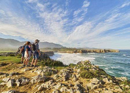
On reaching the Sablón beach, a pretty urban beach of fine sand and calm waters, the most coastal section begins. As soon as you leave the sandy area behind, the path climbs gently up to the San Pedro promenade, with spectacular views over Llanes and the beach. Next, the path goes along the coast to the viewpoint of La Talá, which offers a wide panoramic view of the Bay of Biscay, as well as La Nao beach and the islet of El Peñón.
The route continues westwards, always following the line of the sea, until it reaches the shell-shaped beach of Poo, ideal for families due to its calm waters that resemble a natural swimming pool. Surrounded by meadows and coastal vegetation, it is perfect for a quiet break.
The path continues to San Martín beach, more solitary and wild, ideal for those seeking a more intimate contact with nature. Shortly afterwards, a detour of barely 100 metres takes us to the hermitage of San Martín, located in a secluded spot facing the sea.
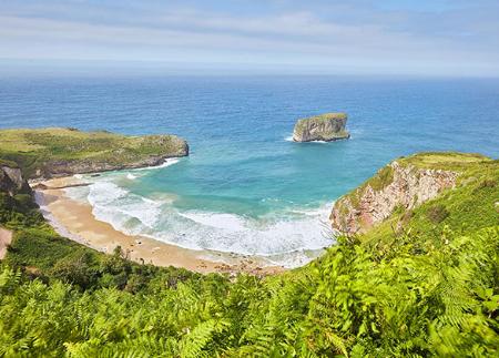
The route then heads towards Celoriu, a village with character that is home to the church of San Salvador and its old monastery, a site steeped in history and tradition. The route ends at Las Cámaras beach, a sandy area surrounded by islets, which preserves a privileged natural environment.
This walk offers a complete experience: villages with history, unique beaches, natural viewpoints and a succession of landscapes that combine the blue of the Bay of Biscay with the green of the Asturian coastline.
- It partially runs through the ZEC and ZEPA Ría de Ribadesella - Ría de Tinamayor of the Natura 2000 Network.
- The route partially coincides with the GR-204.
- Catering services along the whole route
Basic tips before going into the mountains
- If you go with a dog, always keep it on a leash.
- Avoid approaching livestock.
- If you find mastiffs protecting livestock, do not approach them, do not pet them and do not feed them. Do not allow them to follow you or stray from their herd. They are working.
- Don't leave a trail. Collect all your waste, including organic waste. Nature is not a dumping ground.
- Act with prudence. Plan your route well, take everything you need and make sure it is adapted to your physical capacity.


