Da Yernes a Cuevallagar

- Yernes y Tameza Asturie centrali
- Distanza: 14,91 kms
- Difficoltà: Media
- Dislivello cumulativo: +701 m
- Dislivello cumulativo: -701 m
- Altitudine massima: 1216 m
- Altitudine minima: 700 m
- Indice IBP: 62
- Modalità: Escursionisti
- Tipo di percorso: Circolare
- Tipo di percorso: Montagna
- Ritorno in treno: No
- Punto di partenza: Yernes
- Punto di arrivo: Yernes
- Epoca: Tutto l'anno
- Durata stimata: Più di 5 ore
L'Itinerario di Cuevallagar, conosciuto anche come Cuallagar, è un percorso circolare che attraversa uno dei paesaggi montani più singolari e meno battuti del centro delle Asturie. Tra prati d'alta quota, mandrie di bestiame, rifugi di pastori e viste panoramiche aperte, questo itinerario vi porta nel cuore della catena montuosa di Yernes y Tameza, un territorio profondamente legato alla tradizione della pastorizia e dell'allevamento.
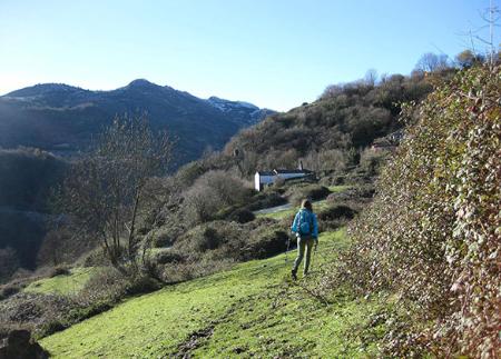
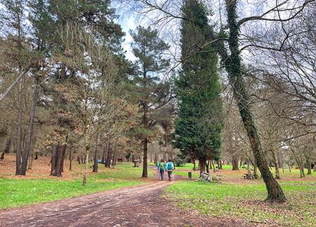
Il percorso inizia nel villaggio di Yernes, dove gli edifici tradizionali e la disposizione irregolare delle strade riflettono il passato legato alla pastorizia che ha plasmato queste terre per secoli. Dalle prime rampe, il tracciato offre una vista elevata del borgo, che viene presto lasciato alle spalle per entrare in un paesaggio di prati e macchie di alberi autoctoni.
Il sentiero sale dolcemente fino alla Braña de Senra, dove le vecchie capanne in pietra e gli abbeveratoi testimoniano l'attività zootecnica che caratterizza la zona. Man mano che si guadagna quota, l'orizzonte si apre sulle sierre vicine, con la sagoma del Collado Fancuaya come punto di riferimento.
Da lì, il sentiero avanza verso il Pico Loral, coronando la sua cima prima di scendere alla Collada de la Cadavina, dove si unisce al PR-AS 260. Questo tratto conduce al campo di Cuallagar o Cuevallagar, un'ampia spianata di montagna dove spicca il singolare rifugio dei pastori, costruito in pietra a forma di tronco piramidale, perfettamente integrato nel paesaggio.
Il nome della valle di Cuallagar deriva da una grande cavità situata all'estremità meridionale, la grotta di Cuallagar o Cuevallagar, un riparo naturale dove il bestiame è solito "moscar" nelle calde giornate estive, cioè proteggersi dal caldo e dalle punture delle mosche. Oltre al ruolo di allevamento, questa zona ha un affascinante passato storico: in epoca preistorica era frequentata da comunità umane che hanno lasciato tracce come il complesso litico di Fuente Cimera, i ripari di Peña Blanca e i tumuli dell'Alto de Sograndio.
Al centro della pianura si trova anche un tradizionale corro di forma quadrata, una costruzione unica nella regione che è diventata un punto di riferimento nel consiglio di Yernes y Tameza.
Ogni anno, l'ultimo sabato di agosto, il campo di Cuallagar o Cuevallagar ospita un pellegrinaggio popolare, un evento essenziale nel calendario locale in cui la gente del posto e i visitatori festeggiano tra natura, tradizione e bestiame.
Il luogo ospita anche una delle leggende più curiose del comune: l'antica disputa per il pascolo tra gli abitanti di Proaza e Tameza, risolta dalla lotta tra due tori alla Fuente Cimera. Gli abitanti di Proaza ne portarono uno molto grande, il ratín. Gli abitanti di Tameza stavano per opporgli un altro, anch'esso molto grande, proveniente da Ca Ramón de la Casona ma, su consiglio di un servitore della casa, decisero di prendere un toro più piccolo ma molto forte, rosso e cattivo. La lotta iniziò a La Veiga de Cuallagar, presso la Fonte Cimera, dove si scontrarono per le corna e il toro di Tamezano spinse il toro di Proaza fino al Cantu la Flecha, dove lo fece cadere a terra; il confine fu segnato lì con un finxu (segna confine) nero. L'episodio è raffigurato nello stemma di Tameza, dove i due tori sono raffigurati uno di fronte all'altro.
Dopo aver esplorato questa enclave, il percorso di ritorno assume la forma di un itinerario circolare che costeggia il Pico Loral e fa una deviazione verso l'Aula Vital, uno spazio educativo che promuove la conoscenza dell'ambiente, delle energie rinnovabili e del legame con la natura.
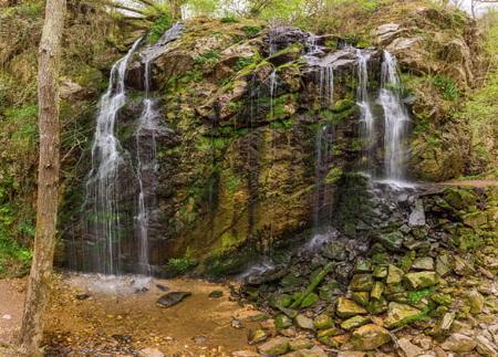
Il percorso scende infine alla Fontana di Focea, dove è possibile rinfrescarsi prima di tornare al centro di Yernes, chiudendo così un viaggio che unisce paesaggio, storia, architettura pastorale e la memoria viva delle montagne asturiane.
- Attraversa in parte il SIC Caldoveiro e in parte la ZEPA Ubiña-La Mesa della Rete Natura 2000.
- Parte del percorso coincide con il PR-AS 260
Consigli di base prima di andare in montagna
- Se andate con un cane, tenetelo sempre al guinzaglio.
- Evitare di avvicinarsi al bestiame.
- Se trovate dei mastini che proteggono il bestiame, non avvicinatevi, non accarezzateli e non date loro da mangiare. Non permettete loro di seguirvi o di allontanarsi dalla mandria. Stanno lavorando.
- Non lasciate tracce. Raccogliete tutti i vostri rifiuti, compresi quelli organici. La natura non è una discarica.
- Agite con prudenza. Pianificate bene l'itinerario, portate con voi tutto il necessario e assicuratevi che sia adeguato alle vostre capacità fisiche.