Alto La Llama - Majada de Espineres

- Distanza: 8,47 kms
- Difficoltà: Media
- Dislivello cumulativo: +440 m
- Dislivello cumulativo: --440 m
- Altitudine massima: 859.45 m
- Altitudine minima: 415.97 m
- Indice IBP: 52
- Modalità: Escursionisti
- Tipo di percorso: Andata e ritorno
- Tipo di percorso: Montagna
- Ritorno in treno: No
- Punto di partenza: Alto La Llama (Piloña)
- Punto di arrivo: Alto La Llama (Piloña)
- Epoca: Primavera Estate Autunno
- Durata stimata: Tra 3 e 5 ore
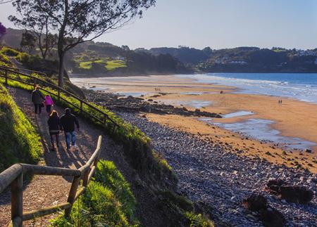
Il percorso per raggiungere il cairn di Espineres inizia all'Alto de la Llama, AS-248, dove possiamo lasciare l'auto nel parcheggio adiacente. Da lì si imbocca un'ampia pista sterrata in direzione est. Bisogna tenere presente che i sentieri in questa zona non sono segnalati e che la nebbia può comparire rapidamente, quindi è importante prendere le dovute precauzioni.
Pochi metri dopo aver iniziato a camminare, si incontra un incrocio. A questo punto si prosegue dritti lungo il sentiero principale. Il tratto iniziale, in costante salita, ci porterà ad attraversare boschi di castagni e querce, ma anche prati dove è frequente vedere cavalli e mucche al pascolo.
Lungo il percorso avremo anche l'opportunità di osservare la ricca fauna della Sierra del Sueve. Tra i mammiferi più emblematici ci sono il cavallo Asturcón, la nostra razza autoctona per eccellenza, e i daini; tra gli uccelli, grifoni, capovaccai e gracchi.
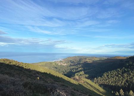
Proseguendo lungo il percorso e dopo altri 600 metri, si incontra un'altra deviazione a destra; si continua a percorrere il sentiero. Da qui si gode di una vista spettacolare sui comuni di Colunga, Villaviciosa e Piloña. Con un po' di fortuna, possiamo anche scorgere l'estuario di Villaviciosa.
Dopo circa un chilometro, incontreremo altre due svolte a destra, ma le ignoreremo. Dopo aver percorso circa 3,5 chilometri dall'inizio, si arriva all'Alto la Cruz, dove il paesaggio cambia completamente. I boschi lasciano il posto a un terreno carsico, caratterizzato da numerose doline, depressioni tipiche delle formazioni calcaree.
Poco dopo, intorno al chilometro 4, si incontra la croce di María Mingo. Qui vicino, accanto a una capanna, si trova un abbeveratoio dove i cervi che abitano la zona sono soliti abbeverarsi. Infine, dopo 4,5 chilometri, si arriva alla famosa Majada de Espineres, una conca verde, circondata da rocce calcaree e biancospini bianchi o espineras, che danno il nome al luogo. Qui, capanne e stalle in pietra, alcune delle quali molto ben conservate, punteggiano il paesaggio.
Ogni anno, questo ovile ospita la Festa dell'Asturcón, una giornata per pubblicizzare il recupero di questo piccolo e rustico cavallo autoctono delle Asturie da parte degli allevatori della zona. Un evento in cui si cerca di addomesticare i cavalli selvatici adulti e di marcare i puledri nati quell'anno.
Prima di riprendere il viaggio di ritorno, è opportuno fare una pausa per osservare attentamente il paesaggio, che ci offre una delle migliori viste panoramiche di tutte le Asturie.
Consigli di base prima di andare in montagna
- Se andate con un cane, tenetelo sempre al guinzaglio.
- Evitare di avvicinarsi al bestiame.
- Se trovate dei mastini che proteggono il bestiame, non avvicinatevi, non accarezzateli e non date loro da mangiare. Non permettete loro di seguirvi o di allontanarsi dalla mandria. Stanno lavorando.
- Non lasciate tracce. Raccogliete tutti i vostri rifiuti, compresi quelli organici. La natura non è una discarica.
- Agite con prudenza. Pianificate bene l'itinerario, portate con voi tutto il necessario e assicuratevi che sia adeguato alle vostre capacità fisiche.