

Route of the Canal del Texu
- Cabrales Eastern Asturias
- Distance: 3,2 kms
- Difficulty: Half
- Altitude: 647 m.
- Unevenness: 284 m.
-
On foot:
2 h. 30 min.
One way
- Start point: Poncebos
- Tour type: Ida
- Layout of the route: Download kml, Download gpx
Info
This route involves additional risks and needs that are not directly related to the slope or level of difficulty of the canal itself: falling stones, polished surfaces that become dangerous in the rain, cliffs and other orographic features, little or no mobile phone coverage, the need for adequate equipment, drinks for hydration, etc.
For all these reasons, ALWAYS USE EXTREME CAUTION, AND IT IS NOT RECOMMENDED TO GO WITH CHILDREN.
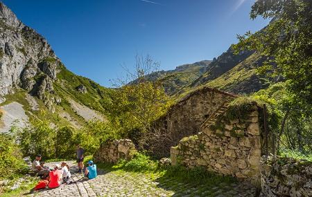
In the middle of the mountain, at the end of a narrow gorge, in a place that from below would seem impossible to exist, hides the village of Bulnes, the place that gives its second name to the Picu Urriellu, Naranjo de Bulnes, legend and myth of climbing at national and international level.
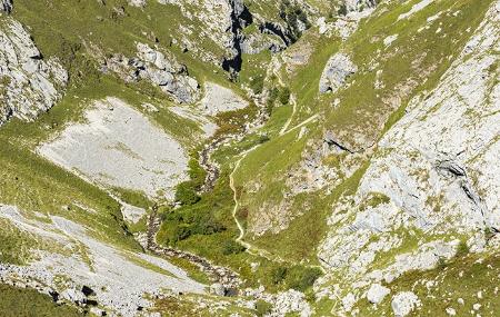
Climbing up the Canal del Texu, between two almost vertical rock walls, is truly impressive; you lose all sense of perspective and distance, you are dwarfed by the sight of it. If you look carefully, looking up, at the exit of the channel, you can see a pronounced V-shaped valley, carved out by the river, tucked inside another wider U-shaped valley, opened up by an old glacier.
The area is notable for the holm oaks hanging from the cliffs, growing in cracks in the rock; the wolf's breeches foxglove, with medicinal properties and endemic to the mountains of the north of the Iberian Peninsula, and especially striking are the small snails, some conical and others flattened, stuck to the rock and which we can hardly see until we are very close to it.
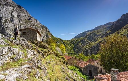
A little further up from Bulnes we end up at the viewpoint with views of the Urriellu.
Route
Poncebos - Bulnes 6,6
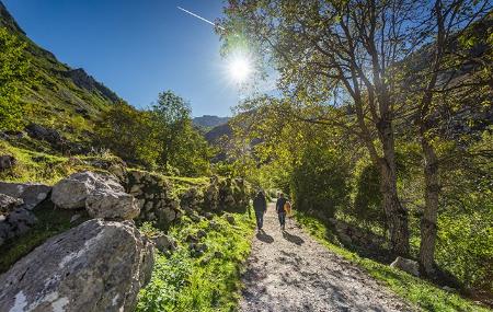
The route starts in the vicinity of Poncebos, at the same point where the Cares Route begins. When you reach the first fork in the Cares Route, you will see the Casa de Jaya on your left. Passing over the bridge of the same name we will reach it and we will have to leave it on our left to begin the route. The route is almost entirely uphill.
After 300 metres from the start, cross the Zardu bridge to continue the ascent. Further on there is a zigzagging ascent up the mountainside.
After 2.5 kilometres, you will come to a fork. On the right hand side is the village of Bulnes de Arriba. Our path continues to the left. Some 400 metres further on, on the left hand side, we find the upper access to the Bulnes funicular railway, which the local inhabitants use in the absence of a road. The path continues for about 400 metres until we reach Bulnes.
We will have walked approximately 3.300 kilometres when we reach the village of Bulnes, the end of the first part of the route. Here we will find the church and the Casa del Puente, worth seeing.