
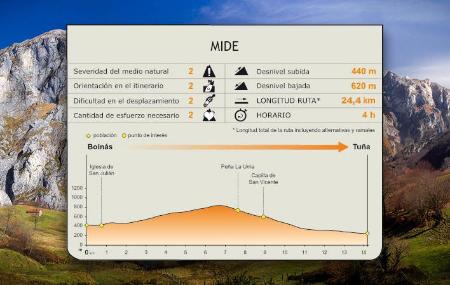
Stage 20: Bueinás - Tuña
- Belmonte de Miranda and Tineo Central and Western Asturias
- Distance: 14 kms
- Difficulty: Short
- Code: GR109 Asturias Interior - Stage 20
- Altitude: 834,16 m.
- Unevenness: 620 m.
-
On foot:
4 h.
One way
- Start point: Bueinás
- Tour type: Crossing
- Layout of the route: Download kml
Info
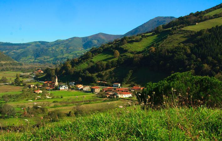
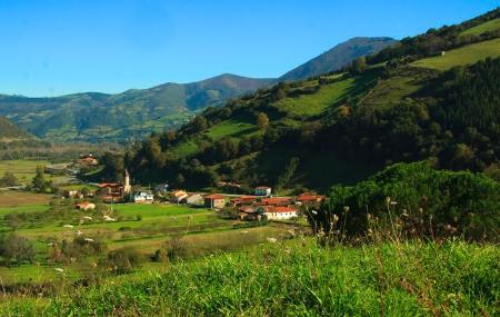
The stage runs between the councils of Belmonte de Miranda and Tineo through cowboy lands, from the village of Boinás to the rural village of Tuña, located in the middle of the Genestaza river valley, very close to one of the most unique geological phenomena in Asturias, the so-called Fana de Genestaza, where the constant landslides threaten to section the mountain.
Route
Bueinás - Tuña 14
From the council of Belmonte de Miranda, the GR heads towards Tineo through the lands of the vaqueiros, the most unique group within Asturian nomadism and transhumance, who, together with their families and belongings, changed their residence in search of the pastures of the higher areas (alzada) in summer, moving to lower areas (brañas) in winter. In Belmonte de Miranda, there are still some "brañas vaqueiras", such as the villages of Villaverde, Santa Marina, Carricedo and Pontigo.
Leaving Boinás, the route leaves the village along the road and turns off in the direction of Quintana. To get there, the route crosses the river Cauxa by road, at the height of a mill located on the banks of the river, and ascends leaving the church of San Julián on the right.
Once in Quintana, following the signs, next to a granary that must be left on the left, the route begins to descend along a narrow road, crossing the river Cauxa again, between meadows and chestnut(Castanea sativa) groves, towards the rural village of Alcedo (Alcéu).
After leaving Alcedo, the path begins to climb moderately until it reaches a crossroads where the signs suggest two alternatives for reaching Tuña. The main option continues along a track on the right that leads to the village of Espinaredo (Espinareu) and the alternative route continues along the track on the left.
Continuing along the main route, the path descends through meadows and scrubland, and then climbs until it reaches a hill from where we can see the rural village of Espinaredo, now in the municipality of Tineo, where the route joins the road again. Along the way we will find a thematic table that interprets the panoramic view from the area.
From Espinaredo, the route runs along the road and, shortly after crossing the river Genestaza, it reaches the rural village of Torayo (Torayu), continuing along the road to the right, between meadows and copses of chestnut and oak trees(Quercus robur), until it reaches Tuña. In the Plaza del General Riego, next to the church of Santa María, there is a signpost indicating the start and end of the stage.
Alternative route 10,4
- Alternative strech:
The other alternative we find at the crossroads after the village of Alcedo is to continue along the track on the left that climbs upwards, between meadows and scrubland, until we reach the Solanos farmhouse, where we turn right and descend until we reach an asphalted track, turning off shortly afterwards onto the road in the direction of Tuña.