Vega de Ario

- Distance: 15.55 kms
- Difficulty: Difficult
- Cumulative difference in altitude: +743 m
- Cumulative difference in altitude: -743 m
- Maximum altitude: 1653 m
- Minimum altitude: 1094 m
- IBP index: 80
- Modality: Mountaineers
- Type of route: Round trip
- Route type: Mountain
- Return by Train: No
It is a long route, without great technical difficulty, ideal for discovering how shepherding has shaped this corner of the National Park, which offers unequalled views of the Massif Central before reaching the refuge.
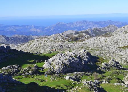
To climb the Vega de Ario is to enter one of the most characteristic and breathtaking landscapes of the Picos de Europa National Park. This route, about 16 km round trip from the Buferrera car park in the Covadonga Lakes, crosses ancient pastures, traditional sheepfolds and spectacular karst formations sculpted by centuries of wind, water and ice.
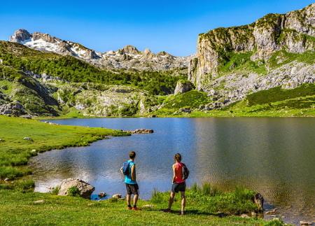
The route begins next to Lake Enol and continues towards Lake Ercina (1,108 m), where you take the path that borders it to the east, heading S-SE. The path, which is well signposted, advances through pastureland to the sheepfold of La Veguina or La Ercina, and begins to ascend along a short channel called La Cuenye, bordering the Riega del Brazu. After gaining altitude, we reach Majada de Las Bobias (1,280 m), a beautiful meadow dotted with shepherds' huts, some of which still maintain the tradition of taking their livestock up to the passes when the snow is gone.
A little further on, about 100 metres further on, it is possible to take a break in the shade of the beech trees and refresh yourself at a spring - the water is taken from a hose above a trough. The path continues along a narrow path between rocks that ascends briefly to offer views over the Majada de Redondiella, located a little further down. It then descends to the Jou del Llaguiellu, where a small stream has to be crossed before starting a steep zigzagging ascent up the Reblagas slope.
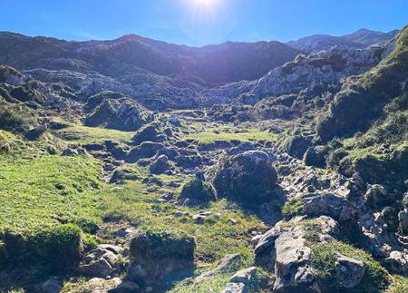
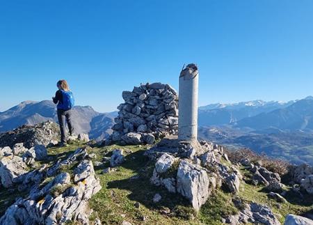
After this demanding stretch, we reach an area of fields known as Las Campizas and Los Abedules (1,400 m), which finally lead to the Collado del Jito (1,660 m). From this point there is one of the most impressive views of the Massif Central, with a stone table showing the main peaks.
From the Jito, just turn slightly to the left, almost on the plain, crossing small jous, green meadows and rocky areas, to reach Vega de Ario (1,634 m) in about 10 minutes, where the Vega de Ario Hut is located, a strategic point for mountaineers and hikers.
The surroundings are a mosaic of pastures, living rock and silence, where you can still feel the traces of traditional high-altitude shepherding. The views open out towards the Cares valley, the Western Massif, and on clear days, even as far as the Cantabrian Sea.
The return is by the same route, completing a route that is as much a lesson in geography and geology as it is a journey into the past. Ideal for hikers with a good physical condition.
- It runs through the Picos de Europa National Park and Biosphere Reserve and the Picos de Europa SAC and SPA (Asturias) of the Natura 2000 Network.
Basic tips before going into the mountains
- If you go with a dog, always keep it on a leash.
- Avoid approaching livestock.
- If you find mastiffs protecting livestock, do not approach them, do not pet them and do not feed them. Do not allow them to follow you or stray from their herd. They are working.
- Don't leave a trail. Collect all your waste, including organic waste. Nature is not a dumping ground.
- Act with prudence. Plan your route well, take everything you need and make sure it is adapted to your physical capacity.