Charles V Route

- Villaviciosa, Bedriñana, Tazones Eastern Asturias
- Distance: 11.2 kms
- Difficulty: Easy
- Cumulative difference in altitude: +274 m
- Cumulative difference in altitude: -272 m
- Maximum altitude: 1 m
- Minimum altitude: 161 m
- IBP index: 40
- Modality: Hikers
- Type of route: Linear
- Route type: Mountain
- Return by Train: No
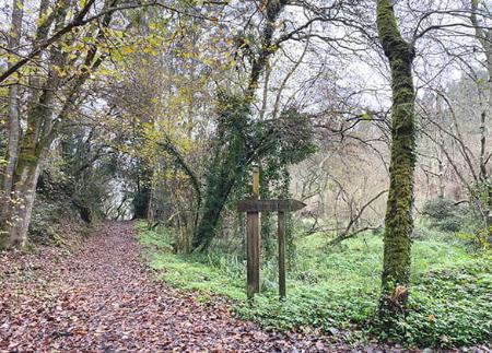
Nature, heritage and historical memory come together in an itinerary between marshes, waterfalls, pre-Romanesque churches and charming villages. A well-signposted route full of cultural and scenic value.
The Charles V Route allows you to relive one of the most unique episodes in the history of Asturias: the arrival of the young emperor in Spain in 1517. This is an experience that connects nature, heritage and historical memory, following in the footsteps of the future ruler of the Holy Roman Empire from Tazones to Villaviciosa.
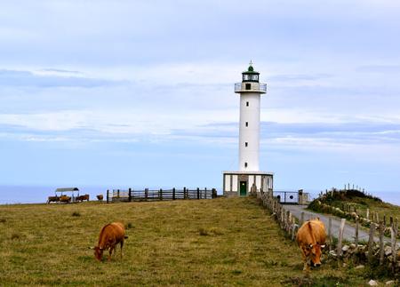
Charles V, grandson of the Catholic Monarchs, disembarked in the picturesque fishing village of Tazones, declared a Historic-Artistic Site, when a storm forced him to deviate from his route to Valladolid to take possession of the Crown. His unexpected arrival, initially mistaken for a pirate attack, is today remembered with an annual historical re-enactment which, at the end of August, restores the village to its 16th century atmosphere. Its cobbled streets and traditional port still preserve the authentic character of the Asturian coastline.
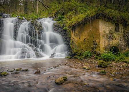
From Tazones, the path climbs gently towards Liñero, between green hillsides and country lanes, leaving the sea behind to enter a changing landscape of meadows, woods and villages. Along the route, the Villaviciosa estuary takes centre stage, with its marshes and porreos - land reclaimed from the water by dykes - which form one of the most important wetlands in the north of the peninsula. In these surroundings you can also visit the tidal mill of La Encienona, built in 1880, an example of the old hydraulic engineering of the area.
In San Martín del Mar, the traveller can stop next to its rural church and its 18th century yew tree, or take a short detour to the Llames Waterfall, a beautiful wooded spot where the Woodwardia radicans grows, a tropical fern included in the catalogue of protected species of the Principality of Asturias.
The route continues to Bedriñana, where we find the pre-Romanesque church of San Andrés, declared a National Monument in 1931. Finally, the route ends in the town of Villaviciosa, also a Historic-Artistic Site, where the Romanesque church of Santa María de la Oliva and the Casa de los Hevia, where Charles V stayed for four days, stand out. Today, this building houses the permanent exhibition "The King's First Journey", which commemorates that arrival.
The Route of Charles V is much more than a walk between two villages: it is a journey through one of the key moments in the history of Spain, crossing rural landscapes, religious heritage, charming villages and unique natural spots. Ideal for those who wish to walk along paths that connect culture, history and Asturian landscape.
- PR-AS 302
Basic tips before going into the mountains
- If you go with a dog, always keep it on a leash.
- Avoid approaching livestock.
- If you find mastiffs protecting livestock, do not approach them, do not pet them and do not feed them. Do not allow them to follow you or stray from their herd. They are working.
- Don't leave a trail. Collect all your waste, including organic waste. Nature is not a dumping ground.
- Act with prudence. Plan your route well, take everything you need and make sure it is adapted to your physical capacity.