Tabayón del Mongallu

- Tarna Central Asturias
- Distance: 11.66 kms
- Difficulty: Moderate
- Cumulative difference in altitude: +576 m
- Cumulative difference in altitude: -576 m
- Maximum altitude: 1288 m
- Minimum altitude: 913 m
- IBP index: 63
- Modality: Hikers
- Type of route: Circular
- Route type: With waterfall
- Return by Train: No
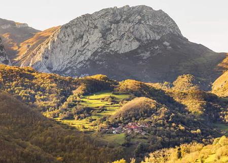
The route allows you to discover the spectacular Tabayón del Mongallu, declared a Natural Monument, and places such as the Llanu'l Toru oaks, the Rebollau sheepfold or the stone bridge over the river Nalón, in a setting of pure nature and Asturian tradition.
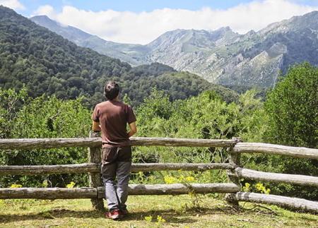
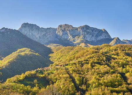
The route to Tabayón del Mongallu is a spectacular circular route that starts in the village of Tarna, in the council of Caso, and runs through the heart of the Natural Park and Biosphere Reserve of Redes, combining wide paths, trails, beech forests and environments of high natural and ethnographic value. The route includes a visit to the impressive Tabayón del Mongallu, a 60-metre high waterfall that has been declared a Natural Monument.
The route starts in the centre of Tarna, next to the church of San Pedro. Take a path that climbs gently uphill along sections of concrete pavement and old stone walls, until you reach a beautiful beech forest. A little over a kilometre from the start, you reach the crossroads of Terreros, a key point where the path forks.
Optionally, you can first take the detour to the left, which takes you to the Llanu'l Toru oak groves, where you can see a hundred-year-old oak tree in the middle of the forest. After enjoying the surroundings, return along the same path to the crossroads to continue along the other fork, now in the direction of Tabayón.
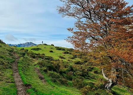
The route continues along the Saperu mountain, where you can breathe in the calm under the half-light of the beech forest. Shortly after, cross the Requexada stream over a wooden bridge and continue on without any major slopes until you reach the Arellales spring, next to a small rest area. From here, the path gains height gently and makes its way to a clearing from where you can see Cuitu Negro and Cantu'l Osu, before reaching the esplanade of La Campona. Shortly after, the waterfall or tabayón (in Asturian) of Mongallu appears, a spectacular waterfall that gushes out among beech groves and white heaths, leaving an unforgettable sight.
The return journey begins on an alternative path, well marked but less obvious at first, which skirts the meadows of the sheepfold and enters the Mongallu valley. The path becomes a wide track that crosses the forest and reaches the Rebollau sheepfold, where it turns sharply to the left to offer a new perspective of Cantu'l Osu.
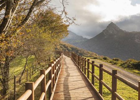
The final stretch of the descent follows the Ablanosa valley, and ends at the stone bridge over the Nalón river. After crossing it, the path climbs a few metres up to the road to the Puerto de Tarna (AS-17), but just 20 metres further on it takes a path to the right that runs between the river and the farms, leading directly back to the village of Tarna.
This route is ideal for those looking for a combination of spectacular scenery, forest environment, natural and cultural values, and a demanding but accessible hike. A complete experience in one of the most beautiful corners of the Redes Natural Park.
- It runs through the Redes Natural Park and Biosphere Reserve, this area also being a ZEC and ZEPA of the Natura 2000 Network.
- The route partially coincides with the PR-AS 060.
Basic tips before going into the mountains
- If you go with a dog, always keep it on a leash.
- Avoid approaching livestock.
- If you find mastiffs protecting livestock, do not approach them, do not pet them and do not feed them. Do not allow them to follow you or stray from their herd. They are working.
- Don't leave a trail. Collect all your waste, including organic waste. Nature is not a dumping ground.
- Act with prudence. Plan your route well, take everything you need and make sure it is adapted to your physical capacity.