Las Xanas Route

- Pedroveya, Dosango Central Asturias
- Distance: 9.03 kms
- Difficulty: Moderate
- Cumulative difference in altitude: +437 m
- Cumulative difference in altitude: -437 m
- Maximum altitude: 619 m
- Minimum altitude: 197 m
- IBP index: 47
- Modality: Hikers
- Type of route: Circular
- Route type: Mountain
- Return by Train: No
The path carved into the rock enters a landscape of great beauty, between limestone walls and lush forests. The return, along the Valdolayés path, completes a circular route full of contrasts, between villages, meadows and unforgettable panoramic views.
The Las Xanas Route is one of the best-known and busiest routes in Asturias, and it is not difficult to understand why. Its circular route offers the walker a diverse and surprising experience that combines rugged landscape, rural history, living geology and forests, all in the heart of central Asturias.
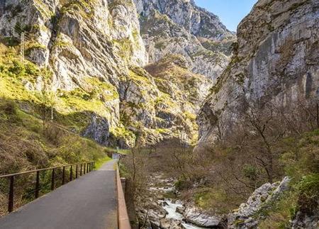
The starting point is the recreational area of El Molín de Las Xanas, where a short stretch of road begins leading to Tenebreo. You soon leave the asphalt for a signposted path on the right, which takes you into the Las Xanas gorge, declared a Natural Monument. This canyon was opened up by the Las Xanas stream and at some points it is up to 100 metres deep. The path, carved out of the rock in the mid-20th century with the intention of connecting the villages of Pedroveya and Dosango with the Trubia valley, is carved directly into the wall of the gorge, offering dizzying and spectacular stretches.
The path advances between tunnels, footbridges and rocky outcrops, alternating sections protected by wooden stakes with others where ropes have been installed anchored to the wall to offer greater safety to the walker. From this privileged height you can see the canopy of the riverside forest at the bottom of the gorge and, in the cracks of the driest limestone rock, the resistance of holm oaks and strawberry trees that survive where there is almost no soil.
Further on, the path enters a leafy forest, cool and shady, which gives way to the open pastures of Pedroveya, where the first part of the route ends next to the church of San Antonio, with magnificent views over the path already travelled.
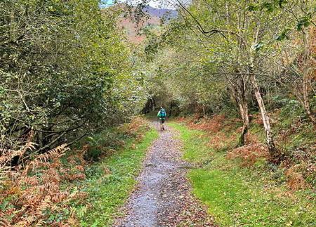
Instead of returning along the same route, the circular itinerary continues from Pedroveya towards the nearby village of Dosango. The route between the two is on a slightly uphill concrete path, with splendid views of the surrounding mountains. After crossing the village, the route joins the Valdolayés path, which runs between meadows, stone walls and areas where it is common to find goats. Ferns, ashes and oaks accompany the walker along this rural path that offers a more peaceful side to the landscape.
After crossing a gate, take a track that leads to a path that descends gently to the road to Tenebreo. From here, all that remains is to return comfortably to the recreational area of El Molín de Las Xanas, thus closing a circular route that brings together some of the most admired ingredients of the Asturian landscape: spectacular gorges, mixed forests, traditional villages and historic trails.
The name of this route pays homage to the xanas, figures from Asturian mythology who, according to tradition, inhabit the waters and forests. And certainly, few places like this gorge seem more appropriate for imagining their presence.
- This route partially coincides with the GR-106 in a minor section.
Basic tips before going into the mountains
- If you go with a dog, always keep it on a leash.
- Avoid approaching livestock.
- If you find mastiffs protecting livestock, do not approach them, do not pet them and do not feed them. Do not allow them to follow you or stray from their herd. They are working.
- Don't leave a trail. Collect all your waste, including organic waste. Nature is not a dumping ground.
- Act with prudence. Plan your route well, take everything you need and make sure it is adapted to your physical capacity.