Esva Gorges

- Longrey, Bustieḷḷu de Paredes Western Asturias
- Distance: 5.88 kms
- Difficulty: Easy
- Cumulative difference in altitude: +295 m
- Cumulative difference in altitude: -295 m
- Maximum altitude: 314 m
- Minimum altitude: 116 m
- IBP index: 41
- Modality: Hikers
- Type of route: Circular
- Route type: Mountain
- Return by Train: No
From Bustieḷḷu de Paredes, the path climbs through oak and alder forests to the gorge, where the river Esva has shaped a landscape of great beauty. A route that combines nature and river scenery in Asturias.
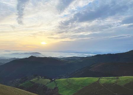
The Esva Gorges Route begins in the village of Bustieḷḷu de Paredes, a small hamlet located in the council of Valdés. The route enters the Hoces del Esva Natural Monument, an impressive narrow gorge carved out of quartzite, whose landscape is characterised by high rocky walls that reach a height of 400 metres. This natural space is located within the Protected Landscape of the Esva Basin, specifically in the sector between the hills of Andornoso and Villagermonde, in the stretch that goes from San Pedru (Paredes) to Brieves (La Chanona).
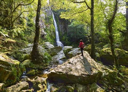
The path begins ascending gently through forests of oak, chestnut and alder trees, following the course of the river Esva, one of the richest in otters in the whole of Spain. After leaving behind the village of Bustieḷḷu de Paredes, the path reaches a fork where you take the fork to the right. This section, of approximately 700 metres, introduces walkers to the most spectacular area of the route: the gorges themselves. Here, the river Esva has sculpted an impressive gorge for centuries, forming rapids and pools that highlight the purity of its waters.
Before tackling the ascent, it is worth going a further 200 metres to see the old dam on the river Esva, a vestige of the hydraulic exploitation of the area. After this brief stop, the path becomes more demanding, climbing steeply towards Pico Cabanón. Although the effort is considerable, the scenery from the summit more than compensates for the effort made, offering a spectacular view of the gorge and the surrounding mountains.
From the summit, you can choose to continue towards the Cabanón Peak itself or start the descent, which offers a different perspective of the gorges, with views that take in the river valley and the surrounding vegetation. The path descends gradually until it returns to Longrey, where the route ends.
This route is ideal for those looking for an experience where nature, history and geology intertwine. The combination of the beauty of the waterfalls, the rocky walls covered with oak groves and the fluvial environment make up a unique setting in western Asturias.
- It runs partially through the Río Esva SAC of the Natura 2000 Network.
- PR-AS 002
Basic tips before going into the mountains
- If you go with a dog, always keep it on a leash.
- Avoid approaching livestock.
- If you find mastiffs protecting livestock, do not approach them, do not pet them and do not feed them. Do not allow them to follow you or stray from their herd. They are working.
- Don't leave a trail. Collect all your waste, including organic waste. Nature is not a dumping ground.
- Act with prudence. Plan your route well, take everything you need and make sure it is adapted to your physical capacity.