

From Oviedo to the Alfilorios Reservoir
- Oviedo, Ribera de Arriba and Morcín Asturias Centre
- Distance: 33 kms
- Difficulty: Short
- Mountain bike: Half day
- Start point: Oviedo
- Tour type: Circular
- Layout of the route: Download kml, Download gpx

Route
Oviedo - Oviedo 33
This is a circular cycling tour, starting and finishing at the same point, and is suitable for all types of bicycles. This route shows how close we are to the mountains and the Los Alfilorios reservoir in particular, and as it runs along roads with little traffic, it will be a great route to disconnect. The ascent from the village of Argame is a stretch of 4 kilometres of steady ascent, so it is a bit tough, but if you are used to cycling a bit, it is no problem.
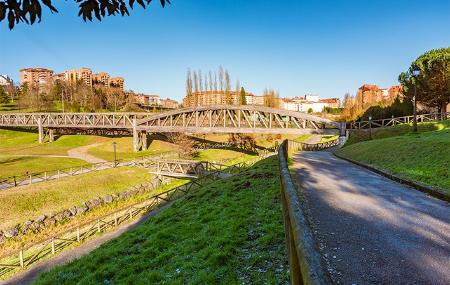
You leave the capital of Carbayona along the Parque de Invierno path towards Fuso de la Reina, where the train used to run to Trubia. On the way, it is possible to visit the old La Manjoya train station, which houses the Nature Interpretation Centre. At this point, take a detour to climb the Alto de El Caleyo. Once at the top, take the road that leads, in a steep descent, to Bueño.
Bueño is a village famous for having a high concentration of hórreos and paneras (raised granaries) in Asturias; fifty or so - no more, no less - and some of them more than a hundred years old. The oldest, in the centre of the village, dates from the 16th century.
From Bueño, head towards Las Segadas along a quiet and practically flat road, except for the last 200 metres where there is a 14% slope (which can be climbed on foot). From there, the route heads towards Soto de Ribera, crossing two rivers along the way. Firstly, we cross the river Nalón by the famous "entrepuentes", to join the N-630, with little traffic (although, as always, we must take the necessary precautions). Secondly, we cross the river Caudal, after which we reach the village of Soto de Ribera, although we do not enter it, as just before crossing the railway tracks we have to turn left onto the MO-5 road to continue until we reach Argame. It is in this village that the climb begins, following the MO-5 road for just over 4 kilometres to the Los Alfilorios reservoir.
The Los Alfilorios reservoir was built to supply drinking water to the towns in the central area of Asturias, mainly Oviedo. It is located in the council of Ribera de Arriba, although almost the entire reservoir is in the council of Morcín. There is a small recreational area with tables and benches, and even a bar-restaurant nearby, which can be used for a stop. From this point it is possible to admire the views offered by this spot and also by the reflection in the waters of the reservoir of the Monsacro mountains, the whole of the Aramo mountain range and, further to the left, the Mostayal.
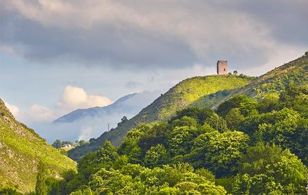
After skirting the reservoir, we climb a little further up to the village of Campo (Peñerudes), where we can see the Peñerudes Tower in the distance. Its origin is medieval (12th century) and it is believed that its function was defensive (its walls are almost two and a half metres thick). The route continues towards the village of La Mortera via a steep descent. But if you go down carefully there will be no problem - there is no hurry! However, we recommend that you keep a safe distance and moderate your speed to avoid any silly surprises or falls.
In the village of La Mortera you can stop to drink water at the fountain and, looking back, contemplate the Peñerudes tower from another perspective. From this point the route heads towards Lavarejos, where it reaches the junction with the AS-360 road, which must be taken to reach Fuso de la Reina, after passing through the villages of Rebollal and La Arquera.
From this town you return to Oviedo along the green path (Fuso de la Reina - Oviedo), the capital of the Principality being the end point of this route.