

Stage 5: Santibáñez de Murias - Cabañaquinta (Aller)
- Aller Asturias Centre
- Distance: 13,2 kms
- Difficulty: Short
- Code: GR208 - Central Mountain Cycle Ring
- Mountain bike: 2 h. 30 min.
- Start point: Santibáñez de Murias
- Tour type: Crossing
- Layout of the route: Download kml
GR208 - Central Mountain Cycle Ring
Route
Santibáñez de Murias - Cabañaquinta 13
The fifth stage of the GR-208 "Anillo Ciclista Montaña Central" begins on the outskirts of Santibanes de Murias, taking the AE-3 road downhill to take the first turning to the right that goes up a path marked PR-AS 133 and 236, and along which the GR-109 "Asturias Interior" also runs. We continue along this path, which will soon be flatter, to reach the hamlet of Vil.lar, which we cross to head east towards Coto Bello along a stretch that is now uphill.
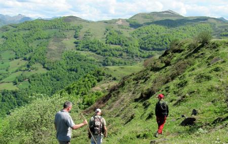
Little by little the GR "Anillo Ciclista Montaña Central" gradually gains altitude. Further on, we leave the PR-AS 133 path to the right and the route of the "Anillo Ciclista Montaña Central" now runs on a calmer plane, crossing a large wooded area halfway up the slope, in the direction of Moreda/Morea, following a north-westerly course.
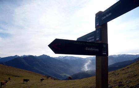
Once past this mass of woodland, the GR-208 climbs up to reach the Curriel.los ridge. Once we reach the top, we will have an excellent panoramic view of the Cabañaquinta valley and the neighbouring mountain ranges, such as Navaliego, which separates the councils of Aller and Mieres. At Curriel.los, the GR-208 turns to the right in search of the pastures of Coto Bello, joining the track that goes up to Renorios, which we leave on the left to cross the meadow of Braña de Sote, looking for the road to Coto Bello.
At this point we turn left and start a descent on tarmac to La Collaína, where we come to a wide esplanade where the branch that allows us to quickly descend towards Soto starts. This is a very steep descent, but with wide traces, on which vehicles and livestock circulate.
In the village of Soto and in front of the tower, we turn right onto a concrete track that takes us to Espineo. Once past a gate and the four local houses, the Anillo Ciclista Montaña Central (Central Mountain Cycle Route) follows a path through the meadows until it reaches the Aller River, which is crossed by a suspension bridge. Here there is nothing left to do but cross the FEVE tracks with great care and attention, ending the stage in front of the railway station in the capital of the council.