Turón Valley Greenway

- Uxo, Figaredo, La Güeria de Urbiés Central Asturias
- Distance: 14.1 kms
- Difficulty: Moderate
- Cumulative difference in altitude: +390 m
- Cumulative difference in altitude: --8 m
- Maximum altitude: 623 m
- Minimum altitude: 233 m
- IBP index: 47
- Modality: Hikers
- Type of route: Linear
- Route type: Greenway
- Return by Train: No
This 15 km route perfectly combines cultural, industrial and natural tourism, making it an ideal plan for everyone. Walking along the Senda Verde de Turón is a journey into the most recent industrial past of Asturias.
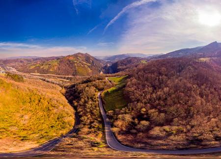
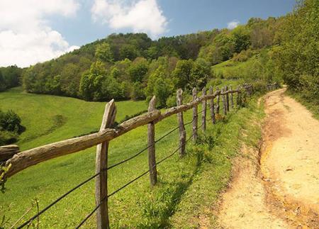
The Turón Valley Greenway, in the council of Mieres, is one of the most emblematic routes for discovering the mining and industrial past of Asturias, combining natural landscapes with unique heritage remains. With a total length of about 15 kilometres (30 km round trip), this former mining railway has been reconditioned for pedestrian and cycle tourism use, making it one of the most recommended green trails in the Principality.
The route begins in the vicinity of the Ricastro Bridge, in Uxo, where the railway siding and auxiliary facilities of Hulleras del Turón, a mining subsidiary of Altos Hornos de Vizcaya, were located in the past. The route runs mostly along the old railway line, with a comfortable surface, without technical difficulties, ideal for all audiences.
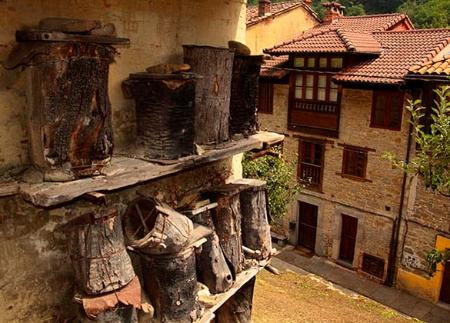
As you go deeper into the valley, the path becomes an open-air museum. We pass by the chalet of the family that owned the mines, the work of Enrique Rodríguez Bustelo, and cross the installations of Minas de Figaredo, now in disuse but steeped in history. In La Cuadriella, it is worth stopping to contemplate the complex formed by the old hospital, the church of Santa Bárbara, workers' dwellings and industrial remains such as the Dörr tanks.
The route continues through the neighbourhood of San Francisco, overlooking the rubbish dumps of Pozo San José, and continues through the areas of Pandiellu, San Benigno and San Pedro, where the installations of Pozo Santa Bárbara, declared an Asset of Cultural Interest in 2008 and considered a jewel of Spanish industrial architecture, can be found.
From this section onwards, various items of mining machinery mark out the track: wagons, small wagons, locomotives and old tunnels, such as the restored La Rebaldana tunnels, managed by the Santa Bárbara Mining and Cultural Association, which recreates the inside of a gallery with different types of shoring.
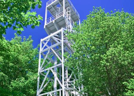
We continue to Pozo Espinos, with the oldest extraction tower preserved in Spain, and its interpretation room. Further on we reach the Pozo Fortuna, another museum space where you can visit the carpentry museum, the powder magazine and the mass grave, a place of historical memory with information panels. Practical note: Bear in mind that Pozo Fortuna is located more or less halfway along the Senda Verde de Turón. If you are doing the route on foot, you may want to divide it into two sections, so as not to cover the whole 30 kilometres at once (there and back). This point is the best option for finishing or starting the route, as it has a large car park and is next to the main road.
The route ends in the recreational area of El Mosquil (Urbiés), after crossing a natural environment of great beauty: unlit tunnels (such as the one at Biesca), hanging footbridges, old railway bridges such as those at Arnizo and Pomar, and the old mining installations at Mosquil. This last part is the wildest and most peaceful part of the trail, where the natural landscape prevails over the urban landscape.
Whether on foot or by bicycle, the Turón Valley Greenway is a unique experience to get to know the history of the Asturian mining basins up close, with the option of guided tours on several sections (prior reservation at info@pozuespinos.com). An accessible, cultural and scenic route, ideal for any time of the year.
PR-AS 100.1
Basic tips before going into the mountains
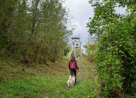
- If you go with a dog, always keep it on a leash.
- Avoid approaching livestock.
- If you find mastiffs protecting livestock, do not approach them, do not pet them and do not feed them. Do not allow them to follow you or stray from their herd. They are working.
- Don't leave a trail. Collect all your waste, including organic waste. Nature is not a dumping ground.
- Act with prudence. Plan your route well, take everything you need and make sure it is adapted to your physical capacity.