
The Central Mountain or the Olympus of the Gods
- Ribera de Arriba, Morcín, Riosa, Mieres, Lena and Aller Central Mountain
- Distance: 204,4 kms
- Difficulty: Short
- Cars: 5 days
- Start point: Bueño
- Layout of the route: Download kml
The Central Mountains is a land of colossal nature, with mythical peaks that have made cycling history.

Info
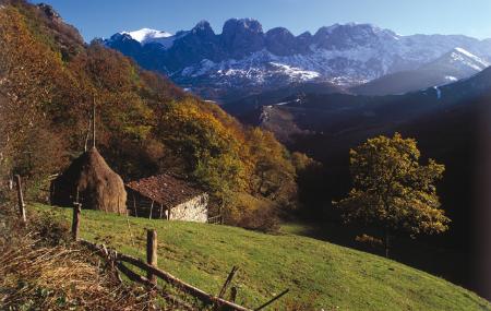
The Central Asturian Mountains is a mining area by definition, but it is also a region with a complex history and a colossal nature, with mythical cycling peaks, among which El Angliru stands out.
Route
Güeñu/Bueño - Riosa - El Angliru 40,7
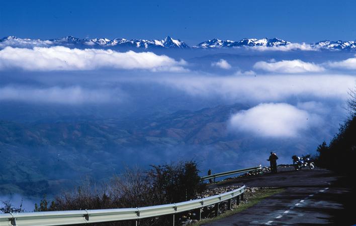
Day 1: Güeñu/Bueño is a small village in Ribera de Arriba, located just 15 minutes from the centre of Oviedo/Uviéu (to the south on the A-66 and the N-630), where time seems to have stood still. Its streets still preserve a group of 50 hórreos and paneras (granaries), some dating from the 16th century, which are connected by a route signposted with texts and drawings. From Güeñu/Bueño, via the N-630 road, you reach Morcín, which has a unique gastronomy, with typical dishes such as pote de nabos (turnip pot) and afuega`l pitu cheese. The centre of La Foz is located at the foot of Monsacro, a mountain with several access routes, which hides two chapels of great architectural value at its summit, which can only be reached on foot. The AS-231 road leads to Riosa and El Angliru. The mountain rises to an altitude of 1,570 metres and has sections, such as the Cueña les Cabres, with a gradient of 23%. This mythical peak was the first stage finish in the Vuelta Ciclista a España in 1999.
Mieres del Camín - Alto de la Colladiella 24,9
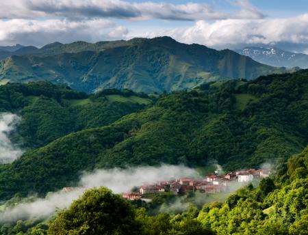
Day 2: In Mieres del Camin, the second stop of the trip, towards the south, the industrial heritage and modern constructions assault the visitor at every step. Thus, you can find the market building, dating from 1907, the Aniceto Sela School Group, a mixture of modernist and art-deco style, the 17th century Casa Duró, or the modern building of the University of Oviedo, built on the old facilities of the Barredo well. The Plaza de Requejo square is another charming spot, ideal for tasting cider. The Caudal river flows down one side of the town. The riverside promenade built on its banks allows us to see how a once very degraded environment has been recovered. There are other attractions in the Mierense area. The valley of Cuna and Cenera is a must-see, with the hermitage of San Cosme and San Damian, the Martyrs of Valdecuna, and a landscape of great beauty, which can be reached from the As-242 and the local road MI-2. Another option for lovers of two wheels is to climb, by bicycle or car, some of the peaks favoured by cycle tourists, such as the Alto de La Colladiella.
Lena - Puerto de Pajares 40,7
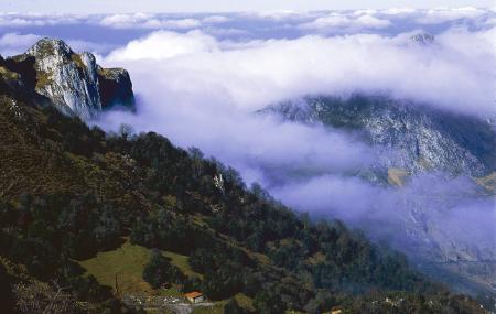
Day 3: The journey continues south along the AS-242 towards Lena. In Vil.layana, the church of San Martino stands, a 12th century temple built on pre-Romanesque remains, which justifies the first stop. Once in La Pola, you can visit the house where the doctor, playwright and poet Vital Aza was born, the town hall building and the La Caleya neighbourhood, the oldest of those preserved in the town. Via the AS-242, you reach La Cobertoria, which houses the Aula Didáctica del Prerrománico (Pre-Romanesque Educational Centre) in the old railway station, the perfect aperitif before, a few kilometres further on, discovering the imposing church of Santa Cristina de Lena, one of the best examples of Pre-Romanesque architecture. After the architecture, nature. From Campumanes, there are two options. The first and best known is to climb the Pajares pass and reach the Valgrande-Pajares ski resort. The other option is La Cubilla, a peak known by cyclists as the Asturian Galibier, with spectacular scenery.
Pajares - Cabanaquinta/Cabañaquinta 64,1
Day 4: On this day we propose two travel options: one, a visit to the Vía Carisa, an ancient communication axis with the plateau from Roman times, which crosses the Cordillera and penetrates the Cordal de Carraceo - a mountain that divides the councils of Lena and Aller - at an altitude of more than 1,500 metres. La Carisa is a paradise for hikers, mountain bikers and history lovers, who can take a look at the archaeological excavations that are being carried out. There are several access points from Lena, but it is advisable to use a vehicle suitable for the mountains and to have a guide to understand the excavations. The descent can be made through Lena, again, or on the opposite side of the ridge, towards Aller. In this case, the proposal is to return to Lena and take advantage of the trip to discover the restored mining settlement of Bustiello, so it is necessary to return to the A-66 in the direction of Mieres and take the AS-112 road. A few kilometres further on from Bustiello, in Caborana, is the Aller Visitor Interpretation Centre, the gateway to the municipality.
The other is especially dedicated to sports enthusiasts, who can replace the 'Roman route' with a cycling route that has made history in the Tour of Spain, and which specialists compare to the mythical climbs of the Tour de France. It is the ascent to the Coto Bello pass, a mining area in the municipality of Aller, which begins in Piñeres, between Morea/Moreda and Cabanaquinta/Cabañaquinta. Once at the top the view is impressive and you can see all the surrounding mountains, including the peak of La Collaona, and the Picu Torres, which is further away, above La Raya.
Cabanaquinta/Cabañaquinta - La Raya 33,9
Day 5: Cabanaquinta/Cabañaquinta and the surrounding area, with the Romanesque church of San Vicente de Serrapio, the hermitages of Vierres and Nuestra Señora de Miravalles and the Torre de Soto are some of its attractions. You can go hiking on one of the dozens of routes that cross the mountains, such as the Foces del Río Pino, or visit the ski resort of Fuentes de Invierno. Similarly, you can try some typical dishes, good restoratives, such as panchón, which is made with spelt flour and water, and fabes con jabalí (beans with wild boar).