
Through the Sierra del Sueve and the Natural Park of Ponga
- Ponga, Parres, Caravia, Colunga and Ribadesella Eastern Asturias
- Distance: 124,6 kms
- Difficulty: Short
- Cars: 5 days
- Start point: Taranes
- Layout of the route: Download kml
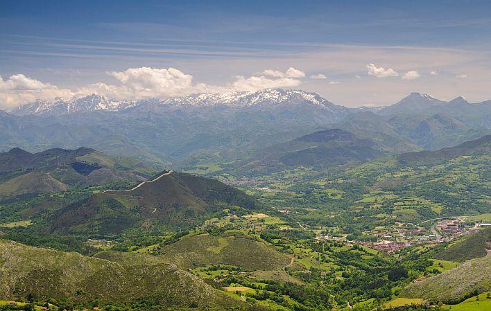
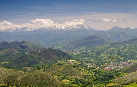
Under the protection of the great landscape umbrella that is Picos de Europa, there are other eastern mountains such as the Sierra del Sueve or those of the Ponga Natural Park that are equally seductive.

Info
Picos de Europa is perhaps the best known Asturian mountain range, but in its shadow, near the foothills of this Biosphere Reserve, rise other mountain ranges of great ecological and scenic value that also enjoy different types of protection. Municipalities such as Ponga, Parres, Piloña and Caravia have developed under its influence.
Route
San Xuan/San Juan de Beleño - Tarañes - Mesties 21,4
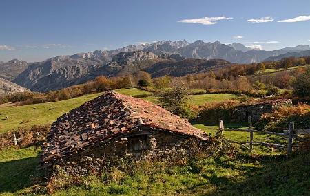
Day 1: The most southerly territory is Ponga, with its Natural Park, which serves as a border to the Picos de Europa. Nature, high quality cheeses and thermal waters are its three main attractions. The council has two different accesses: the AS-339 from the N-634, at Sebares, or the N-625 from Cangues d'Onís/Cangas de Onís. The capital of the municipality is a small rural village called San Xuan / San Juan de Beleño, which can be a good starting point. The villages of Ponga are home to Los Beyos cheese, a highly prized variety made from goat's, sheep's or cow's milk. There are dozens of routes to explore. Perhaps the best known is the Peloño Forest, a large beech forest crossed by a 24-kilometre trail. But there are other options, such as the route to Tiatordos from Tarañes (16 kilometres to cover in seven hours), or the Postman's Path, which has a short variant of almost 4 kilometres and can be covered in 3 hours, as it is an undefined stone path. In the lower area, there are the thermal springs of Mesties, which can be an excellent restorative after a day in the mountains.
Mesties - Alto de la Llama 41,6
Day 2: On the way back to Piloña along the AS-339, you can make a stop in Villamayor to discover the church of Santa María, a temple of Romanesque origin that was originally linked to a Benedictine convent of which there are no remains today. Afterwards, you can continue towards the Sierra del Sueve, the natural habitat of the Asturcones, along the AS-259, a road that leaves the N-634 on the outskirts of Villamayor. If the trip is organised to coincide with the third Saturday in August, you can enjoy the Asturcón Festival in Majada de Espineres. If the trip takes place at another time of the year, there are different routes that allow you to get to know the surroundings and perhaps spot some wild specimens. Two options are the path from El Alto de La Llama to Majada de Espineres or the one from Miyares to Pico Ordiyón.
Alto de la Llama - Arriondas/Les Arriondes 27,8
Arriondas/Les Arriondes - Prado 26,5
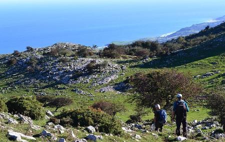
Day 4: From Arriondas/Les Arriondes the AS-260 starts, which leads to the sea after crossing El Fito. At its summit there is a viewpoint, with a unique architectural form, with a privileged view of the centre of Asturias, the sea and the mountains, and a recreation area. If you feel like walking, you can climb Pico Pienzu, which at 1,161 metres is the highest peak in the Sueve. From El Fito, the route takes about three and a half hours to complete. On the other side of the mountain, descending the AS-260, lies Caravia, a council with two beaches of great beauty, La Espasa, popular with surfers and kite pilots who organise a festival every year, and El Arenal de Morís, both connected by an attractive coastal path. In its capital, Prado, is the 18th century church of Nuestra Señora de la Consolación, and in the town of Carrales, the 17th century church of Santiago de Caravia. This area is typical of indianos and therefore has many examples of indiano architecture, although they are privately owned and cannot be visited. Some of them are the Casa de los Hermanos Prieto, Villa Concha, Villa Rosario or the Casona de González-Cutre.
Prado - Colunga 7,26
Day 5: The last two options for exploring the Sueve are the municipalities of Colunga and Ribadesella. In Colunga, specifically in the old schools of Gobiendes, an interpretation centre has been set up to explain the singularities of its flora and fauna, and it is interesting to visit to get to know the peculiarities of this mountain range, which is the highest mountain closest to the sea in Asturias, and where you can follow routes on foot, by bike, on horseback or by car, whether through Parres, Colunga, Caravia or Ribadesella.