
- Mieres and Ribera de Arriba Asturias Centre
- Distance: 12,5 kms
- Difficulty: Short
- Code: GR208 - Central Mountain Cycle Ring
- Mountain bike: 1 h. 30 min.
- Tour type: Crossing
- Layout of the route: Download kml
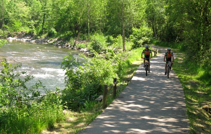
GR208 - Central Mountain Cycle Ring

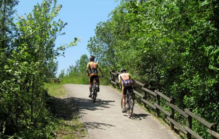
The eighth stage of the GR-208 Central Mountains Cycling Circuit starts out from La Peña, with no other choice but to take the road towards Alto del Padrún hilltop (AS-242), along which the Way of St James also runs. This part of the route offers views of Vega de Baíña industrial estate.
Hikers and cyclists have to be careful as they will have to follow a long stretch of paved road about 6.3 km in length. Once you reach the hilltop, you will be able to see Olloniego, in the borough of Oviedo. You then head downhill towards the village of Casares, after which you turn right, following the signs for the Way of St James ("Camino de Santiago") and the GR-100 "Ruta de la Plata".
Some 500 metres further on, you come back onto the AS-242, which you must follow towards the railway station. You then cross the motorway via the overpass and head for Olloniego, making your way through this village towards the mansion and Olloniego Bridge, by the northern exit of the village.
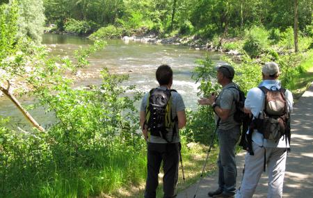
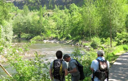
Continue along the road, passing the roundabout on your left to subsequently take an entrance accessing the riverside path running along the River Nalón. Stay on this path until you get to Vegalencia, following in the last stretch the hiking and cycling lane that runs alongside adjoining the road.
Cross the river over the first bridge to then reach Vegalencia Park, where the eighth stage of the GR-208 Central Mountains Cycling Circuit ends.
La Peña - Vegalencia 12
The eighth stage of the GR-208 "Anillo Ciclista Montaña Central" leaves La Peña (Mieres) with no other solution than to take the road towards the Alto del Padrún (AS-242), along which the Way of St. James also runs, and at the same time we can see the industrial area of Vega de Baíña.
Hikers and cyclists should take extreme caution as they will have to tackle a long stretch of some 6.3 km of asphalt. Once we reach the top, we can contemplate the Oviedo side of Olloniego, and the descent towards the village of Casares begins, which we leave behind to turn off to the right following the marks of the Way of St. James and the GR-100 "Ruta de la Plata" (Silver Route).
The shortcut brings us back to the AS-242 road some 500 metres further down, and we must continue along it in the direction of the railway station. Cross the dual carriageway over the footbridge and look for the urban area of Olloniego, which we cross in the direction of the palace and the Olloniego Bridge, at the foot of the northern exit of Olloniego.
Continue along the road, leaving the roundabout on the left, and later take an entrance that gives us access to the waterway next to the river Nalón, which we will not leave until we reach Vegalencia, following the hiking and cycling path that runs alongside the road for the last few metres.
We cross the river over the first bridge to reach the Vegalencia park and thus finish the eighth stage of the GR-208 "Anillo Ciclista Montaña Central" (Central Mountain Cycle Route).