
From La Felguera to El Berrón
- Langreo and Siero Asturias Centre
- Distance: 23 kms
- Difficulty: Short
- Mountain bike: Half day
- Start point: La Felguera
- Tour type: Linear
- Layout of the route: Download kml, Download gpx
Route
La Felguera (Langreo) - El Berrón (Siero) 23
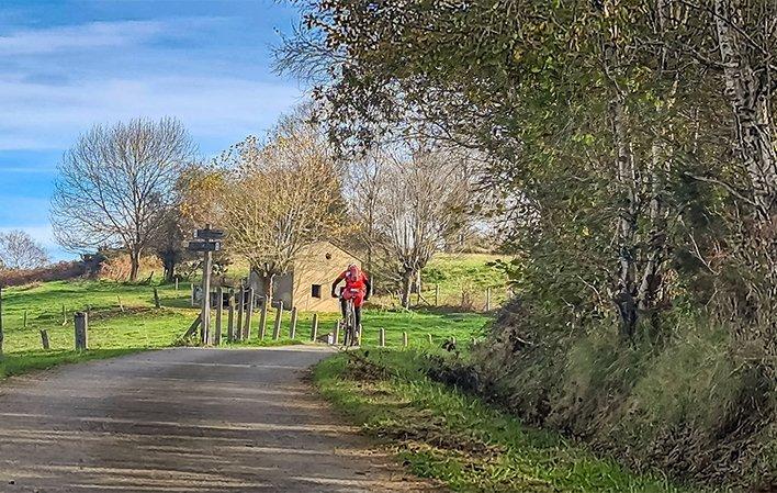
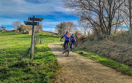
Linear route starting and finishing at different points, and a completely quiet itinerary with hardly any traffic on small local roads and greenways with acceptable road surfaces. It is suitable for all types of bicycles except the section of the Carbayín greenway; there is an alternative for this section along the SI-16 road from the start of the greenway to Carbayín Bajo. With mining stories in between, we will ride through quiet and beautiful corners, changing from the Nalón valley to the Carbayín valley.
It is a reasonably comfortable route, although it has 3 climbs that we will now comment on:
- As soon as we leave La Felguera, once we pass the local hospital, the 3 km Alto de La Zorera awaits us, being the longest climb of the whole route.
- The two subsequent climbs are short. One in Pando 800 mts, and the other 400 mts to the crossroads of the mining motorway in the Bendición area.
We start by leaving La Felguera and cycling a couple of kilometres along the AS-17 in the direction of Riaño, a road on which we will have to be careful because of the traffic, and then we will join a practical cycle lane shared with pedestrians in Barros for another couple of kilometres; it is well designed and avoids slopes and traffic. Except for the initial section between La Felguera and Barros, there is little traffic.
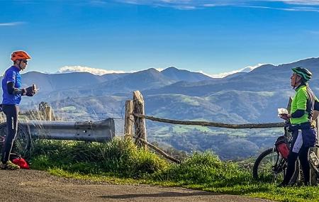
Near the Valle del Nalón Regional Hospital, in Riaño, is the church of San Martín, dating from the 17th and 18th centuries. It consists of a building with a single nave, with masonry porticoes and a generously sized belfry. It is well worth the effort to climb up to La Zorera, a village through which the Pilgrim's Way to Santiago de Compostela passes, as from here you can see a wide panoramic view of the Aramo mountain range. The descent towards the AS-246 road will be vertiginous -control your speed-. If you pay attention to detail, you will see a chapel nestled between the houses of La Moñeca or a quarry further down, at the turn-off to Caballeros.
We climb a little from La Gargantada (500 metres) to turn off towards Pando, a village where we turn off towards Valdesoto.
With a steep descent, we will connect -at the Valdesoto train halt- with the beautiful Vía Verde de Carbayín (also called Senda del río Negro). At this point we are more or less halfway along the route.
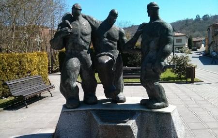
After following the path along the banks of the river Negro, we reach Carbayín Bajo. Here we can recharge our batteries at the fountain, take some photos at the monument to the miner with the Pumarabule well in the background... and even for the more gastronomic lovers, there is time to recharge our batteries (pincho, cider, coffee...) at a nearby cider house.
The Pumarabule pit is a coal mine, a victim of the national coal crisis. It ceased its activity in 2005, being at that time the only working mine in the council of Siero. Its galleries are connected to the Mosquitera mine in the nearby town of Tuilla in Llanre. This mine has two vertical shafts some 500 metres deep and still has two derricks standing on top of them. You can also see part of the tailings dump around the derricks, as well as other mining installations and tools. The return to El Berrón is not unusual. We follow the path of the river Negro to Valdesoto, where we can turn off the route to go up to the village and see the church of San Félix. We continue on to Bendición, where we join the AS-246 road that takes us to our final destination in El Berrón, with the occasional hórreo (granary), fields with cattle and the village of Xixún.
In case it rains in the middle of the route, from Carbayín or Valdesoto we have a FEVE train, an option that is also suitable and open to those who are not very strong physically.