Stage 3: Miyares - Covadonga
- Address Piloña and Cangas de Onís Eastern Asturias
- Distance Distance: 31,6 kms
- Difficulty Difficulty: Short
- Code Code: GR108 Travesía Andariega (Walking Route)
- Altitude Altitude: 264 m.
- Unevenness Unevenness: 617 m.
-
On foot
On foot:
8 h. 30 min.
Only one way
- Start point Start point: Miyares
- Route type Route type: Hiking
- Tour type Tour type: Crossing
- Layout of the route Layout of the route: Download kml
Route
Miyares - Covadonga 31,6
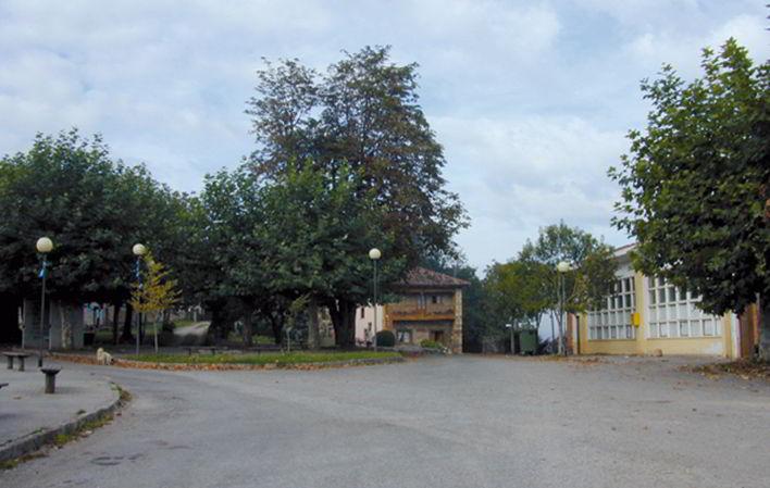
When we reach the village of La Goleta we head along a narrow track towards the PL-11 road. Once there, turn left, passing by the La Goleta schools. From here we must never leave this road, passing through the villages of Brez, Cabastiana, and La Torea, very close to the Palace of Sorribes. Throughout this part we can see the Sueve mountain range on the left, with Pico Pienzu towering above it, and on the right the Pesquerín and Bodes mountain ranges, where the GR105 (Oviedo/Uviéu-Covadonga) runs. We continue along the road through an area where we have a wide sample of the traditional architecture of Asturian manor houses.
After passing through the hamlet of La Ferrera we come to a crossroads, and we must take the one on the right, which skirts the go-kart track and crosses under the N-634, reaching the vicinity of the river Piloña. Without reaching the road, we turn right to cross the river Piloña and reach the FEVE station. Cross the tracks very carefully, taking the path that leaves the station on the left. About 60 m further on, on the right, there is another path with loose stones that leads uphill to Villar de Güergu, where there is a chapel with a Romanesque Virgin, Nuestra Señora del Corriellu.
At this point we join the GR105 on the way from Oviedo/Uviéu to Cuadonga/Covadonga. Leave the road to take a path that leaves the 17th century chapel of the Virgen del Corriellu on the left. Inside the chapel is the only image of the seated Virgin and child to be found in Asturias at the present time.
Continuing along the path we cross the village and begin to walk along the Camín de la Reina, so called because, in 1858, Queen Isabel II, accompanied by her husband, Francisco de Asís, and the Prince of Asturias, later Alfonso XII, walked along it on a pilgrimage from Gijón/Xixón to Covadonga. It is said that the villagers went ahead of the royal retinue opening the path with axes and fozetas. The path passes through meadows and riverside woods next to the river Piloña.
When you come out onto the road, turn right and after a few metres there is a path on the left that borders the fish farm. We continue along this path, ascending slightly through a small wood, and soon find a path on the right which we ignore, continuing straight on, passing through an area of meadows, where we can see the mass of the Sueve mountain range on the left. Shortly afterwards we reach a crossroads where we turn right past the church of San Martín de Escoto, which is a little before reaching Llames.
The route crosses the village to take the road that descends in search of the river Piloña. After a short distance we pass by a house painted blue, which is on the right and which has a beautiful wooden gallery. Shortly afterwards we reach the church of Santa María next to the cemetery. As soon as we pass the church, we leave the road and take the path on the right that passes next to the cemetery and shortly after cross the Beleño stream, leaving the mill on the left. As soon as we cross the bridge we ascend slightly and can see behind us the church, the cemetery and the surrounding houses. We leave the road and take the path on the left that enters a thick riverside forest. Little by little we approach the river Piloña, which runs almost alongside the path for a good stretch.
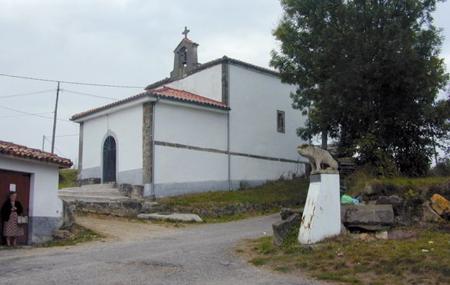
When you reach the road, turn left, passing by the chapel of San Lorenzo, a little before reaching Romiyu, from where you have an excellent view of the Sueve mountain range. Cross the village and follow the road until you reach the junction with the Vallobil y Lago road, and then follow it until you come to a beautiful house at a crossroads. Here you have two options: either continue along the road, or turn left and enter a beautiful wooded area, which, although longer, is a more rewarding route, joining up again a little further on.
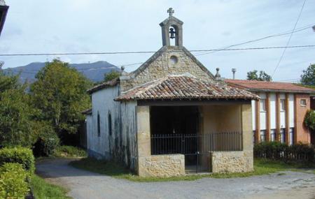
We leave the road, just at the bend that leads to the hermitage of San José, where we can see the small chapel next to the schools. The route skirts the chapel, leaving it on the right. Continue along the path between trees and meadows, crossing the Valdelesfaes stream. Continuing along the main path, we soon see the grandeur of the Picos de Europa, with the Monastery of Villanueva at our feet, and the Sueve mountain range behind us. From here we descend in search of Cangues d' Onís/Cangas de Onís.
At this point our route separates from the GR105 (Oviedo/Uviéu-Cuadonga/Covadonga) and the GR109 (Asturias Interior), which head towards Cangues d' Onís/Cangas de Onís along the left bank of the river Sella. Our route turns to the left, crossing the N-625 road and the river Sella. As soon as we cross the river Sella we come to the entrance to the Parador Nacional de Villanueva, located in what was once the Monastery of San Pedro de Villanueva, declared a National Monument or Historic-Artistic Monument in 1907 for being one of the masterpieces of Asturian Romanesque architecture.
The route turns right at the entrance to the current Parador to go in search of the River Sella, after passing through the village of Villanueva. On leaving the village, take a dirt track that runs alongside the river as far as the entrance to Cangues d' Onís/Cangas de Onís.
Pass under the road and continue along the street you come across. At the next crossroads we can continue along the street in front of us or turn right and head towards Cangues d' Onís/Cangas de Onís. Shortly after we find the chapel of the Santa Cruz. When you reach the chapel, there is a street on the left which you can follow and which soon joins up with the one that came out of the previous crossroads. Continue along it until you reach the River Güeña, very close to the Guardia Civil barracks, where the path runs between the road and the river. Shortly afterwards, when we reach the local slaughterhouse, the route passes under the road again and takes the path that leads us to Cardes, which we do not enter. From this point onwards, the route follows a path that goes through the meadows of the Estraes farm, to reach Celoriu and meet up again with the Güeña river.
We come to a wooden footbridge over the river Güeña, which we must cross and come out onto the main road. On reaching it, we see a path on the left before a house and the Covadonga campsite on the right. Continue along this road into the village of Sotu Cangues, where you will find La Grandera Zoo, which offers you the chance to see the most representative animals of Asturias and a sample of other species from the rest of the world. The Zoo is located in a native forest, among the species that can be admired there are bears, wolves, chamois, otters, lynxes, capercaillies, vultures, Egyptian vultures, hawks, etc.
After passing through the village, the path runs for a short stretch alongside the river Covadonga, before crossing it and joining the road to Covadonga. From this point there is nothing left to do but continue along the pavement to the end of the route.
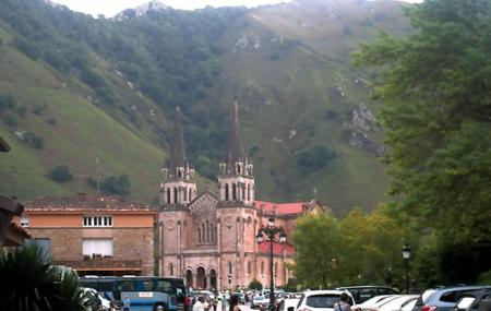
When you reach the car park, you will come to a wooden footbridge that crosses over the road. At this point we have two options: the first is to take the footbridge that leads us to the basilica of Covadonga through a beautiful forest; and the second is to continue along the road to the Santa Cueva and then climb up to the basilica.
Texts: Antonio Alba Moratillas (Editorial Prames)
Map
Itinerary
Miyares - Cuadonga/Covadonga


