Rota de Peña Villa desde Molledo

- Molleo, Bovia, L'Azorera Astúrias central
- Distância: 9,14 kms
- Dificuldade: Média
- Desnível acumulado: +298 m
- Desnível acumulado: --298 m
- Altitude máxima: 590.77 m
- Altitude mínima: 383.14 m
- IBP index: 41
- Modalidade: Caminhantes
- Tipo percurso: Ida e volta
- Tipo de rota: Montanha
- Retorno de Comboio: Não
Este percurso de ida e volta mergulha-nos na essência rural, entre prados, bosques e pomares, culminando em vistas deslumbrantes de um mundo cheio de contrastes: desde a paisagem natural, a leste de Peña Villa, até às zonas industriais do Vale de Nalón e à expansão urbana de Oviedo/Uviéu. Um percurso para todos os níveis, para desfrutar da natureza, da história local e da vida tradicional asturiana.
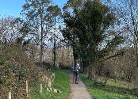
O percurso começa nas ruas tranquilas de Molleo, onde podemos estacionar confortavelmente o nosso veículo. Pouco antes de sair da aldeia, a cerca de 280 metros do início do percurso, encontraremos a primeira bifurcação da estrada, onde o caminho nos convida a seguir pela esquerda. À medida que avançamos, deixamos à nossa direita algumas casas que parecem estar a vigiar os nossos passos, enquanto nos embrenhamos na natureza.
O caminho, ladeado pela sombra de aveleiras, freixos e um ou outro espinheiro, serpenteia por entre prados verdejantes. Em breve chegaremos ao primeiro marco do nosso percurso: a escola de escalada Molledo-La Bobia. A partir deste ponto estratégico, as vistas do vale abrem-se majestosamente. Aproximadamente ao quilómetro 1, chegamos a uma nova bifurcação, onde tomamos o ramo da direita.
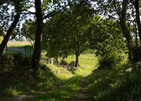
Mil metros mais à frente, ao quilómetro 2, o nosso caminho principal junta-se a outro caminho, que será o que utilizaremos para a opção circular de regresso. No entanto, para a subida, continuamos em frente, deixando a pequena aldeia de Bovia à nossa esquerda e atravessando a Serra de Paranza, que continua a oferecer-nos vistas espectaculares da zona central das Astúrias.
Meio quilómetro mais à frente, chegamos a outro cruzamento, mas continuamos na nossa direção, seguindo em frente até um conjunto de casas onde também há outros cruzamentos que ignoramos, mantendo sempre o caminho principal sem nos desviarmos.
Durante a subida, deparamo-nos com alguns dos mais autênticos exemplos da vida rural. Entre pomares bem cuidados, ainda é possível encontrar alguns habitantes locais a "cuchando" (espalhando estrume nas quintas para as fertilizar). Bétulas, olmos e carvalhos acompanham-nos no nosso passeio, enquanto nos aproximamos gradualmente da imponente Villa Peña.
Quase a chegar ao final, no quilómetro 4, encontramos um desvio à direita que não tomamos neste momento, e continuamos em frente até chegar ao cume de Peña Villa. Esta subida final passa primeiro por pastagens e depois por um denso tojo, com o trinado de uma ou outra cigarrinha a acompanhar-nos desde o cimo do tojo.
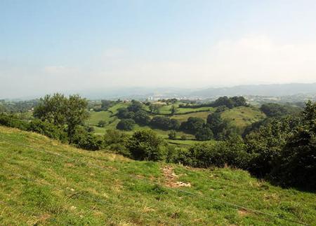
Cerca de 500 metros mais à frente, teremos chegado ao tão desejado ponto final do nosso percurso. As belas vistas da Cuenca del Nalón esperam-nos como recompensa.
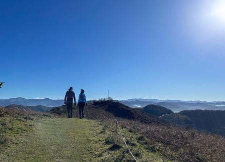
Chegar ao cume de Peña Villa é como ter uma varanda privilegiada sobre o centro das Astúrias. Do alto, a paisagem rural e bucólica que nos acompanhou desde o leste de Peña Villa dá lugar a uma vista completamente diferente para o sul, onde o vale de Nalón se desdobra diante de nós com a sua silhueta industrial caraterística. E a noroeste, sob o nosso olhar atento, estende-se a vasta e vibrante expansão urbana de Oviedo/Uviéu, a capital das Astúrias.
Para a viagem de regresso, temos duas opções: podemos regressar pelo mesmo caminho que antes ou, para mudar de rota, apanhar o desvio à direita mencionado acima. Este desvio situa-se aproximadamente ao quilómetro 7, depois de deixarmos para trás a aldeia de Bovia. Esta alternativa leva-nos a passar pela aldeia de L'Azorera, no concelho de Langreo, antes de voltar ao caminho inicial que nos levará de volta a Molleo.
Este percurso, para além de ser um simples passeio, torna-se numa forma diferente de descobrir as muitas nuances desta zona central das Astúrias.
Conselhos básicos antes de ir para as montanhas
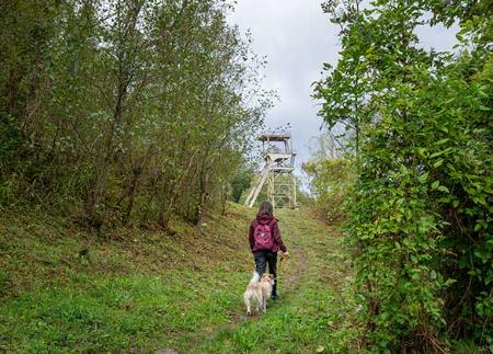
- Se for com um cão, mantenha-o sempre preso por uma trela.
- Evitar aproximar-se do gado.
- Se encontrar mastins a proteger o gado, não se aproxime deles, não lhes faça festas e não os alimente. Não permita que o sigam ou que se afastem do rebanho. Eles estão a trabalhar.
- Não deixe rasto. Recolha todos os seus resíduos, incluindo os orgânicos. A natureza não é uma lixeira.
- Agir com prudência. Planeiebem o seu percurso, leve tudo o que precisa e certifique-se de que está adaptado às suas capacidades físicas.